Search results for gridded nucaps
Stagnation around American Samoa
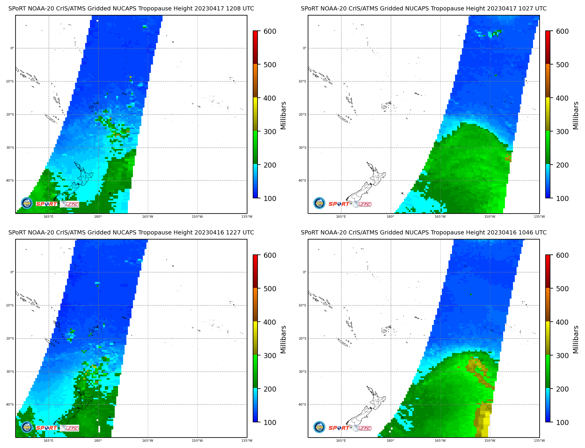
MIMIC Total Precipitable Water (TPW) fields, above, from 0000 UTC on 14 April through 1200 UTC on 17 April show a stagnation in flow in/around the Samoan Islands, starting around 0600 UTC on 16 April. This occurs as a storm develops northwest of New Zealand and a strong push of dryer air moves Equatorward to... Read More
Atmospheric Bore structure over Wisconsin
GOES-16 Visible Imagery, in the mp4 animation above (click here for an animated gif), shows convection initially over central Wisconsin at sunrise moving eastward over Lake Michigan into lower Michigan. In its wake, cloud lines extending east-west move southward into southward Wisconsin. Parallel lines such as these are typically associated with atmospheric bores, previously... Read More
Satellite-derived instability ahead of widespread severe winds over South Dakota and Minnesota
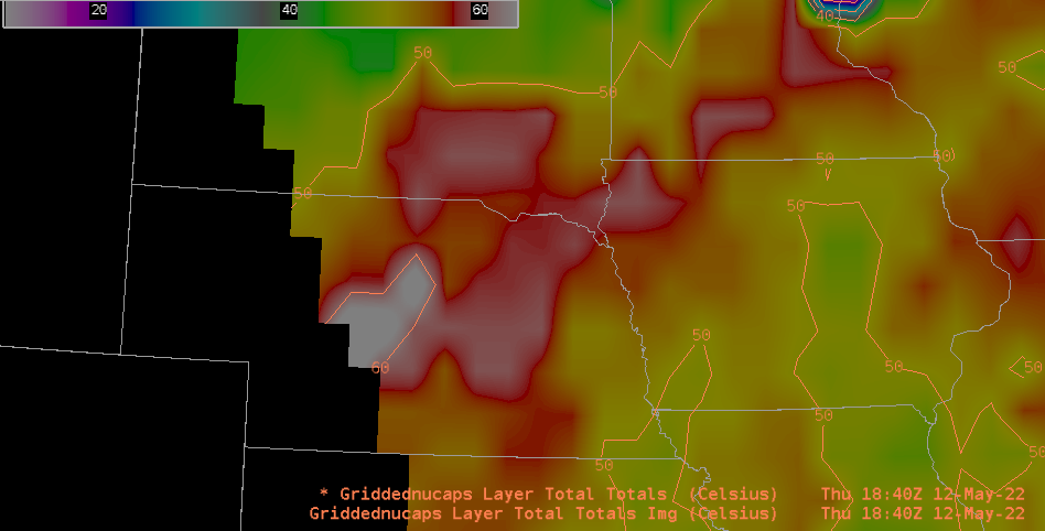
Storm Reports from SPC for 12 May 2022, (also shown below), show an extraordinary number of severe wind reports over eastern South Dakota and western Minnesota. Visible imagery from the CSPP Geosphere site, above, shows the convective system responsible for the widespread winds lifting northeastward out of Nebraska and moving over the Missouri River Valley.The animation below shows... Read More
