Stagnation around American Samoa

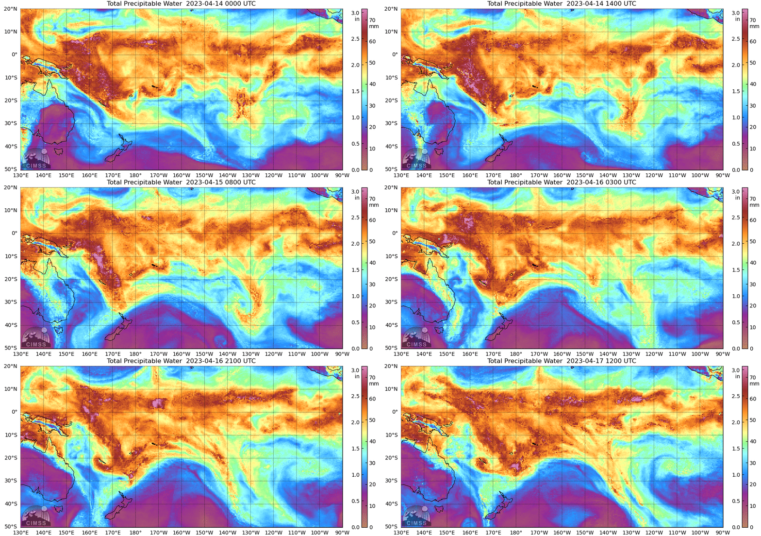
MIMIC Total Precipitable Water (TPW) fields, above, from 0000 UTC on 14 April through 1200 UTC on 17 April show a stagnation in flow in/around the Samoan Islands, starting around 0600 UTC on 16 April. This occurs as a storm develops northwest of New Zealand and a strong push of dryer air moves Equatorward to the east of New Zealand. Total Precipitable water estimates for the Pago Pago radiosonde during this time range from 53 to 63 mm (that is, 2 to 2.5″; 2.5″ is near the usual maximum value in Pago Pago in April as shown here) (animation, created at the Wyoming Sounding site).
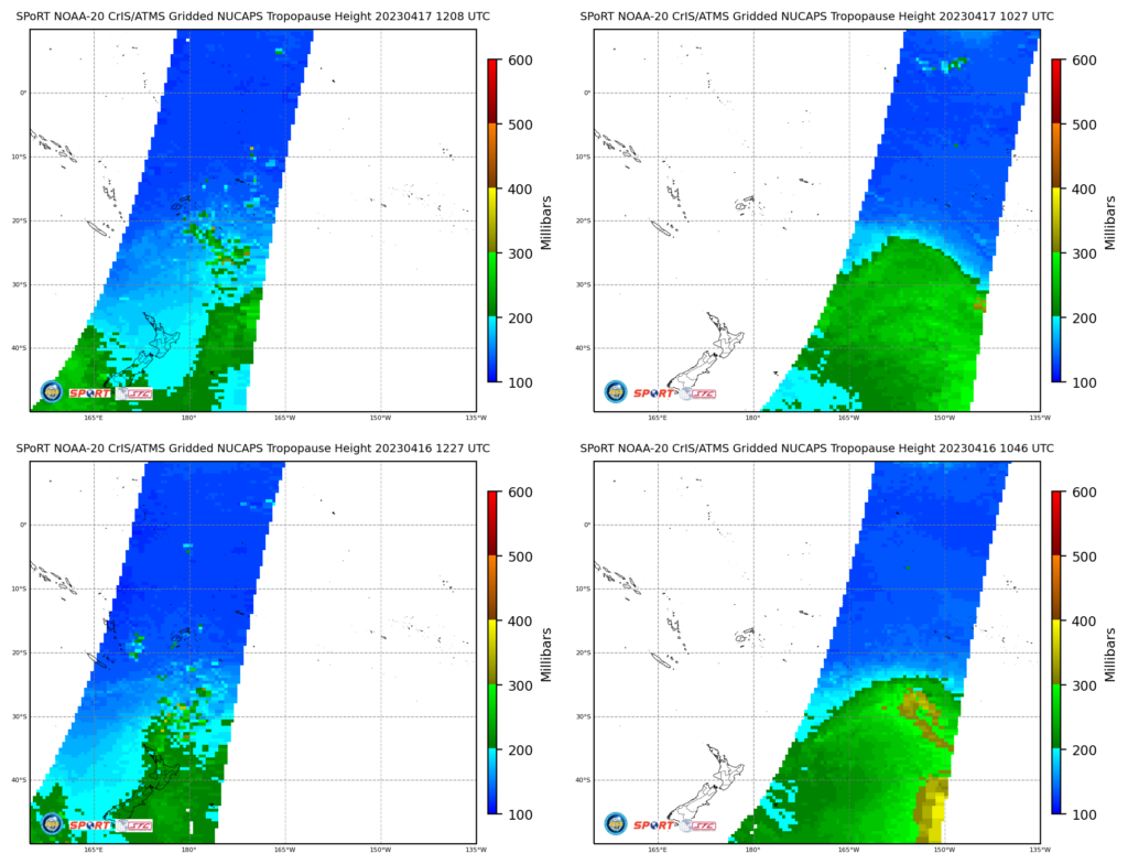
Data from NOAA-20 NUCAPS (from this website) also suggest an interruption in the flow over the south Pacific. Tropopause heights around New Zealand (below left at circa 1200 UTC on 16 and 17 April) show higher tropopause heights moving from west to east over New Zealand. However, the region of lower tropopause heights between 150 and 165 o W longitude is mostly stationary.


