
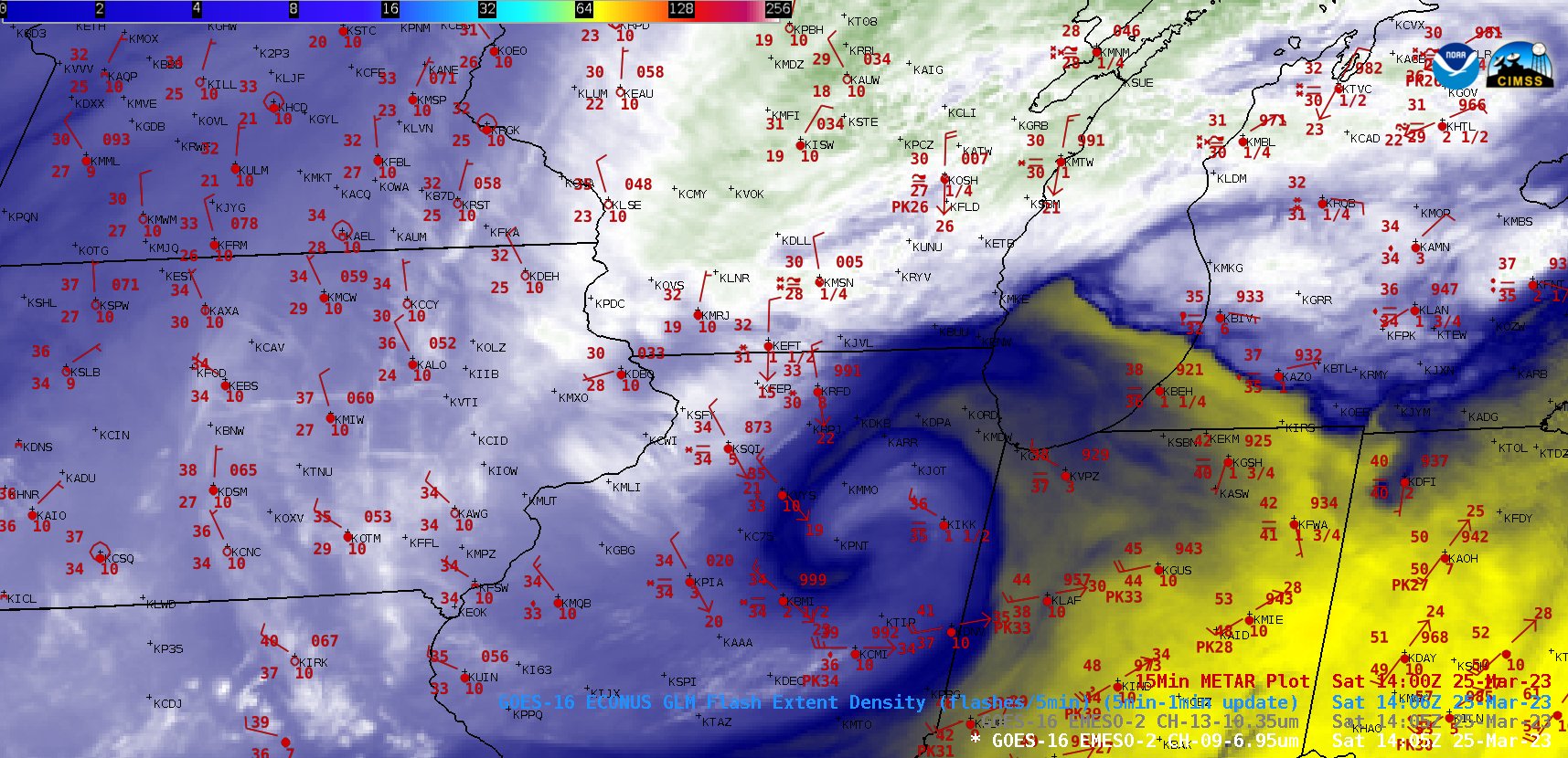
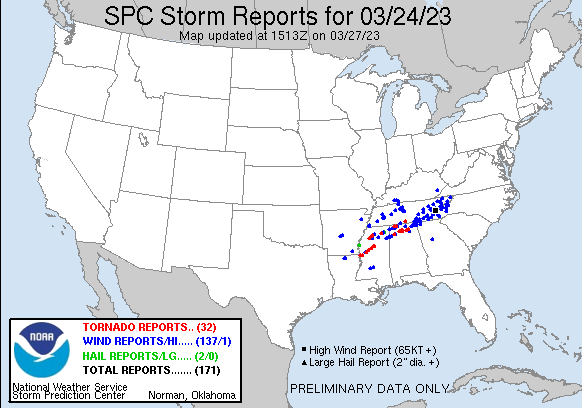
1-minute Mesoscale Domain Sector GOES-16 (GOES-East) “Clean” Infrared Window (10.3 µm) images (above) include plots of time-matched (+/- 3 minutes) SPC Storm Reports during an outbreak of deadly tornadoes across parts of Mississippi, Alabama and Tennessee late in the day on 24 March 2023. The coldest thunderstorm tops exhibited infrared brightness temperatures around -70ºC (darker black enhancement).A... Read More
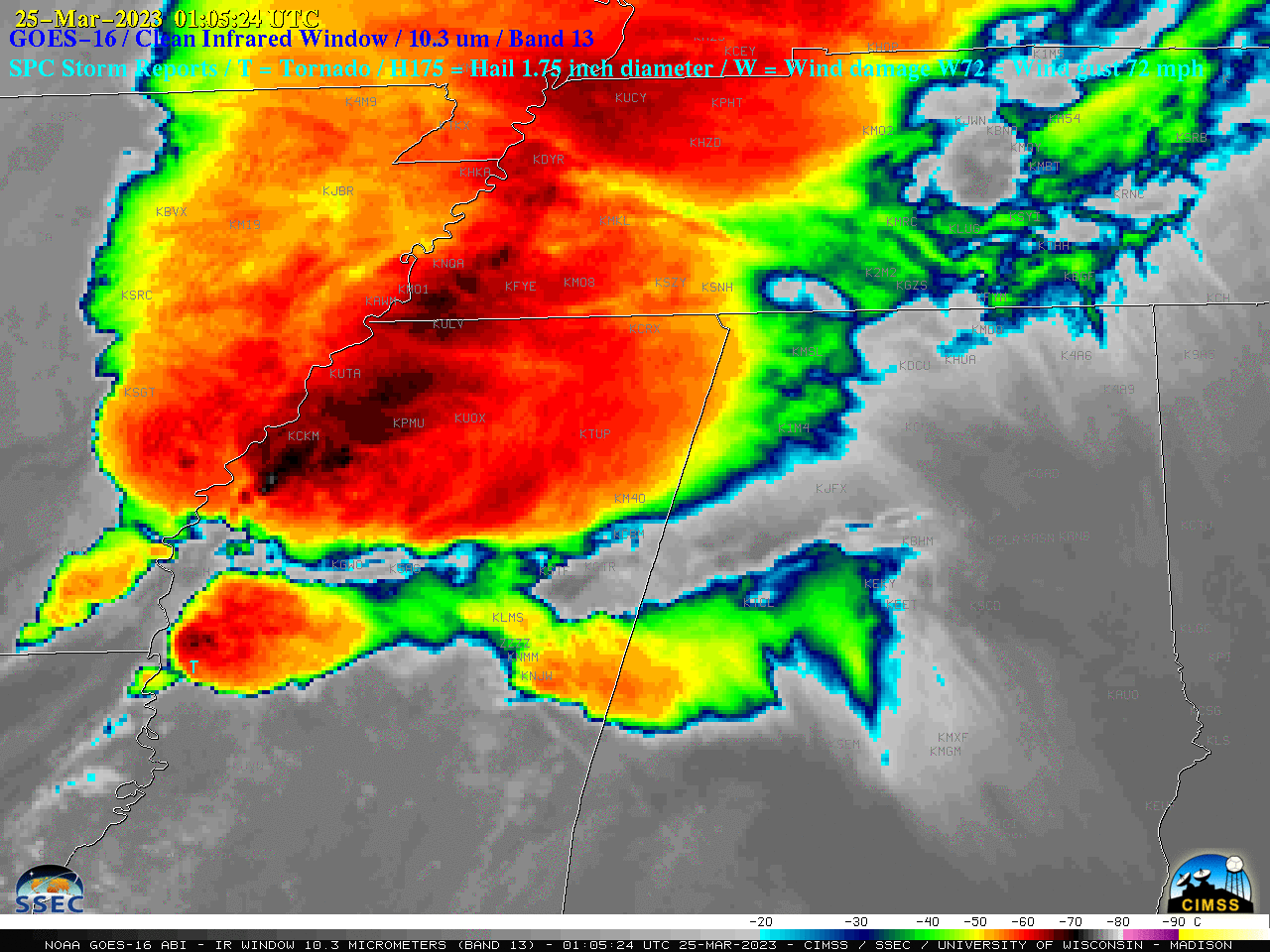
GOES-16 “Clean” Infrared Window (10.3 µm) images, with time-matched SPC Storm Reports plotted in cyan [click to play animated GIF | MP4]
1-minute Mesoscale Domain Sector GOES-16 (GOES-East) “Clean” Infrared Window (10.3 µm) images (above) include plots of time-matched (+/- 3 minutes) SPC Storm Reports during an outbreak of deadly tornadoes across parts of Mississippi, Alabama and Tennessee late in the day on 24 March 2023. The coldest thunderstorm tops exhibited infrared brightness temperatures around -70ºC (darker black enhancement).
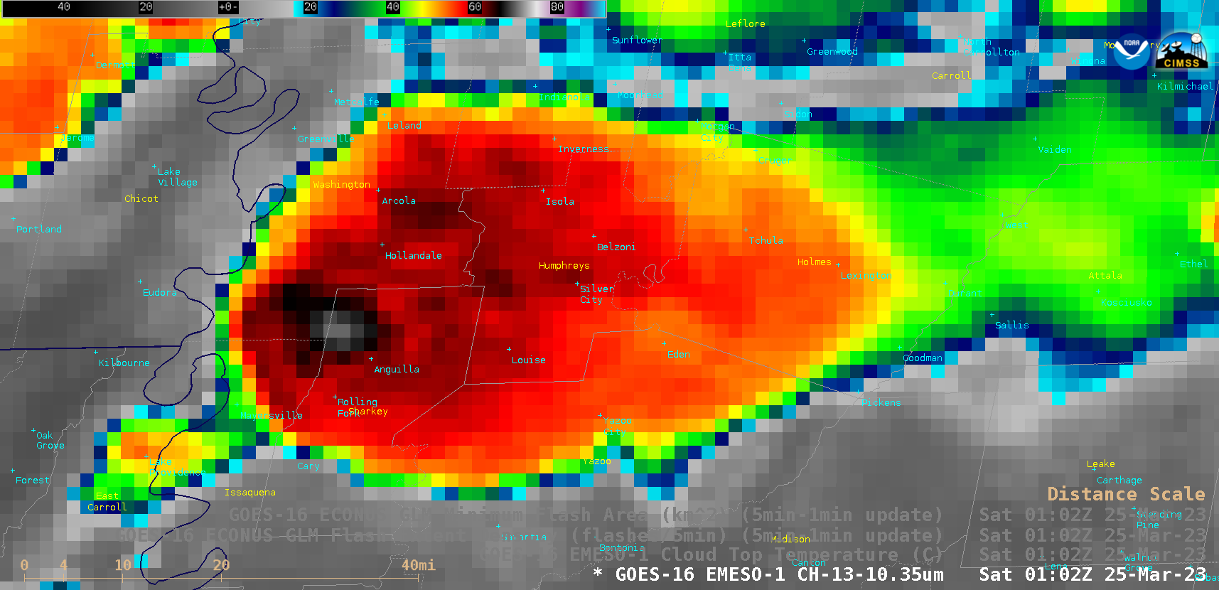
GOES-16 “Clean” Infrared Window (10.3 µm) images, with and without an overlay of GLM Flash Extent Density, from 0028-0208 UTC [click to play animated GIF | MP4]
A closer view of 1-minute GOES-16 Infrared images — with and without an overlay of GLM Flash Extent Density (above) — showed the supercell thunderstorm which produced a fatal EF4-rated long track tornado across far western Mississippi (with devastating effects in the cities of Rolling Fork and Silver City) from 0047-0208 UTC. The default infrared image enhancement was modified — setting the coldest end of the brightness temperature range at -92ºC — to help highlight the pulsing overshooting tops prior to and during the life cycle of this tornado-producing thunderstorm. The GLM Flash Extent Density also revealed a notable lightning jump (denoted by clusters of brighter white pixels) just prior to the development of the tornado. Lightning jumps frequently coincide with an increase in thunderstorm updraft intensity and/or updraft volume, preceding the onset of severe weather.
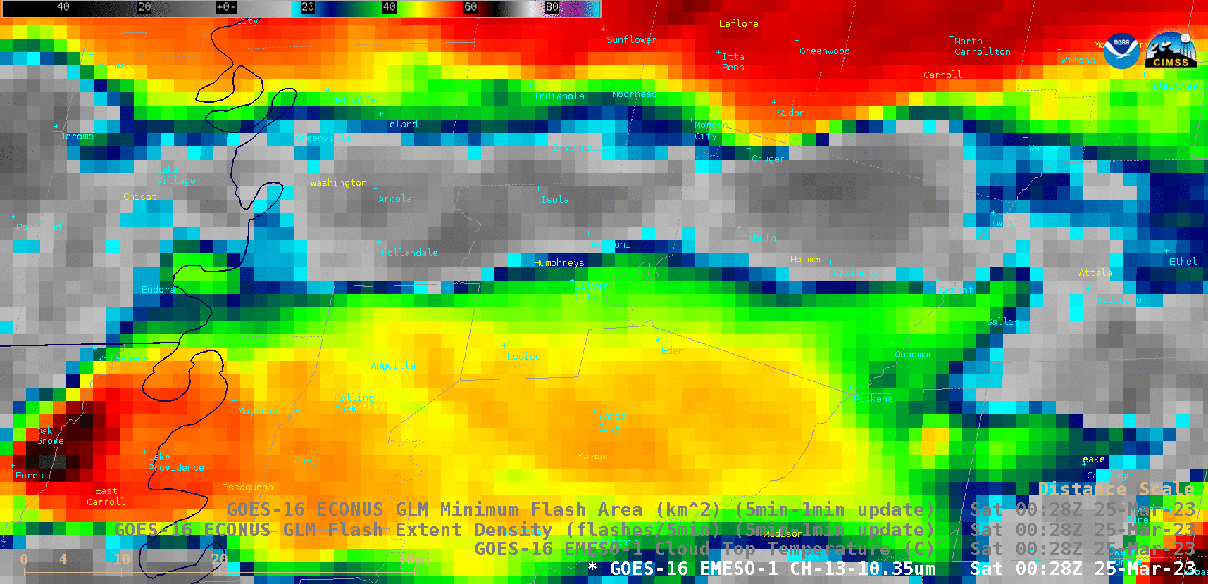
As the lightning jump was beginning, a toggle between GOES-16 GLM Flash Extent Density (FED) and Minimum Flash Area (MFA) at 0049 UTC (below) showed a maximum FED (bright white pixels) coincident with a minimum MFA (yellow pixels) along the Missouri/Mississippi border — the increasing number of lightning flashes within a smaller area was an indicator of the increasing potential of that thunderstorm producing severe weather.

GOES-16 “Clean” Infrared Window (10.3 µm) image, with an overlay of GLM Flash Extent Density and GLM Minimum Flash Area at 0049 UTC [click to enlarge]
A 2-panel animation of FED and MFA is shown below.
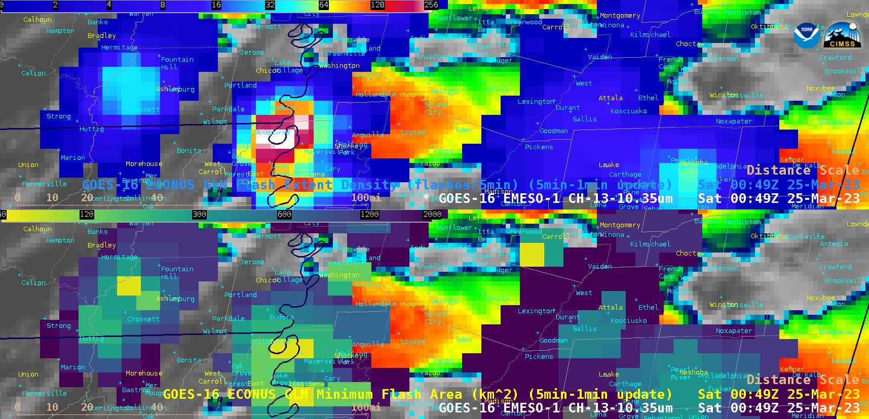
GOES-16 “Clean” Infrared Window (10.3 µm) images, with overlays of GLM Flash Extent Density (top) and GLM Minimum Flash Area (bottom) [click to play animated GIF | MP4]
In a comparison of 1-minute GOES-16 Infrared images with the corresponding Cloud Top Temperature (CTT) derived product (below), the coldest CTT was -75ºC over the Louisiana/Mississippi border at 0047 UTC (the coldest 10.3 µm infrared brightness temperature during that time period was -73ºC).
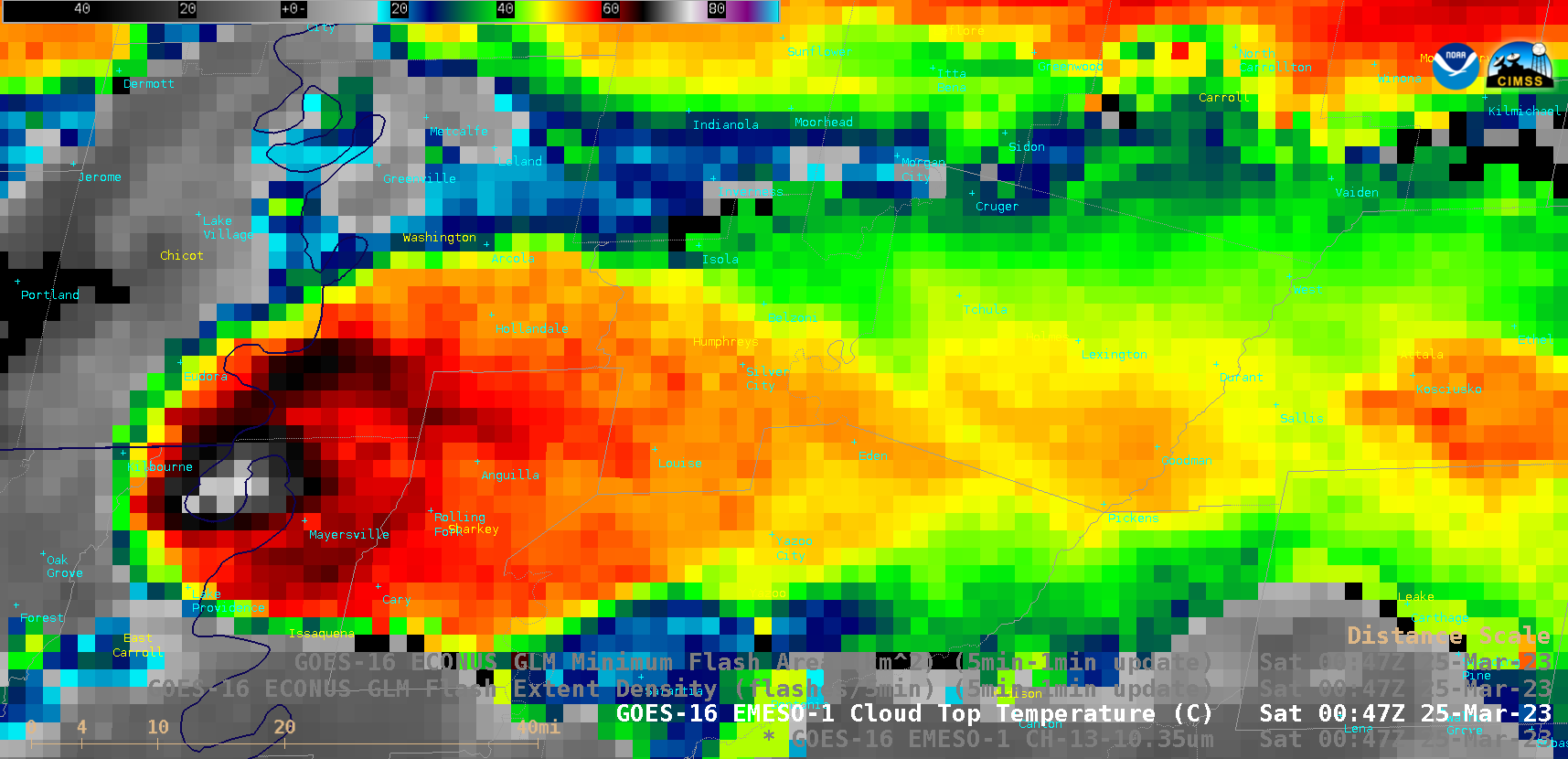
GOES-16 “Clean” Infrared Window (10.3 µm) images and Cloud Top Temperature derived product, from 0028-0208 UTC [click to play animated GIF | MP4]
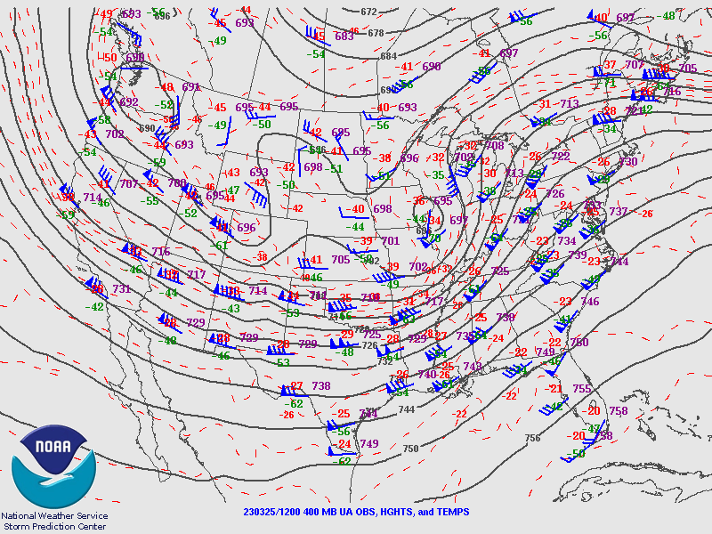
According to a plot of Jackson, Mississippi rawinsonde data at 0000 UTC on 25 March (source), the coldest -75ºC Cloud Top Temperature value closely corresponded to an altitude near that of the calculated Most Unstable (MU) Maximum Parcel Level (MPL), which was 14 km (below).
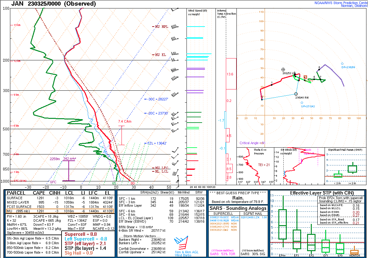
Plot of Jackson, Mississippi rawinsonde data at 0000 UTC on 25 March [click to enlarge]
GOES-16 Total Precipitable Water, Lifted Index and Convective Available Potential Energy (CAPE) derived products (below) displayed a corridor of moisture and instability that extended north-northeastward across the Mississippi Valley ahead of an approaching cold front — which helped to create a favorable environment for the development of severe thunderstorms.
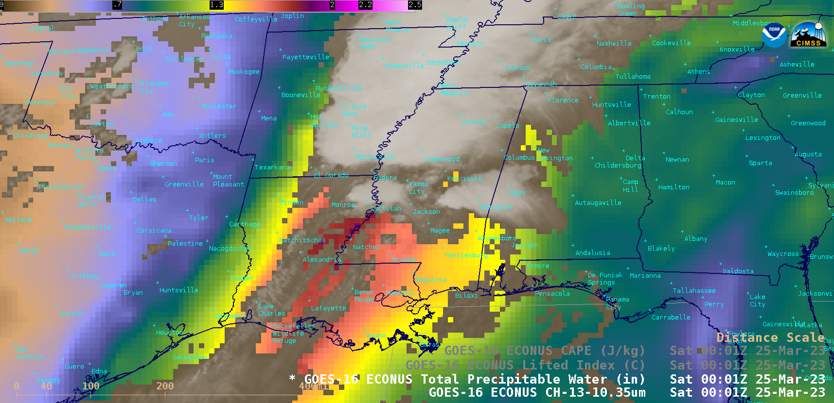
GOES-16 Total Precipitable Water, Lifted Index and Convective Available Potential Energy (CAPE) derived products [click to play animated GIF | MP4]
View only this post
Read Less


