Cold cloud top temperatures associated with Hurricane Ingrid
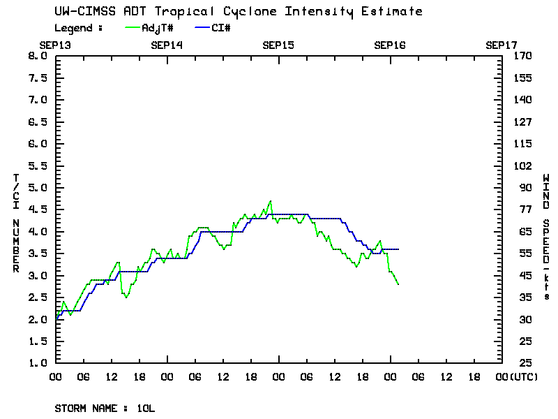
Hurricane Ingrid had been going though a period of slow intensification (ADT plot) off the Gulf Coast of Mexico during the overnight hours on 14 September –
Hurricane Ingrid had been going though a period of slow intensification (ADT plot) off the Gulf Coast of Mexico during the overnight hours on 14 September –
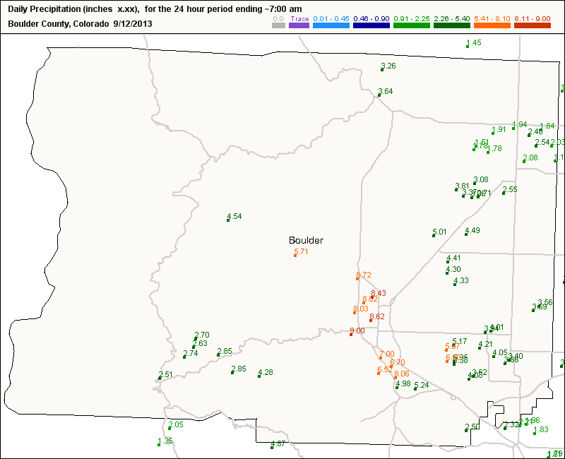
Heavy rain fell over much of the Front Range of Colorado overnight, with Boulder receiving an all-time 24-hour total of 9.08 inches (Weather Underground blog). Numerous CoCoRAHS locations in Boulder County reported 24-hour rainfall amounts in excess of 6″, in a region where monthly precipitation records are close... Read More
AWIPS images of 4-km resolution GOES-13 10.7 µm IR channel data (above; click image to play animation) showed areas of nocturnal thunderstorms over southeastern California, western Arizona, and southern Nevada on 19 August 2013. These storms were initially producing numerous cloud-to-ground lightning strikes... Read More
On the morning of July 22, 2003, a strong derecho moved through metropolitan Memphis, TN, with winds exceeding hurricane-force. The most significant impact of this storm was a loss of power caused in part by the many trees that were downed by the winds. The Storm Report for the day from... Read More
