The Memphis Derecho of July 22 2003
On the morning of July 22, 2003, a strong derecho moved through metropolitan Memphis, TN, with winds exceeding hurricane-force. The most significant impact of this storm was a loss of power caused in part by the many trees that were downed by the winds. The Storm Report for the day from the Storm Prediction Center shows a cluster of wind reports in and around Memphis and Shelby County. The National Weather Service office in Memphis produced a report on this event that includes radar imagery and a discussion of surface and upper-air observations. More information on this derecho is here. What do satellite data show for this event?
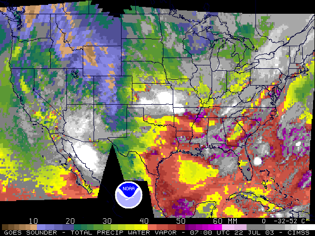
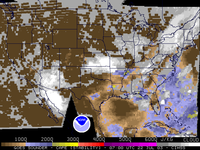
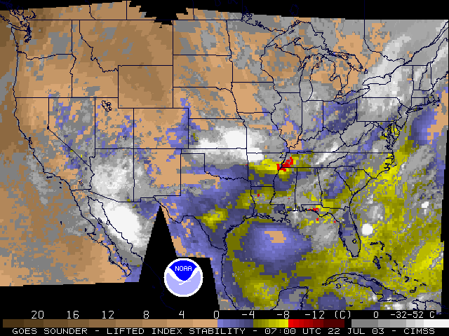
The animation of 10.7 µm imagery, above, shows the development of convection in southeast Kansas and northwest Arkansas that then moves eastward into the mid-South, hitting Memphis around 1200 UTC. Several overshooting tops are evident as the storms pass near Memphis, with the coldest brightness temperatures at 196K! Past derechosdiscussed on this blog (such as the one that hit the East Coast in 2012) were characterized by a channel of moisture and instability aligned with the storm motion, allowing the propagating thunderstorm complex access to a rich source of moisture and instability. This event in 2003 was no different. GOES-12 Sounder retrievals — during that year, 3×3 fields-of-view were used (versus single pixels now) — of Total Precipitable Water, Convective Available Potential Energy (CAPE) and Lifted Index (LI), show abundant moisture and instability aligned west-to-east across northern Arkansas. CAPE values exceeded 3000 J/kg, Total Precipitable Water was greater than 2 inches, and Lifted Indices were near -10.

GOES-10/GOES-12 Sounder-Derived Total Precipitable Water (3×3 Field of View) (Click Image to play animation)

GOES-10/GOES-12 Sounder-Derived Convective Available Potential Energy (CAPE) (3×3 Field of View) (Click Image to play animation)
Visible imagery, above, from GOES-12 shows the convection continuing to develop as it moves across the Mississippi River into Memphis. Several Overshooting tops are evident, as well as parallel cloud lines at the cirrus level that are usually associated with turbulence. GOES-10, as GOES-West, was also able to capture the convection as it moved through Memphis (below).


