VIIRS Sea Surface Temperature patterns in the Gulf of Mexico
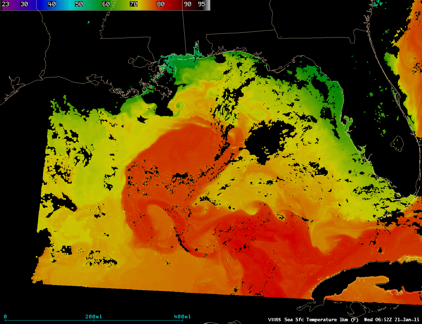
A sequence of four AWIPS images of the Suomi NPP VIIRS Sea Surface Temperature (SST) product (above) showed very detailed information about the SST patterns in the Gulf of Mexico on 21 January 2015. Two features in particular are worth noting: (1) what appears to be a train of