Occluding cyclone in the Gulf of Alaska
GOES-11 6.7µm “water vapor channel” imagery (above; QuickTime animation) revealed a textbook signature of an occluding cyclone over the Gulf of Alaska on 17 May 2007. A dry slot begins to interact with a baroclinic leaf feature after 00:00 UTC, with a distinct cloud head or “comma head” forming after 06:00 UTC. After 12:00 UTC, the characteristic “dry swirl” pattern is evident on the water vapor imagery, indicating that the cyclone was entering the occluded phase of its life cycle.
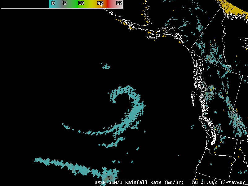
A classic hook-shaped pattern was also seen on AWIPS imagery of the DMSP SSM/I rainfall rate product (below), although rainfall rates were fairly light (in the 1-2 mm per hour range). NOAA Ocean Prediction Center guidance was forecasting gale and storm force winds in the northwestern quadrant of the occluding cyclone.
==================================================
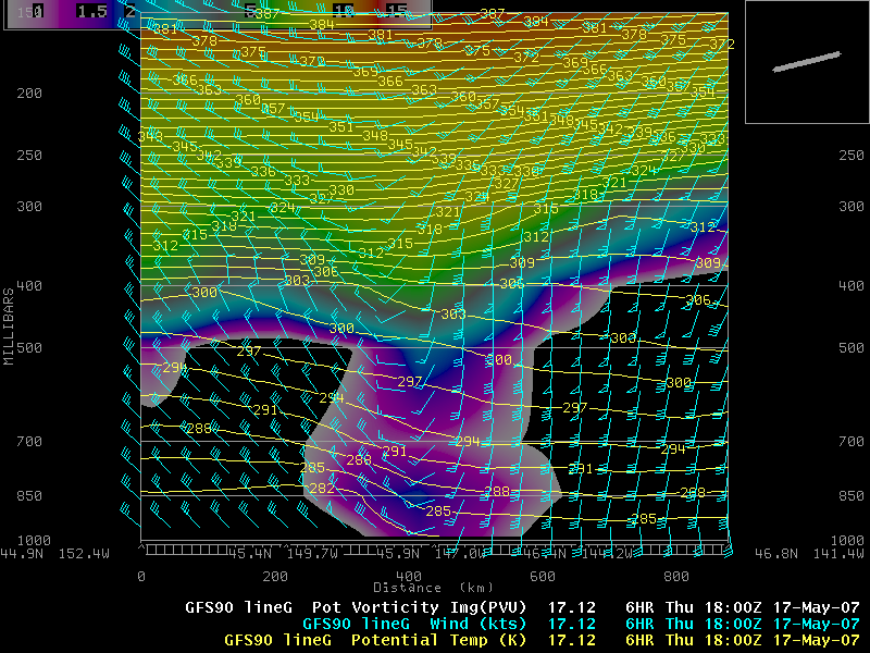
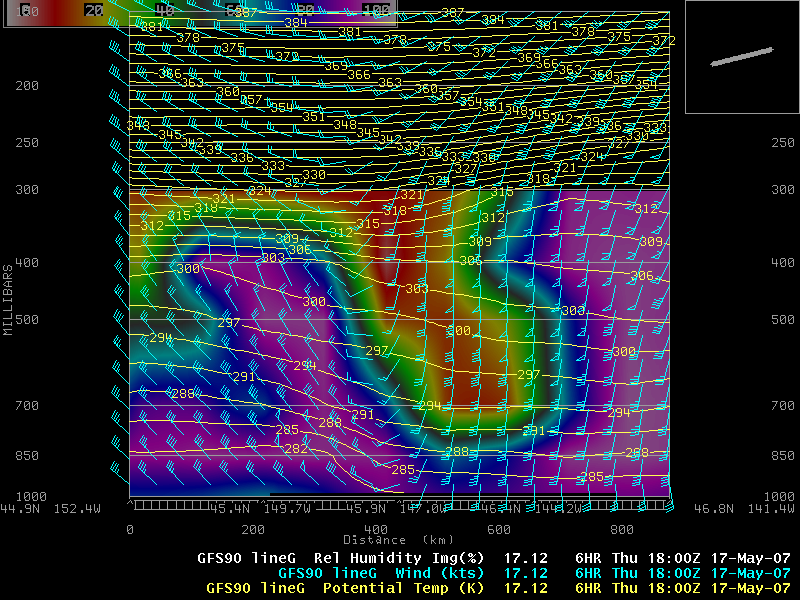
A cross section oriented west to east through the cyclone at 18:00 UTC using AWIPS GFS90 model fields indicated that the dynamic tropopause (taken to be 1.5 Potential Vorticity Units, purple to blue enhancement, above) was fairly low across the region of the cyclone (below the 500 hPa pressure level), with a hint of stratospheric air (greater than 1.5 PVU) extending downward to near the surface. A corresponding cross section of Relative Humidity (below) showed the very dry air (RH values less than 20%, orange to red enhancement) associated with the elevated dry slot that was wrapping around the cyclone.


