Ice storm in southeastern Kansas and southern Missouri
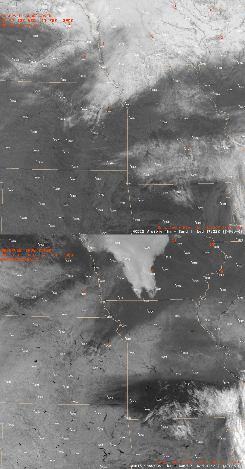
A significant ice storm affected parts of extreme southeastern Kansas and southern Missouri on 11–12 February 2008, leaving an accrual of ice more than 1 inch thick in parts of Missouri. AWIPS images of the visible and 1.6µm near-IR “snow/ice” channels (above) revealed the extent of the coverage of snow and ice that remained a day later on 13 February 2008. Note the very dark signal on the snow/ice channel image in Kansas/Missouri — even though there was much less snow cover there (1-5 inches) compared to areas farther north in eastern Iowa (where there was as much as 12-17 inches of snow on the ground), the fact that much of the affected portions of southeastern Kansas and southern Missouri were also coated with a thick layer of ice made that region exhibit a much stronger (and therefore darker) “snow/ice absorption signal”. In contrast to the darker snow/ice cover, supercooled water droplet clouds appear much brighter on the MODIS snow/ice channel image.
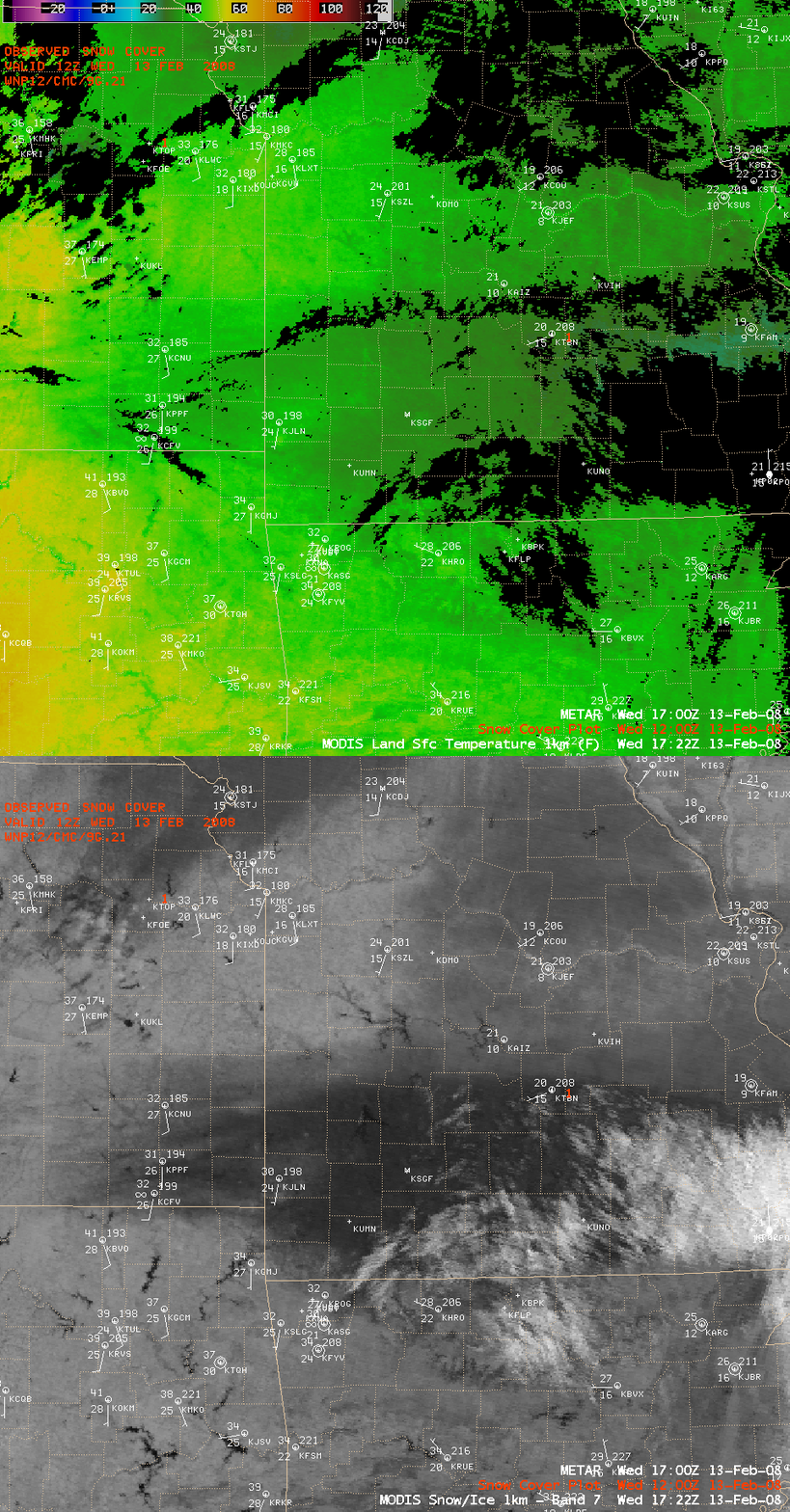
A slightly closer view using AWIPS images of the MODIS Land Surface Temperature (LST) and MODIS snow/ice channel images (below) showed that LST values were about 10º F colder (darker green enhancement) in the swath of snow/ice compared to the surrounding bare ground areas. Note that the “cloud mask” employed by the LST product does tend to produce some false cloud features (black pixels) in portions of the image where large gradients exist (for example, along the northern edge of the snow/ice swath).
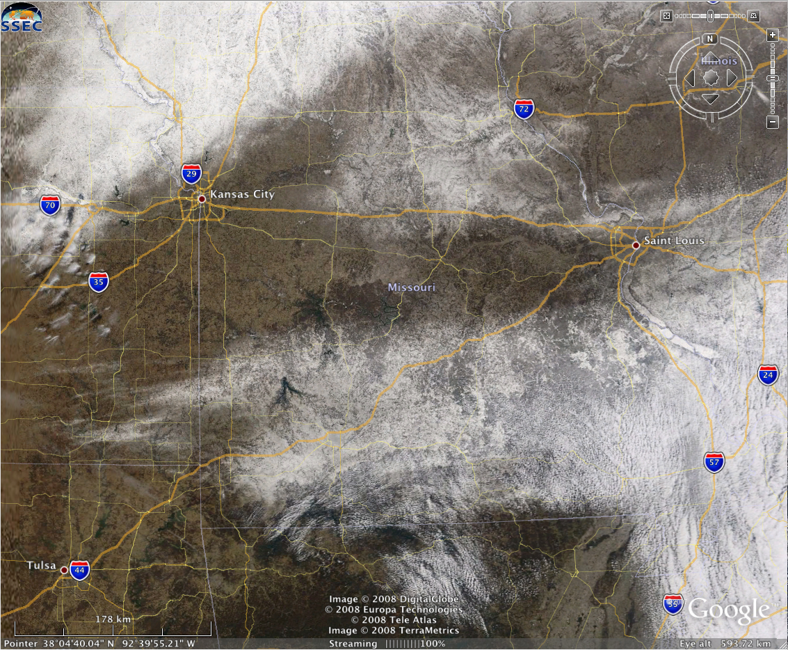
A MODIS true color image of the area (below, viewed using Google Earth) shows that the snow/ice storm affected a good deal of the Interstate 44 corridor in southern Missouri (between Tulsa, Oklahoma and Saint Louis, Missouri).


