Ice in southern Lake Michigan
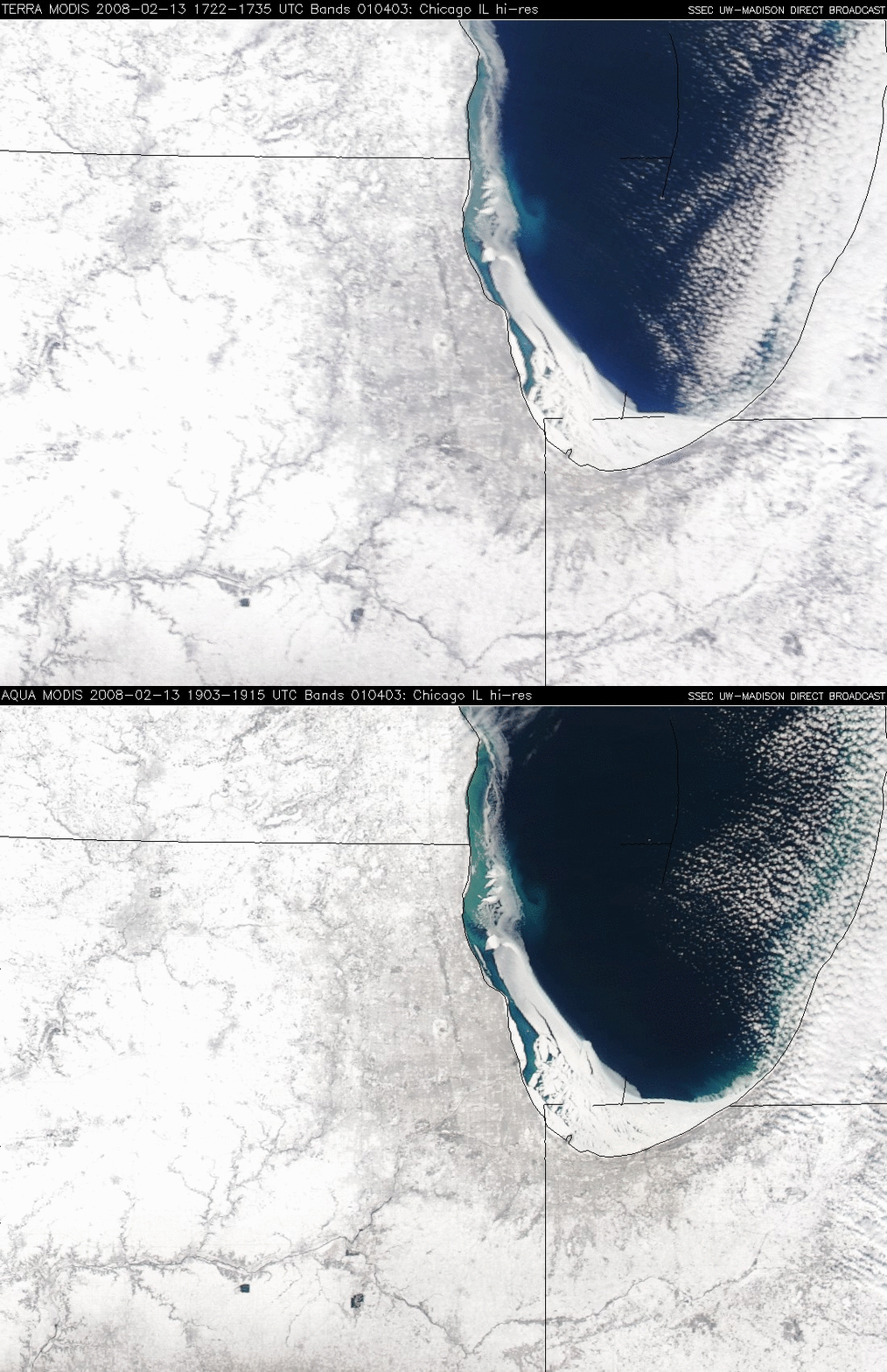
A comparison of Terra and Aqua MODIS true color images on 13 February 2008 (above) shows that thick ice had formed along the nearshore waters of southwestern Lake Michigan; cold arctic air over the region a few days earlier (the daily maximum/minimum temperatures at Chicago O’Hare on 10 February were +1ºF/-4ºF) led to an increase in thickness and areal coverage of lake ice along the coasts of Wisconsin, Illinois, and Indiana. The times of the 2 MODIS images above were about 111 minutes apart — Terra at 17:29 UTC (11:29am local time) Aqua at 19:10 UTC (1:10pm local time) — and they reveal that large segments of the lake ice were drifting eastward during that short time interval. Note the bright white appearance of the land surfaces, due to widespread deep snow cover (which ranged from about 5-6 inches in the Chicago metro area to 24 inches at Janesville in southern Wisconsin). Slightly darker portions of the visible image are due to a higher density of trees (especially in urban areas, and also along river valleys) — a very low tree density exists in the majority of this particular region due to agricultural land use in the rural areas.
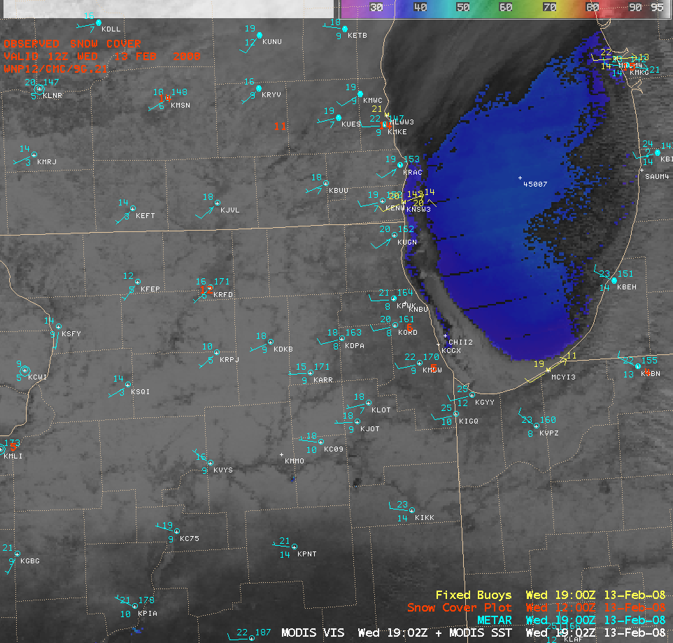
Surface METAR and buoy data plotted on an AWIPS image combination of the MODIS visible channel + the MODIS Sea Surface Temperature (SST) product (below) indicated that surface winds were west-southwesterly at around 10 knots during that time, no doubt aiding the eastward drift of the lake ice; SST values in the ice-free waters of southern Lake Michigan were quite cold, ranging from 33º to 39º F (dark blue to light blue enhancement).


