Another explosive eruption of Mount Ruang in Indonesia
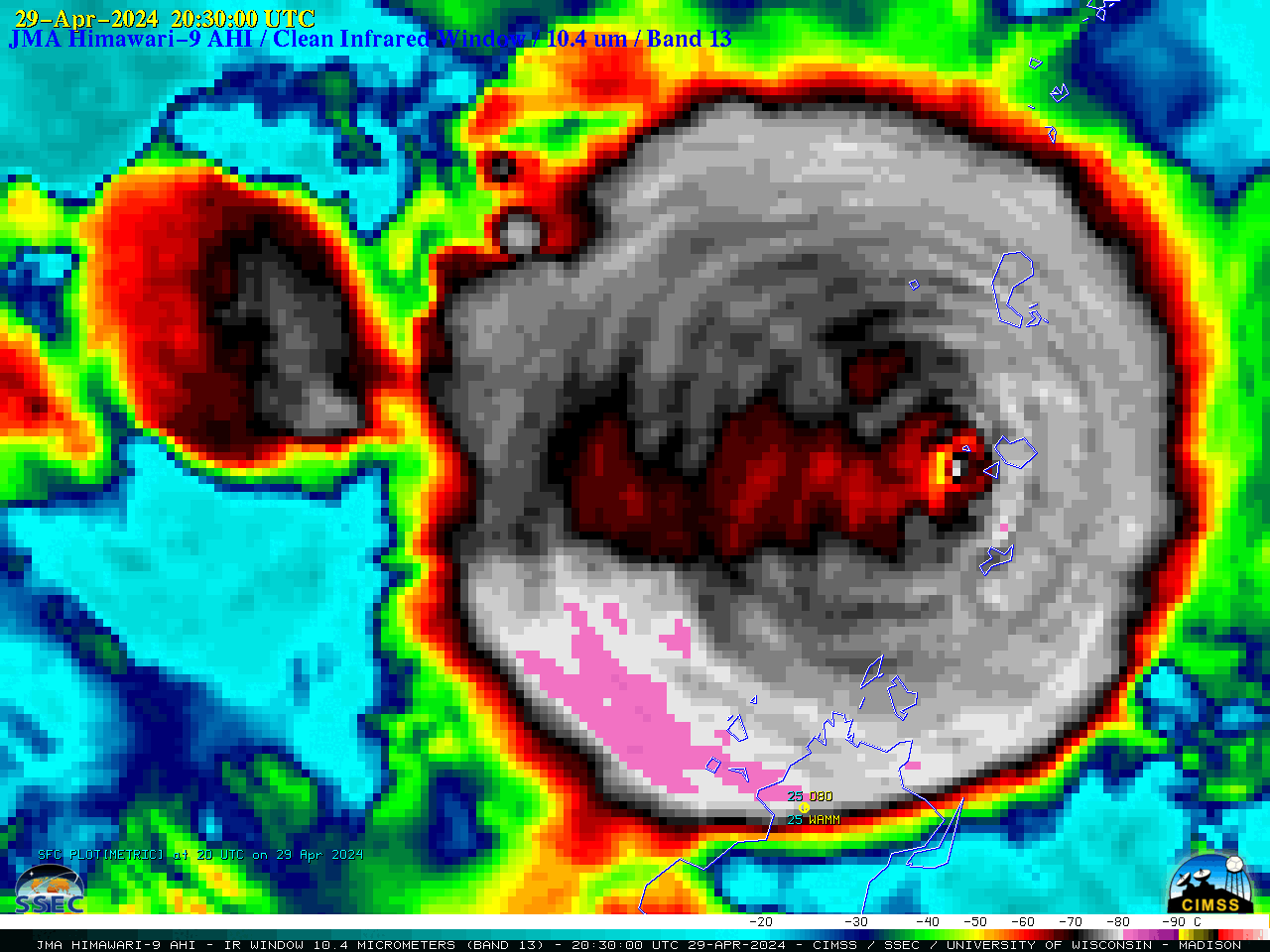
JMA Himawari-9 Infrared Window (10.4 µm) images, from 1810 UTC on 29 April to 0010 UTC on 30 April [click to play animated GIF | MP4]
12 days after its powerful eruption on 17 April, 10-minute JMA Himawari-9 AHI Infrared Window (10.4 µm) images (above) showed another explosive eruption of Mount Ruang in Indonesia on 29 April 2024. The coldest cloud-top infrared brightness temperatures reached -90ºC (internal yellow pixels) at 1850 UTC, shortly after eruption onset. Note that the volcanic umbrella cloud exhibited concentric cloud-top gravity waves from about 1900-2100 UTC. At the surface, volcanic ash (VA) was reported at Menado (station identifier WAMM: text | plot) beginning at 0000 UTC on 30 April, which restricted the visibility to 3-4 miles.
The volcanic umbrella cloud-top gravity waves were more apparent in higher-resolution Himawari-9 Red Visible (0.64 µm) images (below).

JMA Himawari-9 Red Visible (0.64 µm) images, from 2140-2240 UTC on 29 April [click to play animated GIF | MP4]
A toggle between Himawari-9 Visible and Infrared images at 2150 UTC on 29 April (below) showed that the primary volcanic plume (which reached heights above that of the broader umbrella cloud) exhibited warmer infrared brightness temperatures — indicating that it had penetrated the local tropopause and extended into the lower stratosphere.
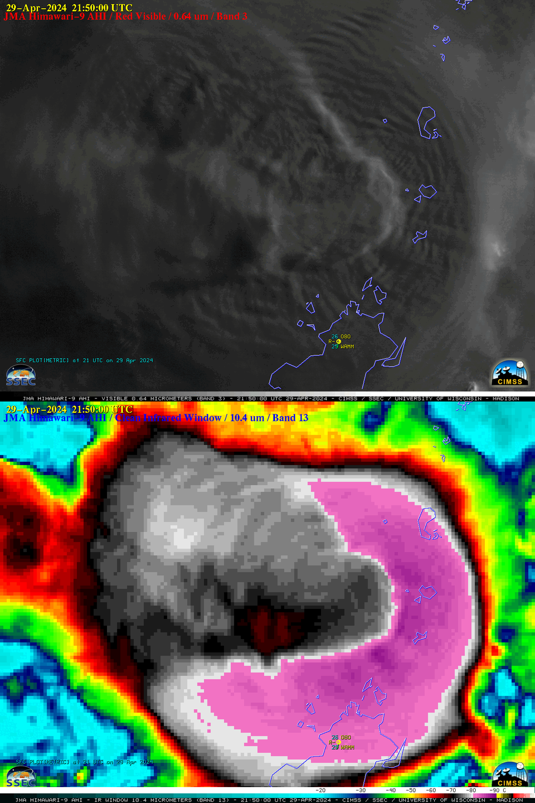
JMA Himawari-9 Red Visible (0.64 µm) and Infrared Window (10.4 µm) images at 2150 UTC on 29 April [click to enlarge]
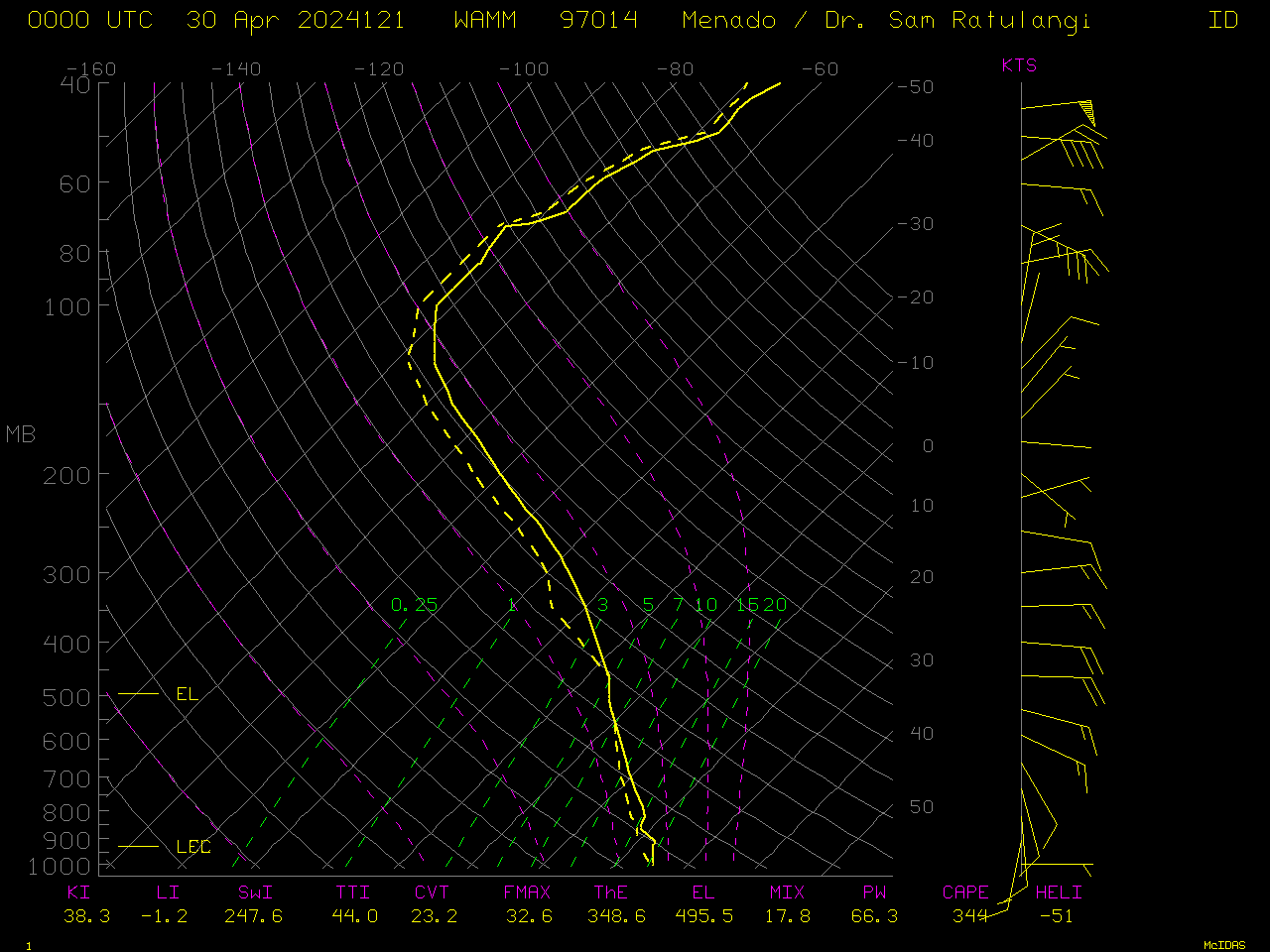
A plot of rawinsonde data from Menado, Indonesia at 0000 UTC on 30 April is shown below.
Himawari-9 imagery below compares a zoomed-out version of upper-level water vapor (Band 8, 6.25 µm) and the window channel (Band 13, 10.4 µm) that is also shown above. The zoomed-out version reveals some similarities is size in the evolution of the eruption cloud to that of surrounding tropical convection occurring at the same time. The Band 13 imagery does show that the eruptive cloud penetrates higher into the atmosphere than typical tropical convection (as discussed above).
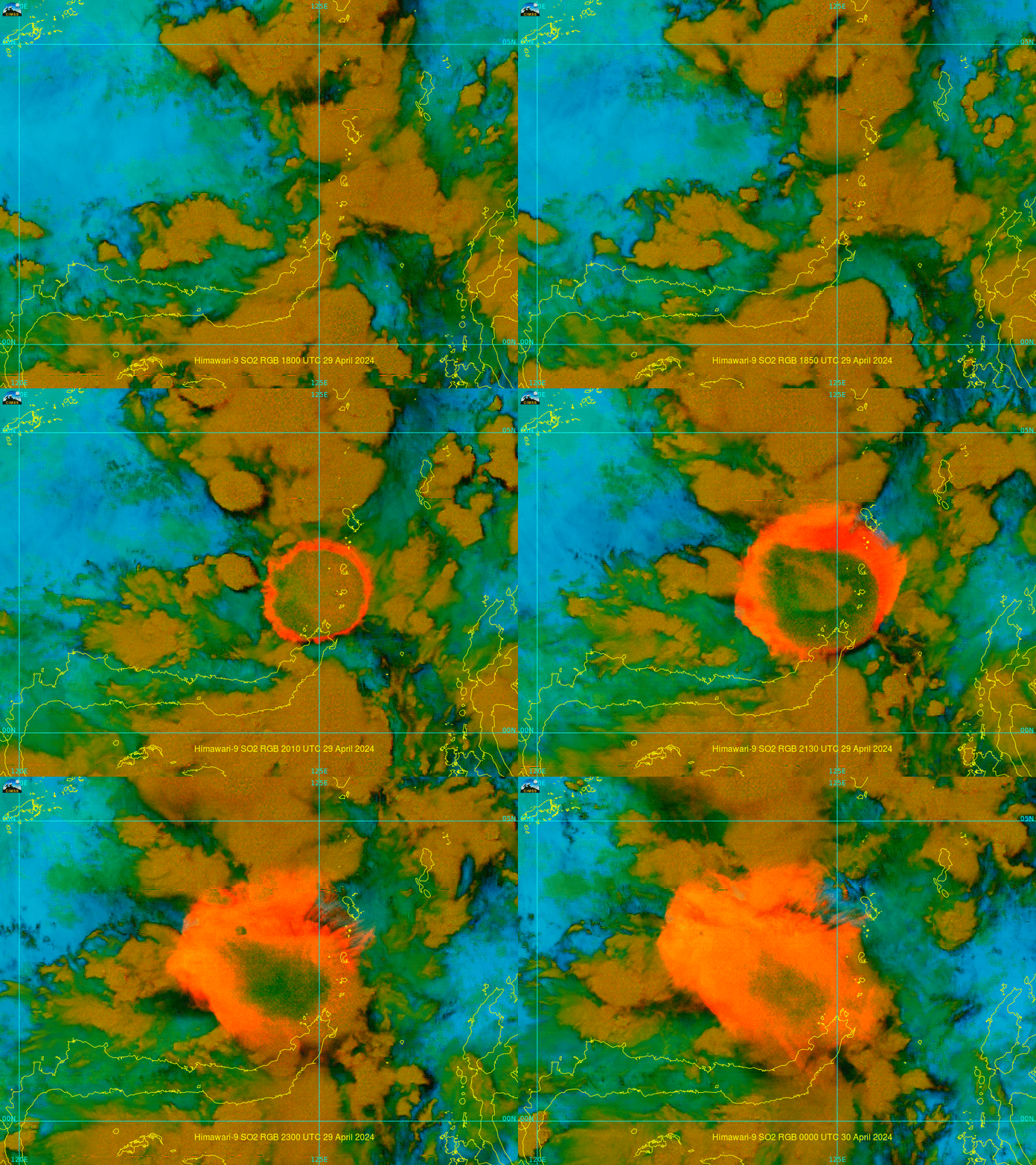
Himawari-9 SO2 RGB imagery (created using Geo2Grid), below, certainly distinguishes between the eruptive cloud of Ruang (whose edges become tinged in shades of orange to pink, suggesting a mixture of SO2 and Ash), and the developing cumulonimbus to the northwest.
