Severe thunderstorms across Nebraska and Iowa
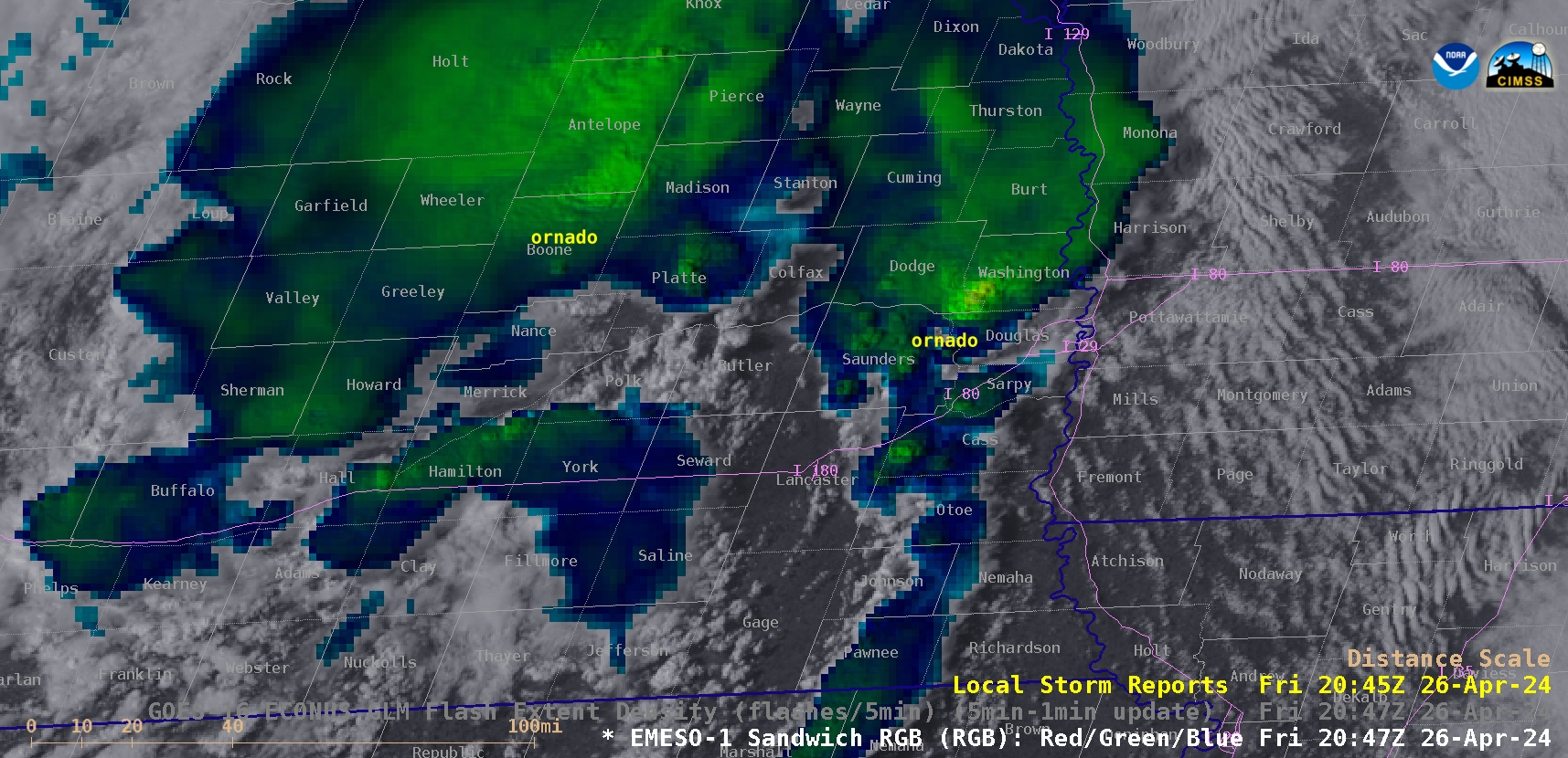
1-minute Mesoscale Domain Sector GOES-16 (GOES-East) Visible/Infrared Sandwich RGB images (above) showed thunderstorms that produced tornadoes, large hail and damaging winds (SPC Storm Reports) across eastern Nebraska and western Iowa on 26 April 2024.1-minute GOES-16 Visible/Infrared Sandwich RGB images with an overlay of GLM Flash Extent Density (below) showed the lightning activity associated with this convection — which included some notable lightning jumps as tornadic thunderstorms moved through the... Read More
