This website works best with a newer web browser such as Chrome, Firefox, Safari or Microsoft Edge. Internet Explorer is not supported by this website.

Archive: Tue Jul 2023

Supercell thunderstorm produces giant hail and 100 mph winds in South Dakota

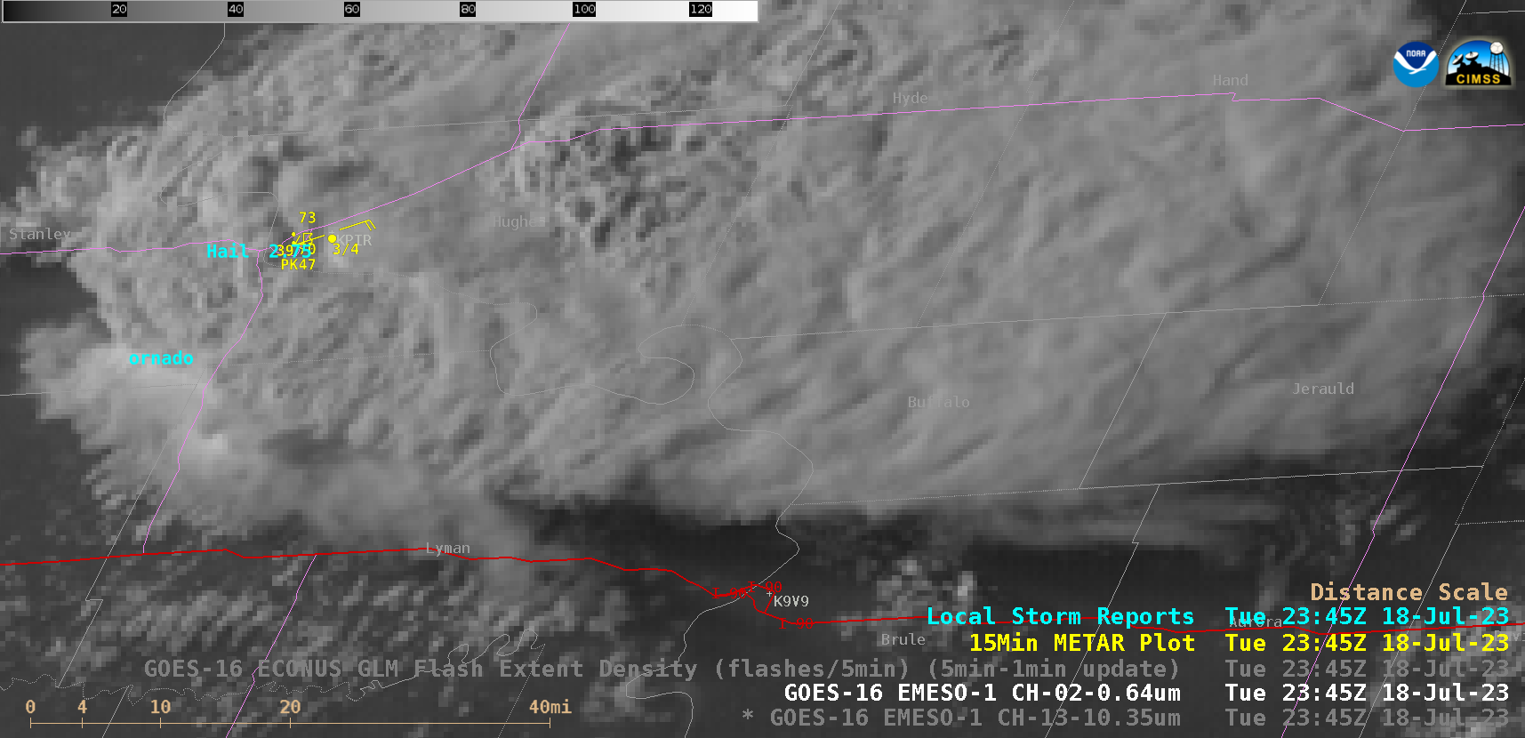
1-minute Mesoscale Domain Sector GOES-16 (GOES-East) “Red” Visible (0.64 µm) images (above) showed a supercell thunderstorm that produced a tornado, hail as large as 5.00 inches in diameter and wind gusts to 100 mph (SPC Storm Reports | NWS Aberdeen summary) in central South Dakota during the late afternoon and early evening hours on 18 July 2023. Several pulses of overshooting tops... Read More

SAR Winds over American Samoa waters

GOES-18 data above show persistent convection around Samoa and American Samoa between 0400 and 0730 UTC. Sentinel-1A overflew the region just after 0550 UTC, yielding information about wind features. At that time, a convective storm was developing in between Tutuila and Upolu. The animation below steps through the Band 13... Read More