SAR Winds over American Samoa waters
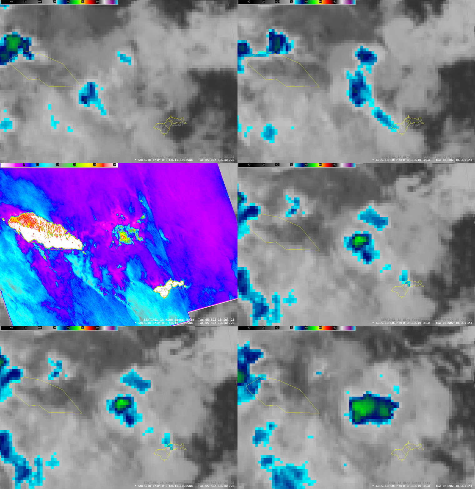
GOES-18 data above show persistent convection around Samoa and American Samoa between 0400 and 0730 UTC. Sentinel-1A overflew the region just after 0550 UTC, yielding information about wind features. At that time, a convective storm was developing in between Tutuila and Upolu. The animation below steps through the Band 13 (Clean window infrared, 10.3 µm) imagery, with a toggle that includes the SAR winds.

SAR detected strong winds under the convection — up to about 30 knots. The toggle below compares winds and Normalized Radar Cross Section fields taken from this website. Past SAR blog posts at this site have suggested that SAR winds are diagnosed too high in regions where significant ice is present in a convective cloud – because of reflection of the SAR Radar signal off that ice back to the satellite. A recent paper (link) suggests that the enhanced backscatter arises not from the ice, but from scattering from wobbling, non-spherical, oblate hydrometeors within the melting layer. That is, the cloud ice is necessary, but the signal arises only when the ice enters the melting layer.

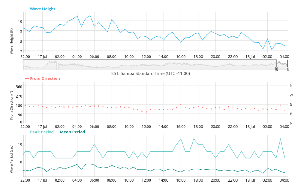
Wave observations from the Aunuu buoy (available at this website), below, show waveheights decreasing during the time of the convective development above (which was, after all, far removed from the buoy site).


