This website works best with a newer web browser such as Chrome, Firefox, Safari or Microsoft Edge. Internet Explorer is not supported by this website.

Archive: Sep 2022

30-second imagery of Hurricane Ian

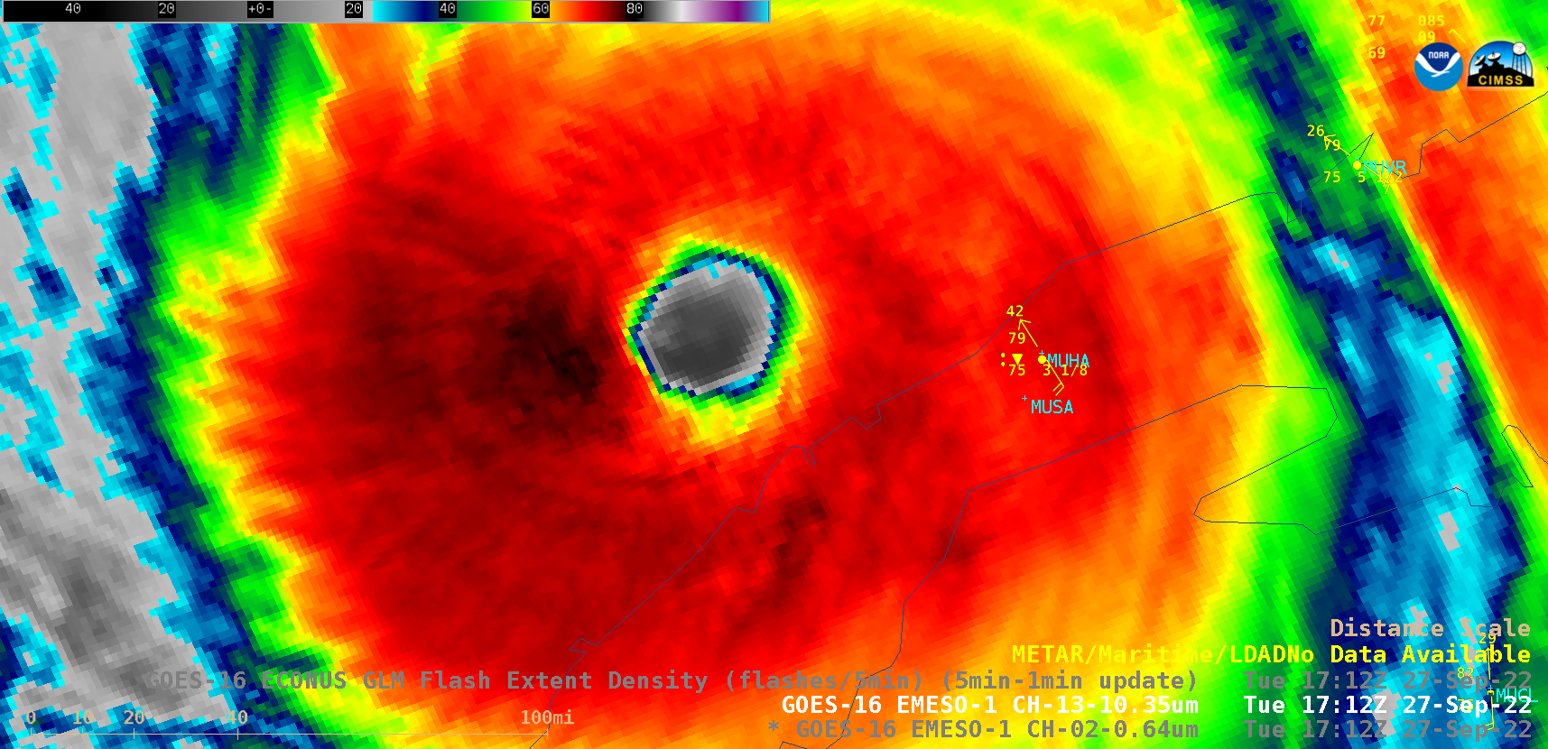
Overlapping 1-minute Mesoscale Domain Sectors provided 30-second interval GOES-16 (GOES-East) “Red” Visible (0.64 µm) images, with and without an overlay of GLM Flash Extent Density (above) — which showed the well-defined eye of Category 3 Hurricane Ian as it moved away from the northern coast of Cuba on 27 September 2022. Near-continuous... Read More

Low-Earth Orbit satellite views of Ian as it formed, and comparisons to Geostationary imagery

Polar-orbiting satellites have microwave detectors that give important information about the low-level structure of an evolving tropical cyclone. If high clouds are omnipresent, it can be difficult for an analyst to diagnose storm strength with accuracy. Microwave energy penetrates clouds, however, and low-earth orbit (LEO) observations of microwave frequencies can... Read More

Center-fixing a storm with SAR and SSMIS data

Sentinel overflew Tropical Storm Gaston, northwest of the Azores Islands, shortly before 0800 UTC on 23 September 2022, as shown above. The Beaufort Scale enhancement suggest peak winds derived from SAR observations to be very close to 50 knots in curved bands to the east/southeast of the center, inferred to... Read More