Low-Earth Orbit satellite views of Ian as it formed, and comparisons to Geostationary imagery
Polar-orbiting satellites have microwave detectors that give important information about the low-level structure of an evolving tropical cyclone. If high clouds are omnipresent, it can be difficult for an analyst to diagnose storm strength with accuracy. Microwave energy penetrates clouds, however, and low-earth orbit (LEO) observations of microwave frequencies can reveal much about a storm’s structure.
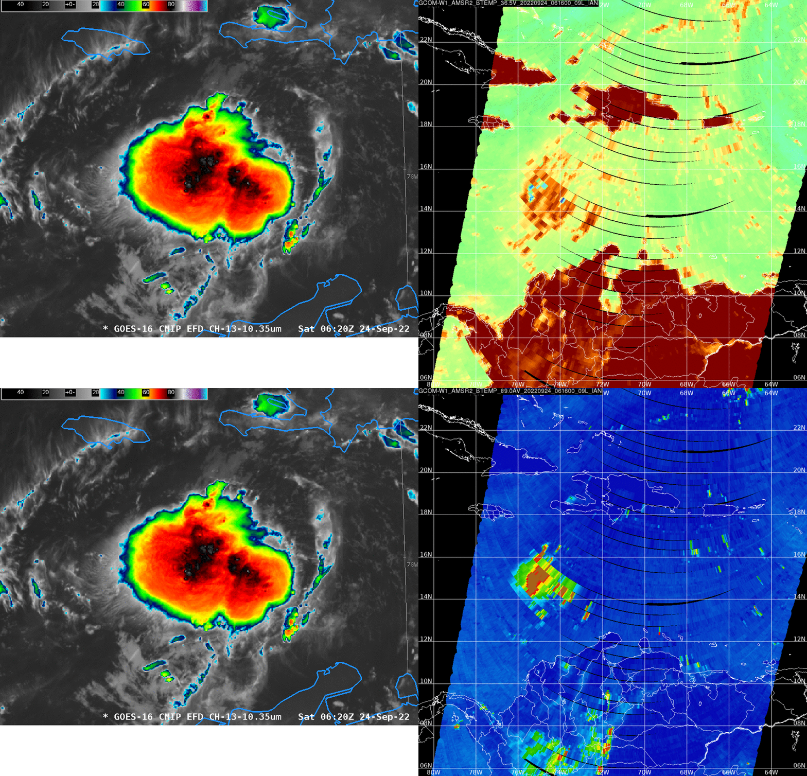
24 September: South of Haiti
Consider the imagery below, showing the cluster of thunderstorms associated with then-Tropical Storm Ian south of Haiti. Based on just the still infrared image (admittedly, this would be easier with an animating image!), where would you place the center? Microwave data — 36.5 GHz and 89 GHz data from GCOM-W1 (from the AOML Direct Broadcast site here) suggest a center in between the top large regions of cold cloud tops in the infrared imagery (the 0900 UTC discussion has a center near 14.7oN, 73.5oW). MIMIC Tropical Cyclone imagery (from this link) for Ian on 24 September (here) can help a user determine where the center is as well.
25 September: Southwest of Jamaica
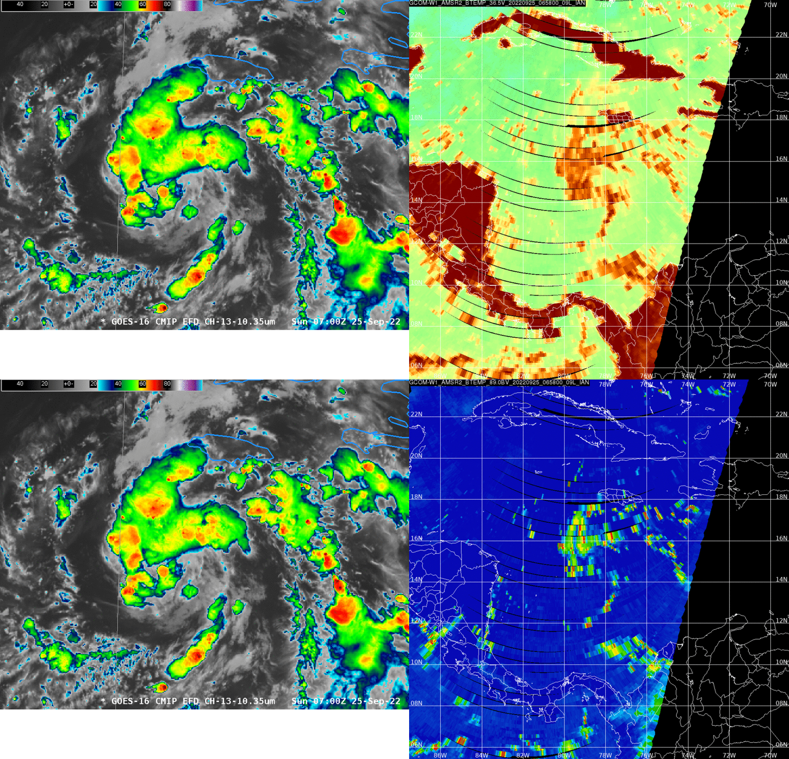
One day later, imagery from ABI and GCOM-W1 show a better-defined tropical system at 0700 UTC (Here’s the NHC discussion from 0900 UTC, at which time the center was at 14.9oN, 78.8oW). Even from the still ABI image, one could infer a center based on the spiral bands. Microwave information (36.5 and 89.0 GHz) certainly will increase confidence. Indeed, the low-level microwave signal (i.e., from 36.5 GHz) suggests a center very near the 0900 UTC location. The MIMIC TC animation from 0000 UTC 25 September – 0000 UTC 26 September (link) is showing a stronger signal for a center as well.
26 September: south of Western Cuba
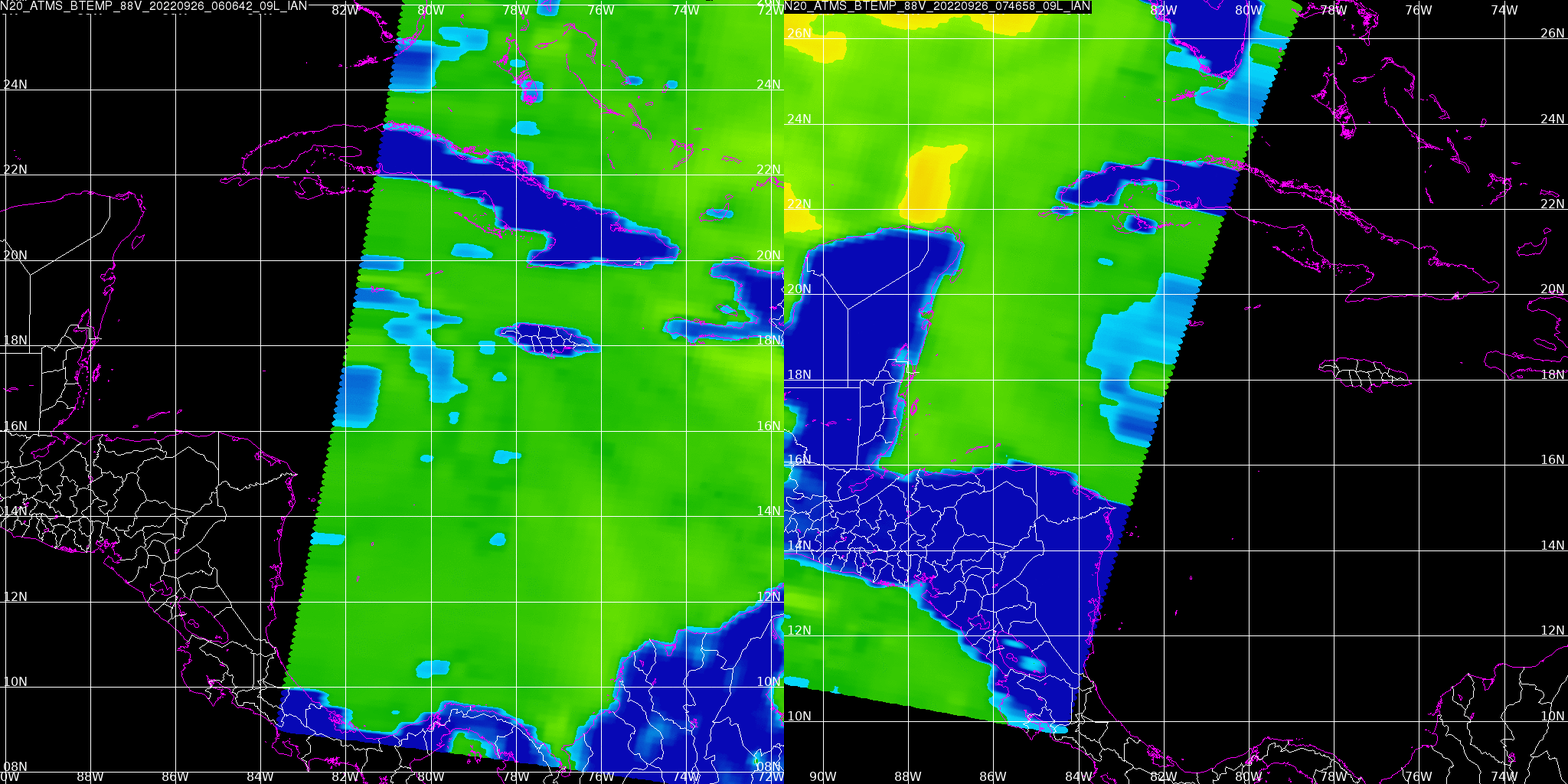
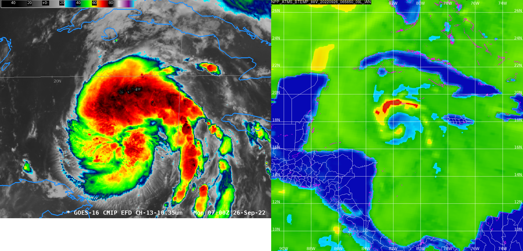
The LEO coverage on 26 September is a great example of why multiple LEO satellites are vital. The early-morning coverage from NOAA-20 is shown above; the gap between the two satellite passes is in an unfortunate spot for monitoring this tropical cyclone! However, Suomi NPP orbits overlap NOAA-20, and on this day Suomi NPP overflew the center of the storm, as shown below. The cadence was NOAA-20 to the east, 45 minutes later Suomi-NPP over the center, 45 minutes later NOAA-20 to the west. Here is an animation of the three passes. Polar monitoring capabilities will receive a big boost when JPSS-2 (slated to become NOAA-21) is launched (tentatively scheduled for 1 November 2022).
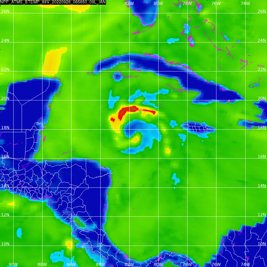
Ian at 0700 UTC on 26 September, below, is on the cusp of being upgraded to a hurricane (0600 UTC intermediate advisory), and an animation of the Band 13 imagery (a still image is shown below for comparison to the ATMS imagery) shows the center of rotation even though an eye is not present in the infrared (although one in the microwave).
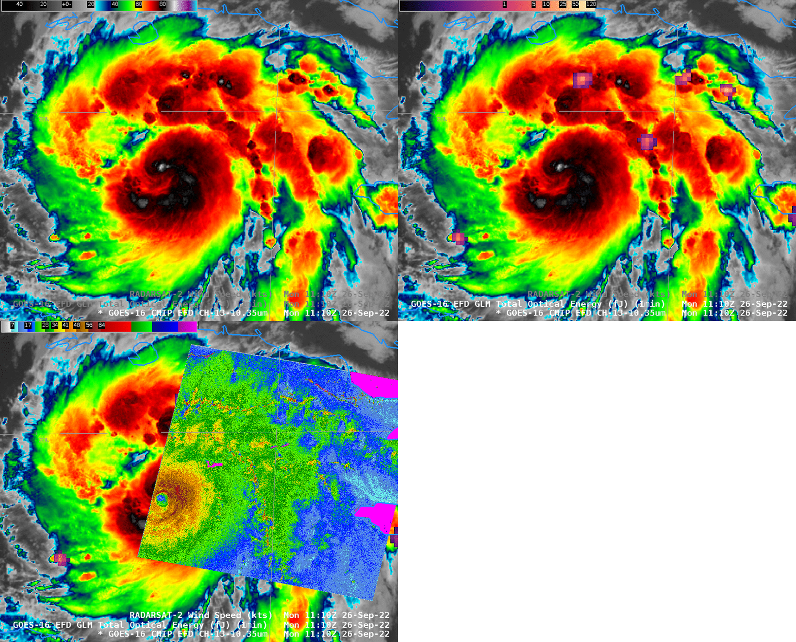
ATMS and AMSR2 imagery as shown above are created from passive microwave sensors; that is, the sensors are detecting the microwave imagery emitted by the ocean, land, clouds and atmosphere. Other LEO satellites emit energy (“ping”) in the microwave and listen for a return signal. This leads to both scatterometry (not shown, as from the Advanced Scatterometer — ASCAT — instrument on Metop-B and Metop-C — available here) and Synthetic Aperture Radar imagery (available here for tropical cyclones), and shown below. The image below shows infrared and GLM imagery for then-newly upgraded Hurricane Ian (link). Although a distinct eye is still not present in the infrared imagery, SAR wind data defines an obvious region of reduced winds. Maximum SAR winds in this image are just above 70 knots.
VIIRS and ATMS imagery of Hurricane Ian on 27 September is here. For the latest information on Hurricane Ian, please refer to the National Hurricane Center. People in southern (and especially southwestern) Florida should be paying very close attention to this storm.

