This website works best with a newer web browser such as Chrome, Firefox, Safari or Microsoft Edge. Internet Explorer is not supported by this website.

Archive: Apr 2022

A month of Himawari imagery over Guam

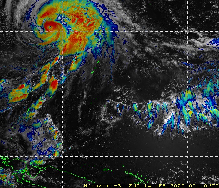
The month-long animation above shows the Himawari-8 Sandwich Product (daytime, blending visible band 3 (0.64 µm) and Band 13 (10.41 µm); and nighttime: Infrared only (Band 13, 10.41 µm) ) for the period from 16 March 2021 through 16 April 2021 over the Pacific Island (1) sector from this site, courtesy... Read More

Severe thunderstorms move from southern Missouri into northeastern Arkansas

Overlapping 1-minute Mesoscale Sectors provided 30-second GOES-16 (GOES-East) “Clean” Infrared Window (10.35 µm) images (above) — with time-matched plots of SPC Storm Reports — of thunderstorms that produced straight-line wind damage and hail as large as 4.25 inches in diameter across far southern Missouri and northeastern Arkansas after sunset on 15 April 2022. These storms... Read More

Blowing snow across the North Slope of Alaska

A sequence of Suomi-NPP VIIRS Visible (0.64 µm) and Shortwave Infrared (3.74 µm) images (above) revealed a long east-to-west oriented swath of horizontal convective roll (HCR) clouds associated with blowing snow and blizzard conditions across parts of the North Slope of Alaska on 15 April 2022. The plume of supercooled... Read More