Severe thunderstorms move from southern Missouri into northeastern Arkansas
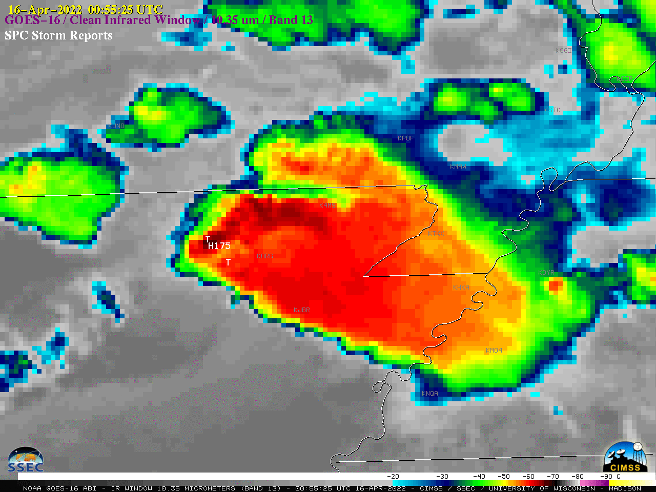
Overlapping 1-minute Mesoscale Sectors provided 30-second GOES-16 (GOES-East) “Clean” Infrared Window (10.35 µm) images (above) — with time-matched plots of SPC Storm Reports — of thunderstorms that produced straight-line wind damage and hail as large as 4.25 inches in diameter across far southern Missouri and northeastern Arkansas after sunset on 15 April 2022. These storms... Read More