This website works best with a newer web browser such as Chrome, Firefox, Safari or Microsoft Edge. Internet Explorer is not supported by this website.

Archive: Sat Dec 2021

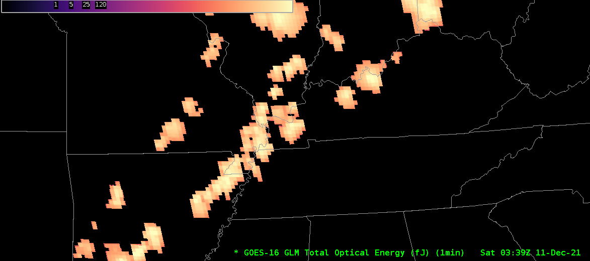
LightningCast in cold air

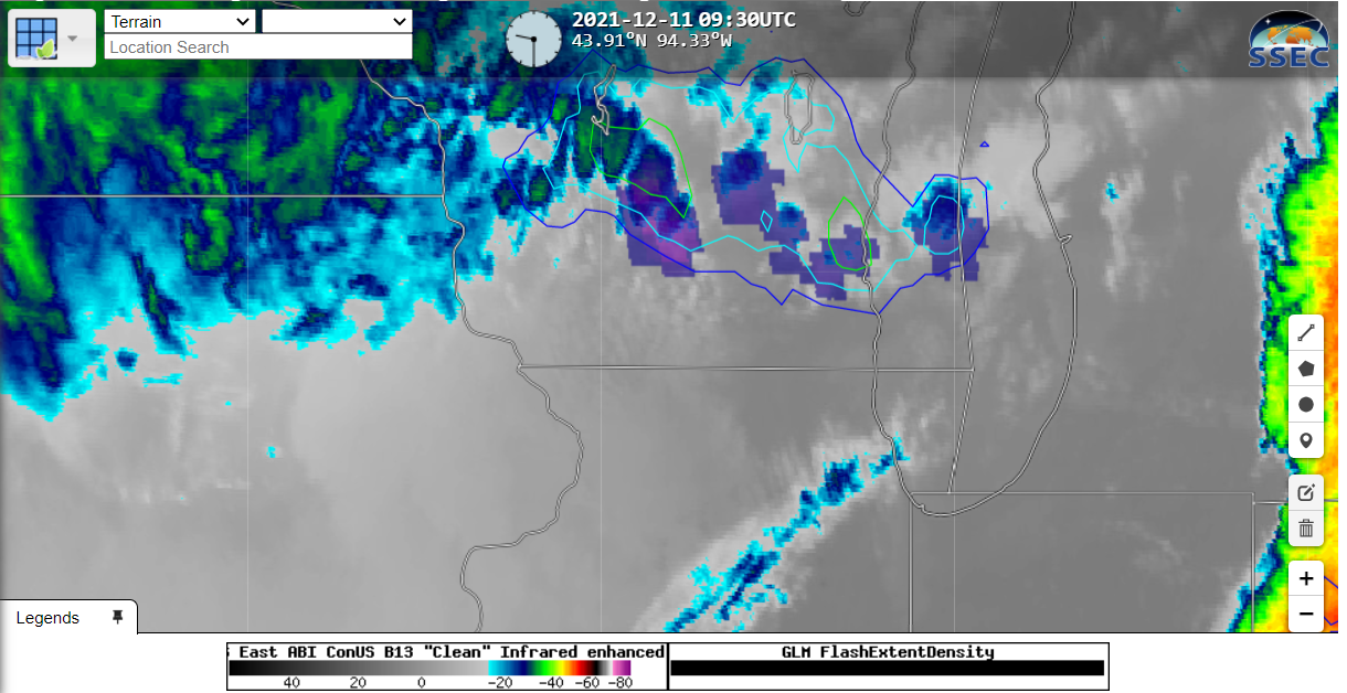
LightningCast probabilities are part of the ProbSevere portfolio, and they are available in RealEarth (link). This machine-learning product relates Band 13 and Band 15 observations to the probability of lightning occurrence (in daytime, Band 2 and Band 5 are also used). When your blogger was awakened by thunder (at 0826... Read More

Historic tornado outbreak across the Midwest and Southeast US

1-minute Mesoscale Domain Sector GOES-16 (GOES-East) “Clean” Infrared Window (10.35 µm) images (above) include time-matched plots of SPC Storm Reports during a large outbreak of severe weather across parts of the Midwest and Southeast US from late in the day on 10 December to a few hours after midnight on 11 December 2021. The severe thunderstorms developed in advance of a strong... Read More

GLM observations of a long-track tornado

Gridded GLM observations of Total Optical Energy, above, capture the tornado-producing long-lived storm that hit Mayfield KY (and others) on 10 December. This storm had its genesis in eastern Arkansas, and it moved northeastward through the bootheel of Missouri, then into western Kentucky. It was mostly isolated from a line... Read More