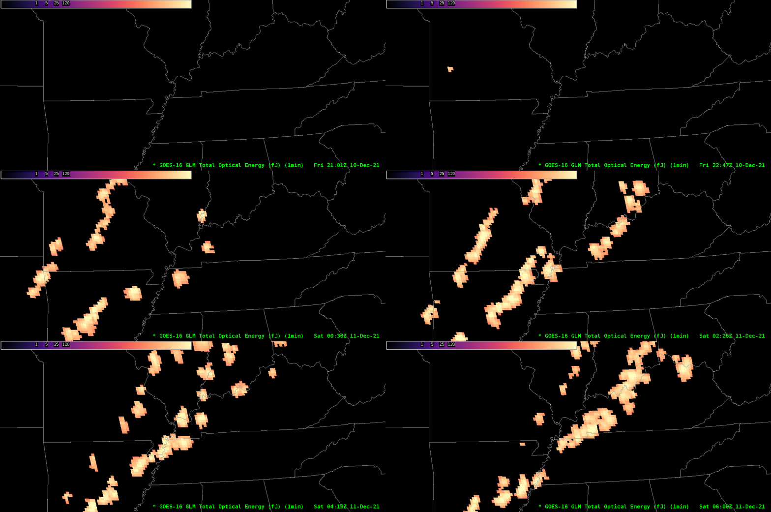
GLM observations of a long-track tornado

Gridded GLM observations of Total Optical Energy, above, capture the tornado-producing long-lived storm that hit Mayfield KY (and others) on 10 December. This storm had its genesis in eastern Arkansas, and it moved northeastward through the bootheel of Missouri, then into western Kentucky. It was mostly isolated from a line of convection to its west until it approached Louisville at around 0600 UTC, when the cells began to join together.
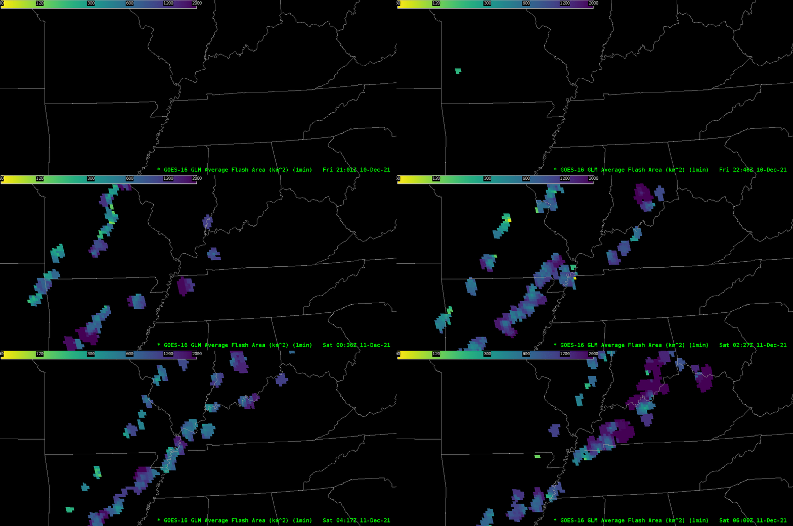
GLM observations of Average Flash Area for the same time period are shown below.


