ACSPO SSTs off the Oregon Coast
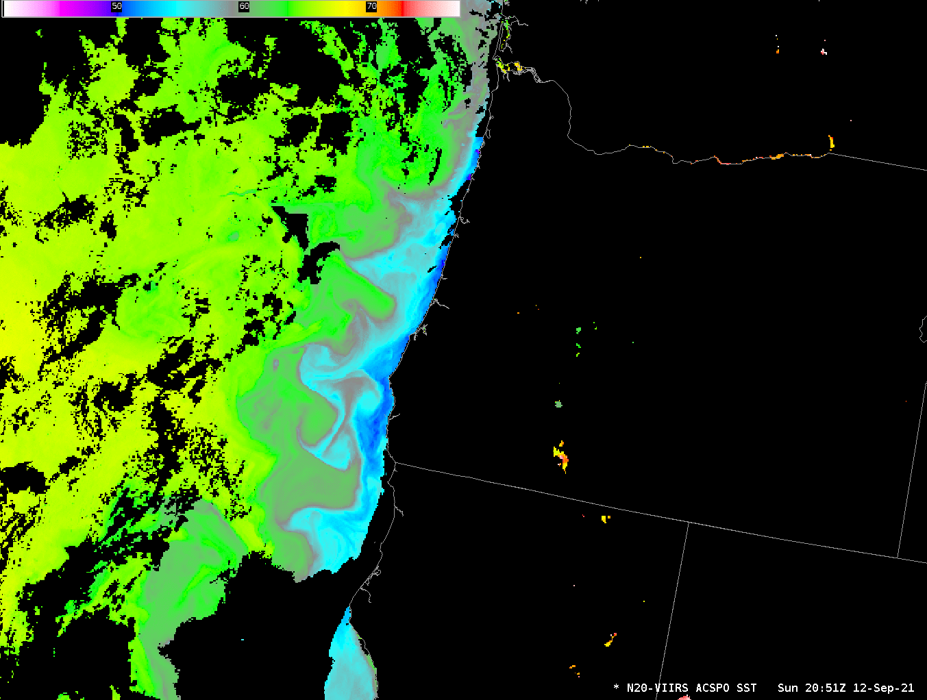
Clear skies to the west of Oregon and California in the past two days have allowed VIIRS data (VIIRS — the Visible-Infrared Imaging Radiometer Suite flying on both Suomi-NPP and NOAA-20) to produce compelling imagery of the Sea Surface using Advanced Clear Sky Processing for Ocean (ACSPO) algorithms. VIIRS imagery is downlinked at... Read More
