![GOES-17 True Color RGB images [click to play animation | MP4]](https://cimss.ssec.wisc.edu/satellite-blog/images/2020/11/GOES-17_ABI_RadF_true_color_2020322_220031Z.png)
GOES-17 True Color RGB images [click to play animation | MP4]
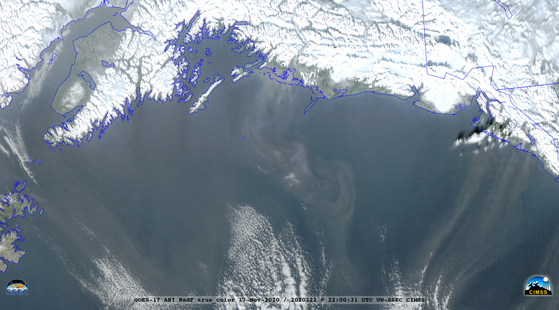
GOES-17
(GOES-West) True Color Red-Green-Blue (RGB) images created using
Geo2Grid (above) showed the offshore transport of glacial silt across the Gulf of Alaska during the 17-18 November 2020 period. A strong pressure gradient between an inland dome of high pressure and a low pressure system off the coast of British Columbia (
surface analyses) forced strong gap winds that accelerated down glacial valleys — lofting the glacial silt from the surface and carrying it off the coast. The most notable plume on both days was streaming out of the
Copper River Valley.
Metop-A ASCAT surface scatterometer winds from this site (below) revealed wind speeds in the 30-40 knot range exiting the coast of the northern Alaska Panhandle at 0536 UTC on 18 November.
![Metop-A ASCAT surface scatterometer winds [click to enlarge]](https://cimss.ssec.wisc.edu/satellite-blog/images/2020/11/201118_0536utc_metopA_ascat.png)
Metop-A ASCAT surface scatterometer winds [click to enlarge]