This website works best with a newer web browser such as Chrome, Firefox, Safari or Microsoft Edge. Internet Explorer is not supported by this website.

Archive: Oct 2020

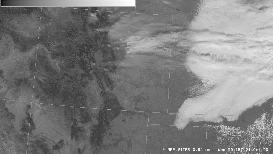
Multiple pyrocumulonimbus clouds produced by the East Troublesome Fire in Colorado

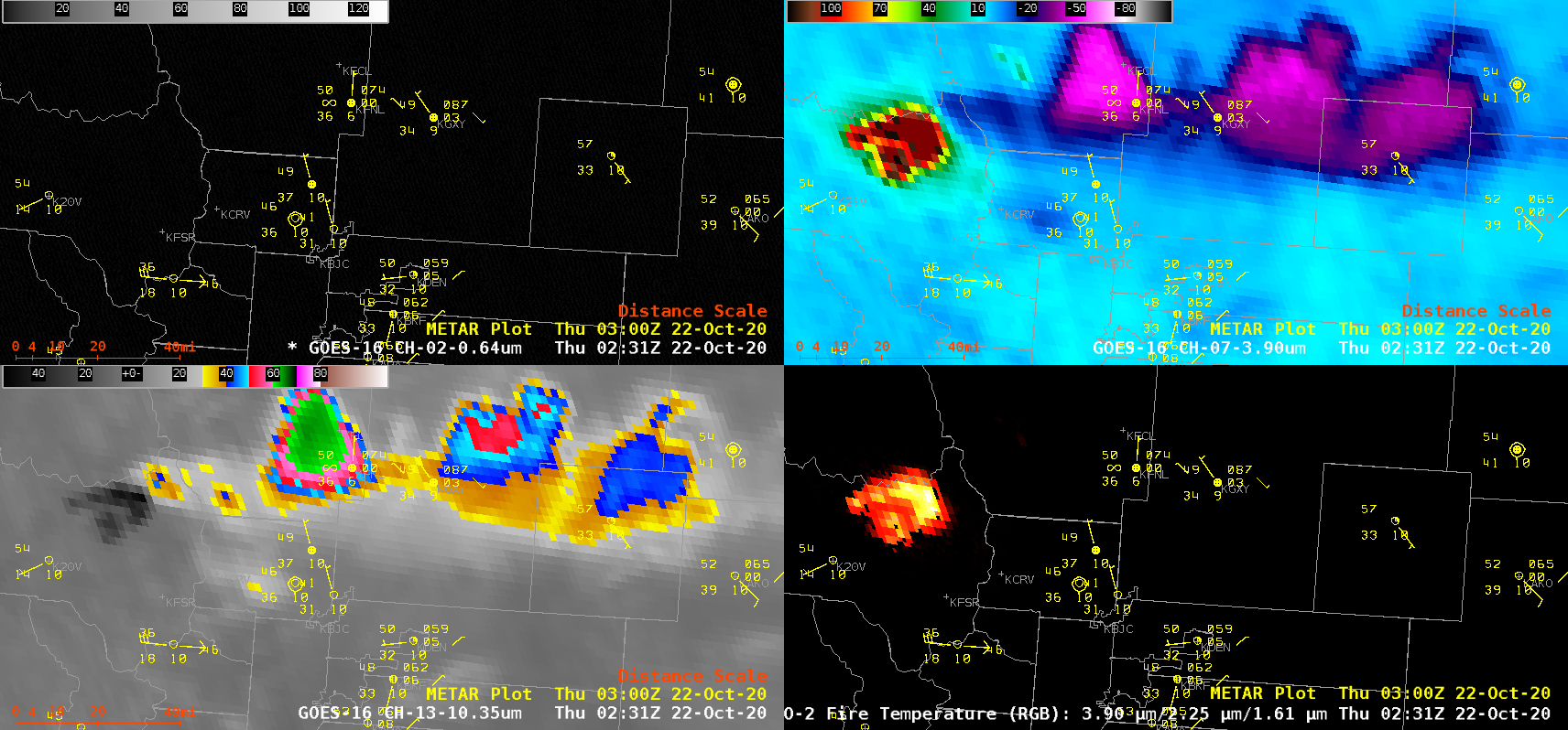
1-minute Mesoscale Domain Sector GOES-16 (GOES-East) “Red” Visible (0.64 µm), Shortwave Infrared (3.9 µm), “Clean” Infrared Window (10.35 µm) and Fire Temperature Red-Green-Blue (RGB) images (above) showed a period of extreme behavior of the East Troublesome Fire in Colorado around and just after sunset on 21 October 2020. This rapidly-growing wildfire produced a series of pyrocumulonimbus (pyroCb) clouds — the coldest pyroCb cloud-top 10.35 µm infrared brightness temperatures... Read More

Hurricane Epsilon

Hurricane Epsilon underwent rapid intensification (ADT | SATCON) on 21 October 2020 — and 1-minute Mesoscale Domain Sector GOES-16 (GOES-East) “Red” Visible (0.64 µm) and “Clean” Infrared Window (10.35 µm) images (above) showed Epsilon as it intensified from a  Category 1 to a Category 3 storm.GOES-16 Mid-level Water Vapor (6.9 µm) images with plots of Derived Motion Winds from CIMSS Tropical Cyclones site (below) displayed the broad... Read More

NUCAPS Sounding profiles surrounding Colorado’s East Troublesome Fire

The East Troublesome Fire in Colorado expanded greatly on 21 October (click here for more information), and produced pyrocumulus clouds.  NOAA-20 overflew the fire at around 1930 UTC (linked-to overpass map from this site) on 21 October, and NUCAPS profiles, shown above, diagnosed the stability of the mid- and upper-troposphere.  The toggle below between the NOAA-20 VIIRS Visible (0.64 µm) and Infrared (11.45 µm) imagery and NUCAPS Sounding availability... Read More