This website works best with a newer web browser such as Chrome, Firefox, Safari or Microsoft Edge. Internet Explorer is not supported by this website.

Archive: Sun Oct 2020

Tropical Storm Zeta in the Caribbean Sea

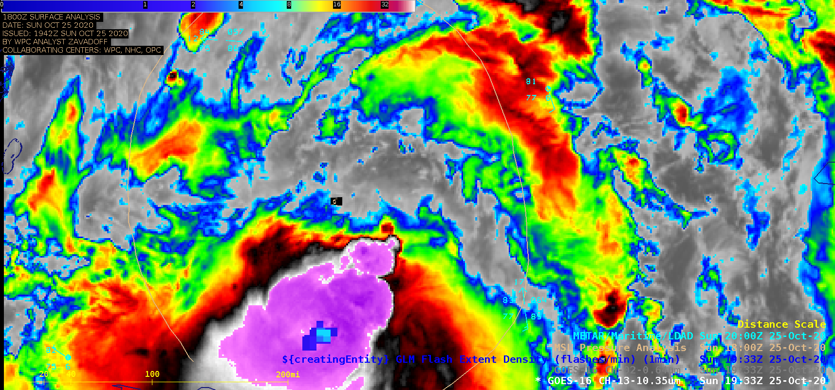
1-minute Mesoscale Domain Sector GOES-16 (GOES-East) “Clean” Infrared Window (10.35 µm) and “Red” Visible (0.64 µm) images (above) showed Tropical Storm Zeta in the northwest Caribbean Sea on 25 October 2020. While it remained somewhat disorganized, Zeta slowly intensified from 35 knots to 45 knots during that time period. The coldest cloud-top infrared brightness temperature observed was -94.4ºC.GOES-16 Infrared images with... Read More

Record-setting cold in Montana

A toggle between Suomi NPP VIIRS Infrared Window (11.45 µm) and Topography images (above) showed a pocket of cold air exhibiting a minimum infrared brightness temperature of -35.2ºC (-31.4ºF) in the vicinity of Potomac, Montana at 0915 UTC (3:15 am MDT) on 25 October 2020 — the overnight low air... Read More