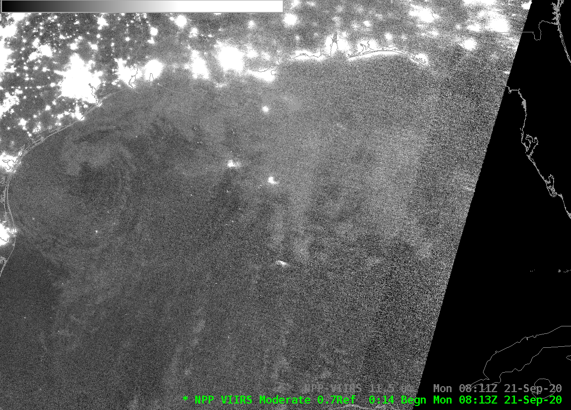
VIIRS Day Night Band imagery of Beta off the coast of Texas
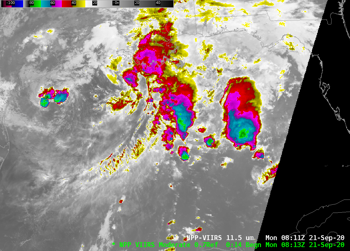
Suomi NPP overflew Tropical Storm Beta off the coast of Texas shortly after 0820 UTC on 21 September (NPP orbits over North America on 21 September are shown below, taken from this site). Day Night band visible imagery shows the swirl of clouds at the center of the storm, off the coast of Texas south... Read More
