Severe weather in Oklahoma, Texas and Louisiana
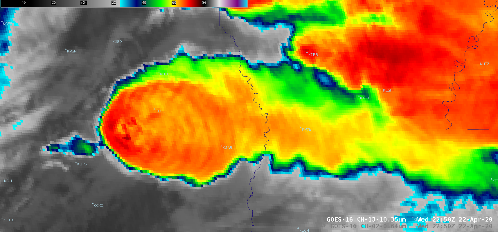
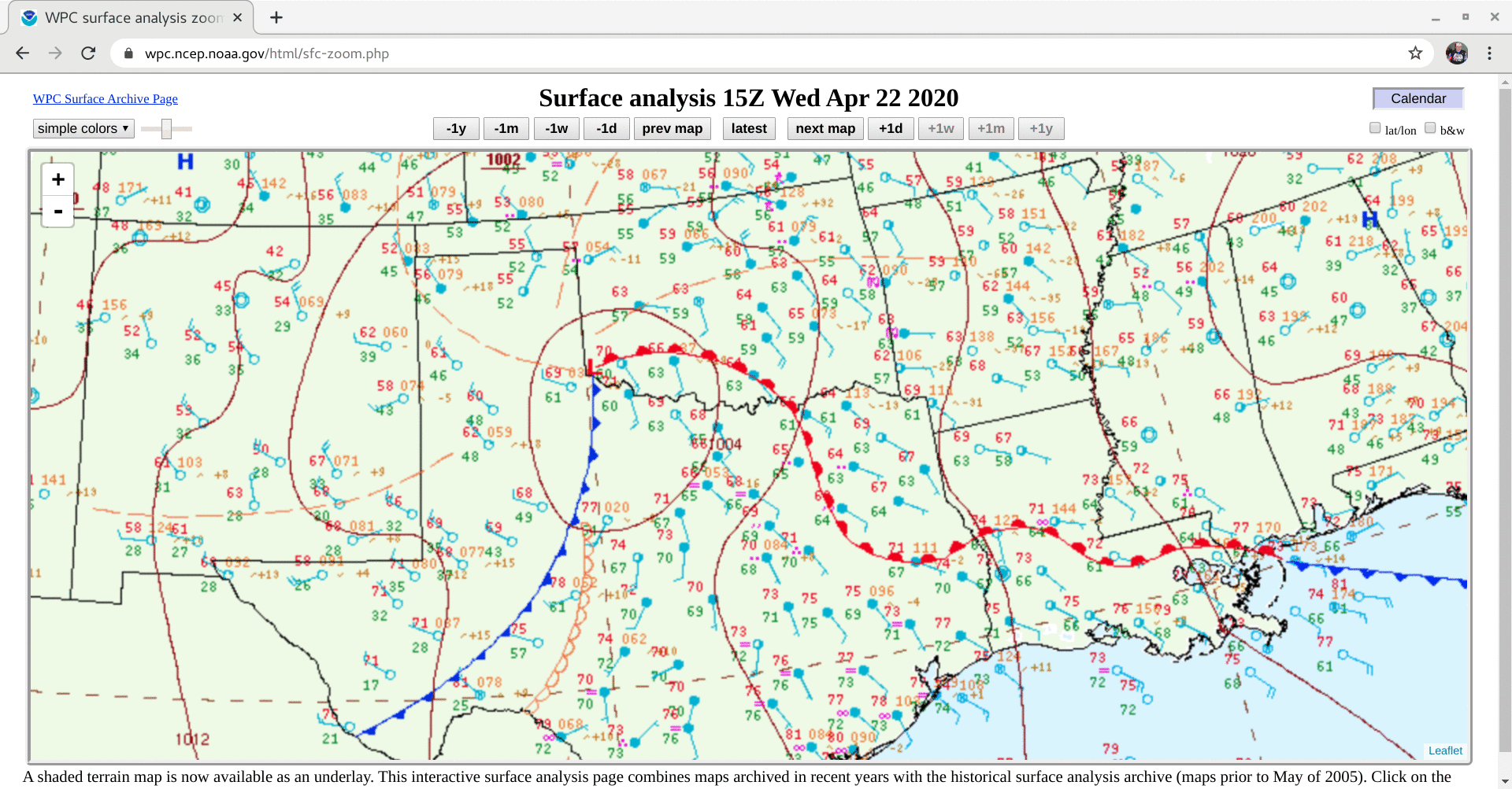
1-minute Mesoscale Domain Sector GOES-16 (GOES-East) “Red” Visible (0.64 µm) and “Clean” Infrared Window (10.35 µm) images (above) showed thunderstorms that produced a variety of severe weather (SPC Storm Reports) across far southern Oklahoma on 22 April 2020. These discrete supercell storms developed along a cold front associated with a low pressure system moving across the region (surface analyses).GOES-16... Read More

