This website works best with a newer web browser such as Chrome, Firefox, Safari or Microsoft Edge. Internet Explorer is not supported by this website.

Archive: Apr 2020

Ice off the coast of Greenland

GOES-16 (GOES-East) True Color Red-Green-Blue (RGB) images created using Geo2Grid (above) showed sea ice features off the southeast coast of Greenland on 30 April 2020. The ice structures were deformed by northerly winds behind a weak disturbance that was moving southward farther offshore.Thanks to Antonio Vecoli for alerting us to... Read More

30-second GOES-16 imagery of rapidly-developing severe thunderstorms over the Midwest

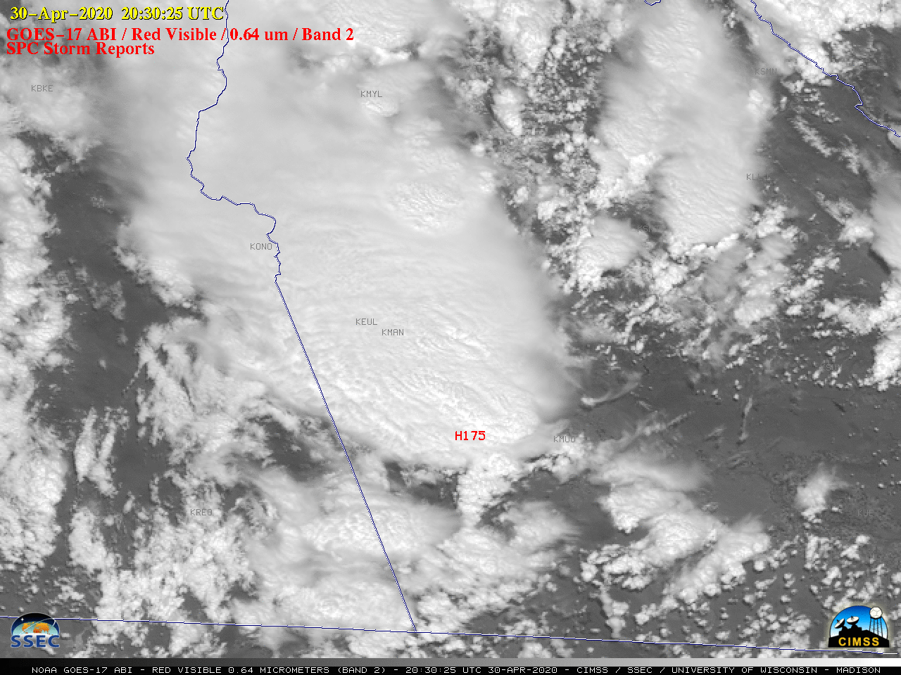
Overlapping 1-minute Mesoscale Domain Sectors provided GOES-16 (GOES-East) “Red” Visible (0.64 µm) images at 30-second intervals (above) — which showed rapidly-developing thunderstorms over northeastern Oklahoma, southeastern Kansas and southwestern Missouri on 28 April 2020. These storms developed along and ahead of an approaching cold front, and produced large hail and damaging winds (SPC Storm Reports).The corresponding 30-second GOES-16... Read More

Damaging winds from a severe thunderstorm in Texas

1-minute Mesoscale Domain Sector GOES-16 (GOES-East) “Clean” Infrared Window (10.35 µm) images, with and without an overlay of GLM Flash Extent Density (above) showed an isolated large thunderstorm moving east-southeastward across the Mexico/Texas border region during the early evening hours on 27 April 2020. Concentric storm-top gravity waves could be seen propagating radially outward from... Read More