Damaging winds from a severe thunderstorm in Texas
![GOES-16 "Clean" Infrared Window (10.35 µm) images, with and without an overlay of GLM Flash Extent Density [click to play animation | MP4]](https://cimss.ssec.wisc.edu/satellite-blog/images/2020/04/200427_goes16_infrared_glmFlashExtentDensity_TX_anim.gif)
GOES-16 “Clean” Infrared Window (10.35 µm) images, with and without an overlay of GLM Flash Extent Density [click to play animation | MP4]
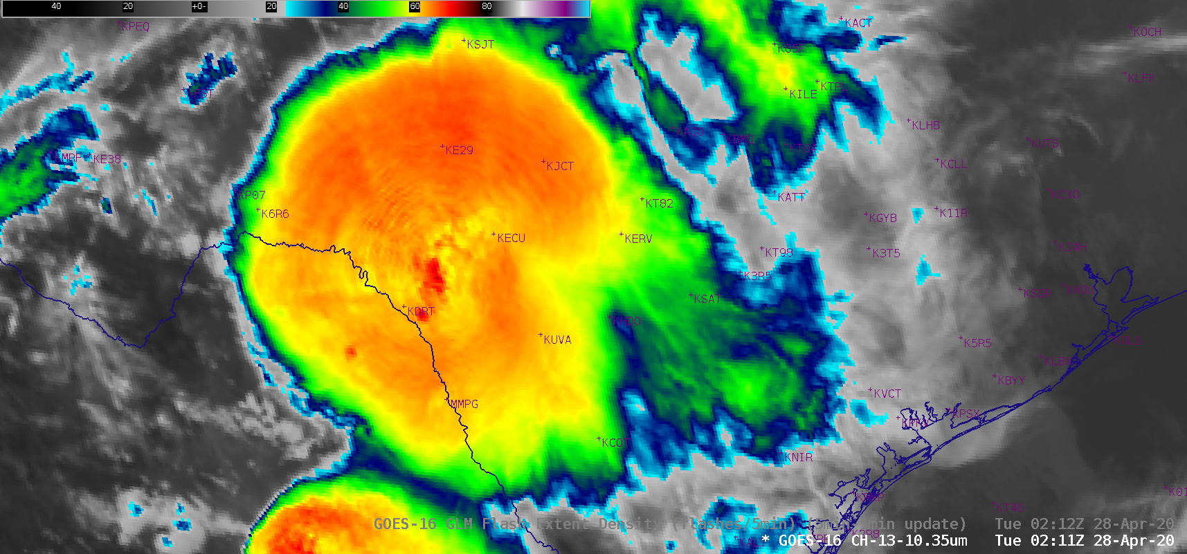
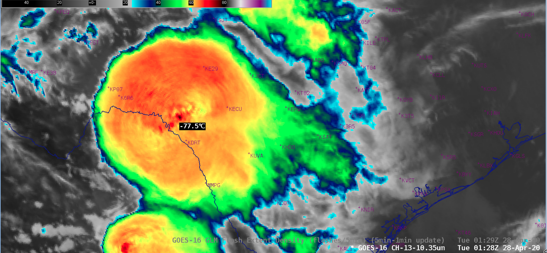
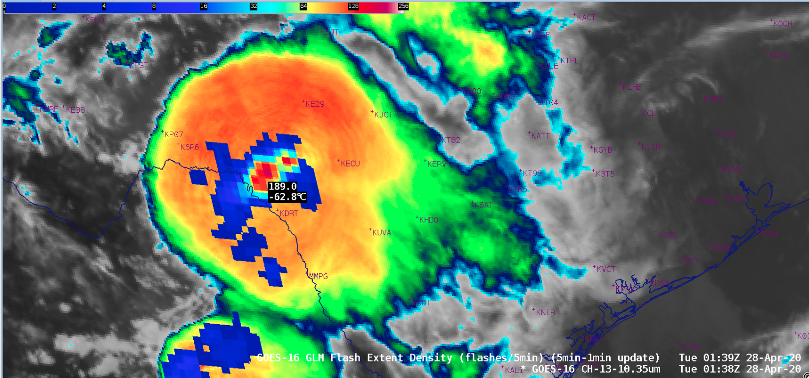
After about 0030 UTC, the GLM Flash Extent Density (FED) began to increase with this storm — in fact, the FED just northwest of Del Rio International Airport (KDRT) rapidly rose from 122 flashes per 5 minutes at 0119 UTC to 189 flashes per 5 minutes at 0139 UTC. During the period of this lightning jump, damaging winds — including a wind gust of 77 mph at KDRT at 0135 UTC — occurred in the Del Rio area (SPC Storm Reports).
8:08p 4/27/2020 – This storm in South Central Val Verde County is producing a ton of lightning. The NLDN reported a total of over 700 strikes out of the storm. A few of these lightning strikes have occurred well out ahead of the storm with one or two within 10 miles of Del Rio.
— NWS Austin/San Antonio (@NWSSanAntonio) April 28, 2020