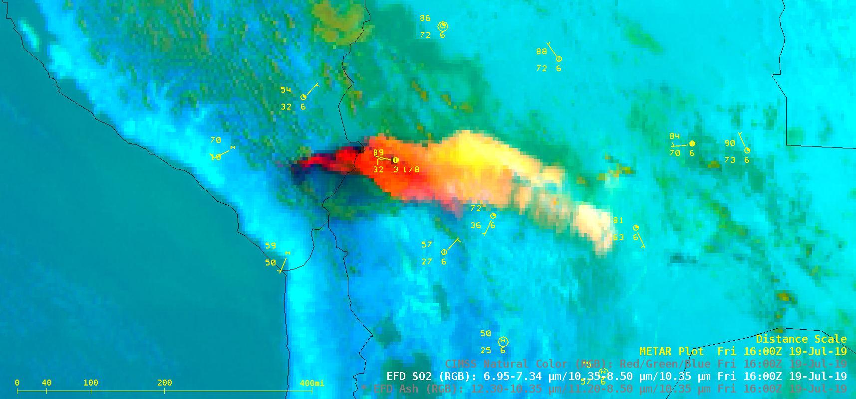
Severe weather in Minnesota and Wisconsin
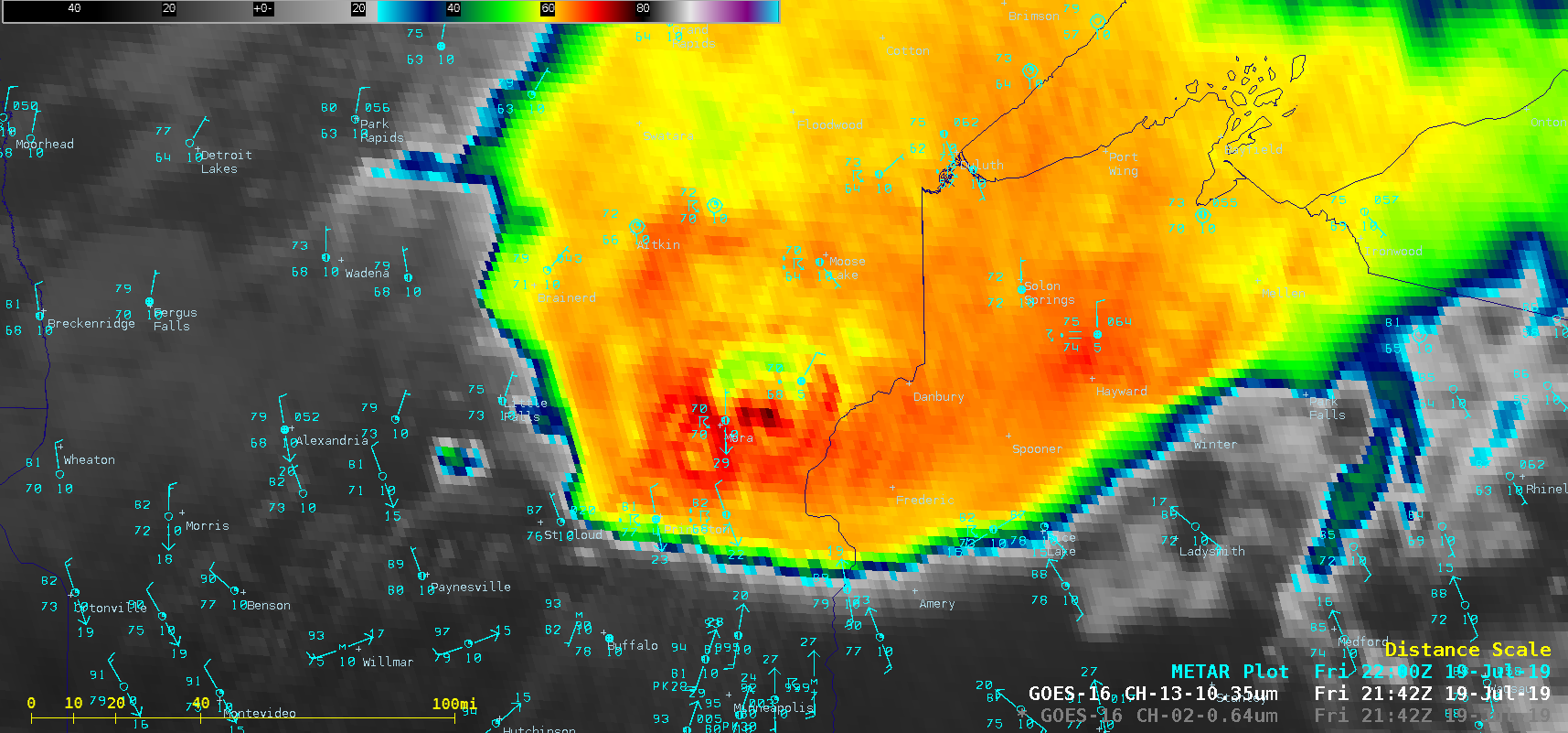
1-minute Mesoscale Domain Sector GOES-16 (GOES-East) “Red” Visible (0.64 µm) images (above) showed the development and propagation of a Mesoscale Convective System (MCS) that produced hail up to 3.0 inches in diameter in Minnesota and wind gusts to 84 mph and a few tornadoes in Wisconsin (SPC Storm Reports | NWS Twin Cities | MN DNR | NWS Green Bay)... Read More