This website works best with a newer web browser such as Chrome, Firefox, Safari or Microsoft Edge. Internet Explorer is not supported by this website.

Archive: Jun 2019

Anomalous cutoff low over the Beaufort Sea

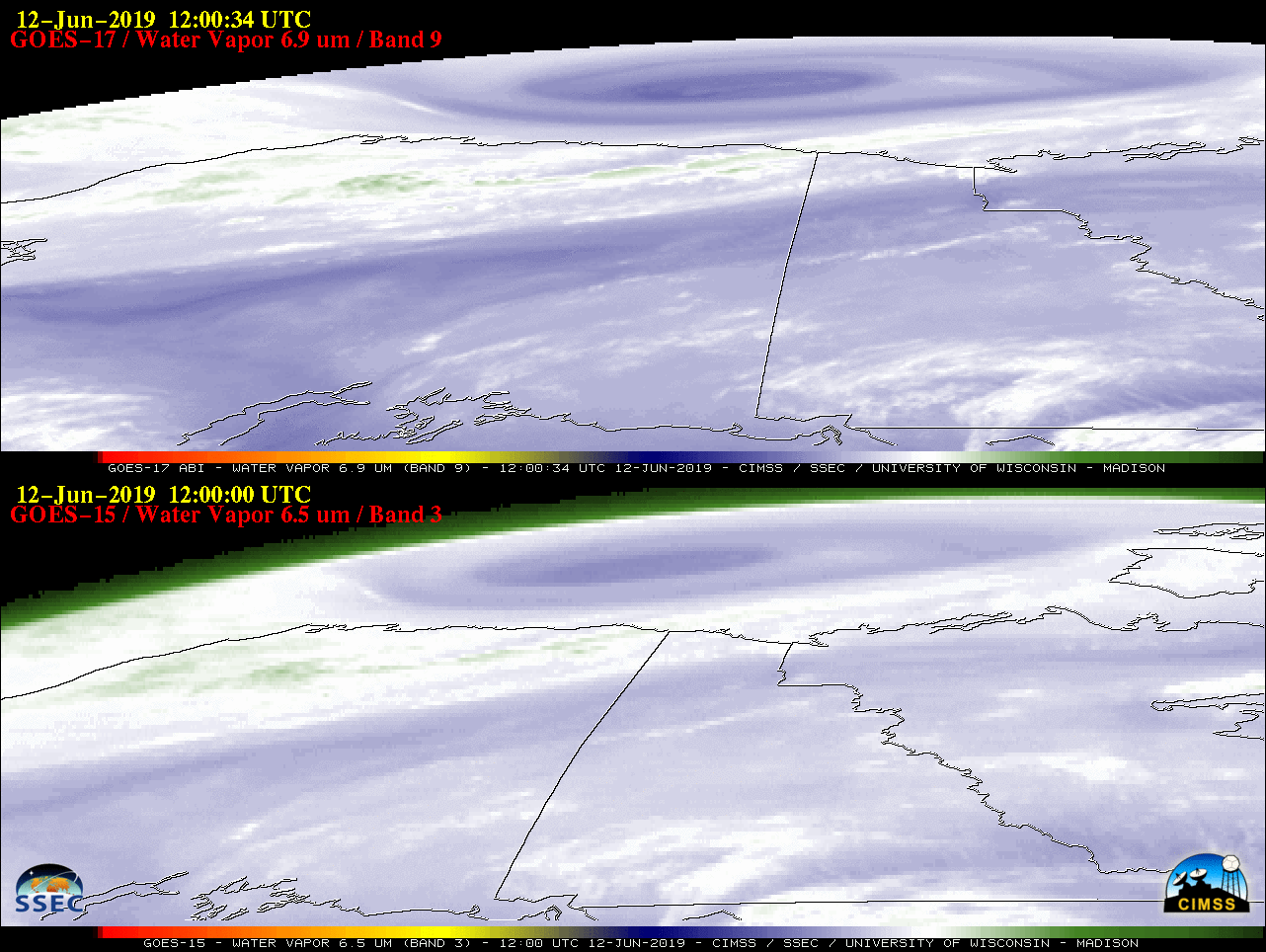
A comparison of Water Vapor images from GOES-17 (GOES-West) and GOES-15 Water Vapor images (above) showed the signature of an anomalously-deep closed low that was moving southeastward over the Beaufort Sea north of Alaska during the 11 June – 12 June 2019 period. The images are shown in the native... Read More

30-second imagery of severe thunderstorms across Nebraska and Kansas

Overlapping 1-minute Mesoscale Domain Sectors provided 30-second interval GOES-16 (GOES-East) “Red” Visible (0.64 µm) images (above) of severe thunderstorms (SPC storm reports) that developed across central Nebraska and northern Kansas along and ahead of an advancing frontal boundary (surface analyses) on 08 June 2019. Robust overshooting tops were very apparent with many of the storms, and a few... Read More