30-second imagery of severe thunderstorms across Nebraska and Kansas
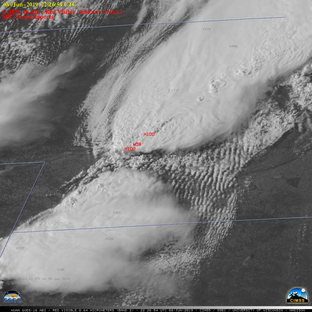
GOES-16 “Red” Visible (0.64 µm) images, with SPC Storm Reports plotted in red [click to play MP4 animation | 407 MB animated GIF]
The corresponding GOES-16 “Clean” Infrared Window (10.35 µm) images are shown below. Numerous overshooting tops exhibited infrared brightness temperatures in the -70 to -75ºC range; note the appearance of a wave feature which propagated radially outward from an overshooting top in south-central Nebraska after 0030 UTC.
![GOES-16 "Clean" Infrared Window (10.35 µm) images, with SPC Storm Reports plotted in cyan [click to play MP4 animation | 159 MB animated GIF]](https://cimss.ssec.wisc.edu/satellite-blog/wp-content/uploads/sites/5/2019/06/G16_IR_NE_SVR_08JUN2019_2019159_222654_GOES-16_0001PANEL.GIF)
GOES-16 “Clean” Infrared Window (10.35 µm) images, with SPC Storm Reports plotted in cyan [click to play MP4 animation | 159 MB animated GIF]