30-second imagery of severe thunderstorms across Nebraska and Kansas
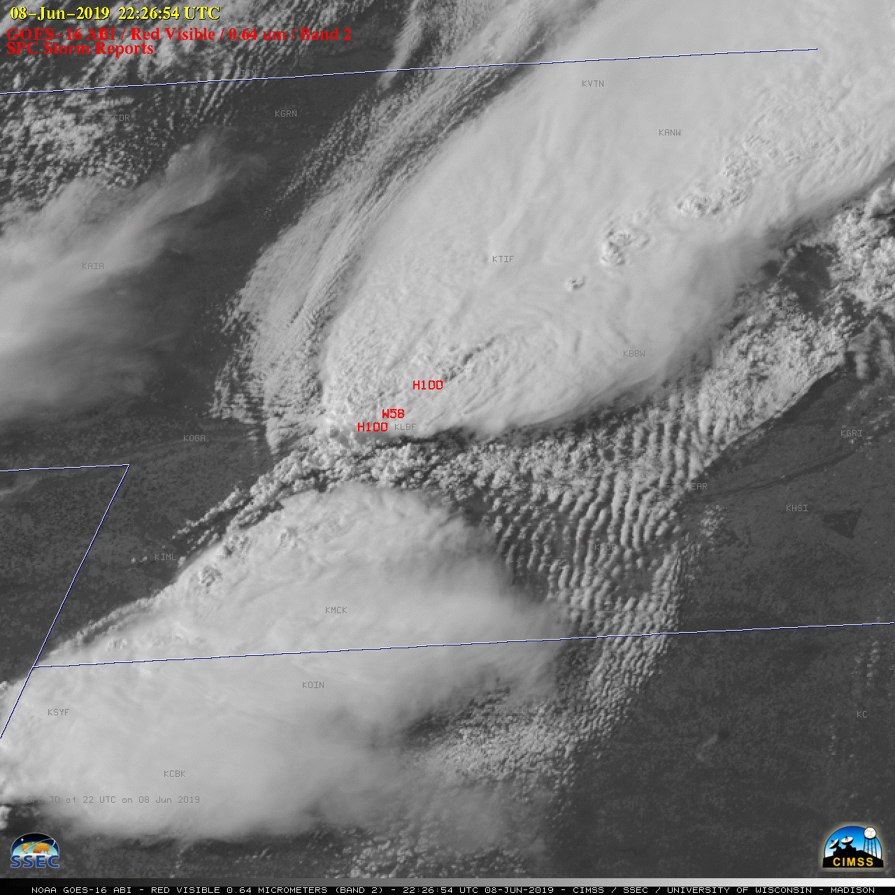
Overlapping 1-minute Mesoscale Domain Sectors provided 30-second interval GOES-16 (GOES-East) “Red” Visible (0.64 µm) images (above) of severe thunderstorms (SPC storm reports) that developed across central Nebraska and northern Kansas along and ahead of an advancing frontal boundary (surface analyses) on 08 June 2019. Robust overshooting tops were very apparent with many of the storms, and a few... Read More
