This website works best with a newer web browser such as Chrome, Firefox, Safari or Microsoft Edge. Internet Explorer is not supported by this website.

Archive: Jan 2018

Eastern US winter storm

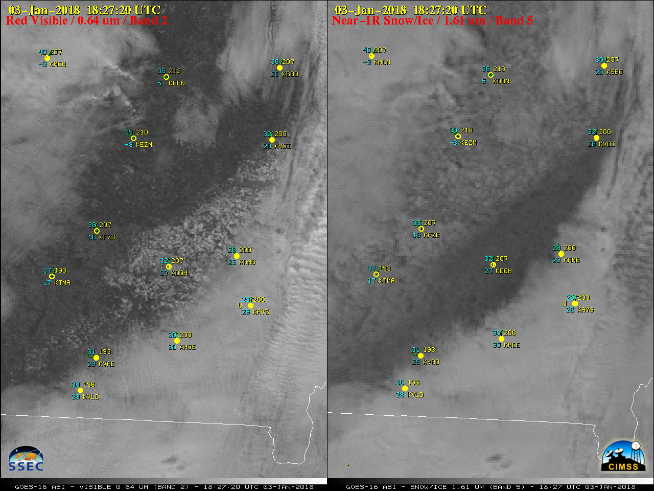
The initial impacts of a large Eastern US winter storm were seen in a comparison of GOES-16 (GOES-East) “Red” Visible (0.64 µm) and Near-Infrared “Snow/Ice” (1.61 µm) images (above) on 03 January 2018 — areas of southeastern Georgia received freezing rain and/or 1-6 inches of snowfall. As clouds began to dissipate, the resulting snow... Read More

When Water Vapor Channels are Window Channels

The very cold and dry airmass over the eastern half of the United States during early January 2018 is mostly devoid of water vapor, a gas that, when present, absorbs certain wavelengths of radiation that is emitted from the surface (or low clouds). That absorbed energy is then re-emitted from... Read More