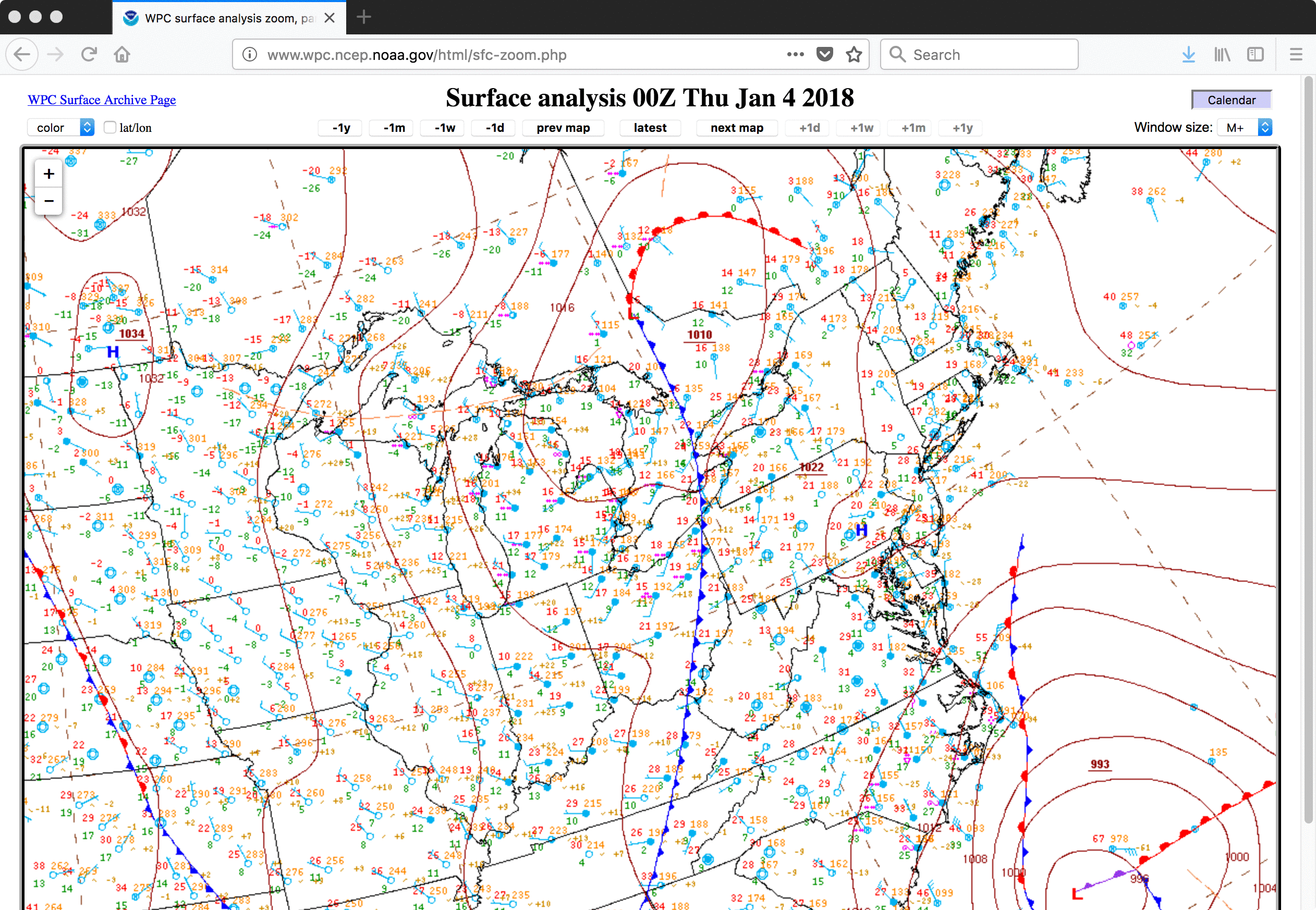
Eastern US winter storm
GOES-16 “Red” Visible (0.64 µm, left) and Near-Infrared “Snow/Ice” (1.61 µm, right) images, with plots of hourly surface reports [click to play MP4 animation]
Earlier that morning, the Florida Panhandle also received snowfall (text | map), but the lighter accumulations there were insufficient to exhibit a good satellite signature.
In a toggle between Suomi NPP VIIRS true-color and false-color Red-Green-Blue (RGB) images from RealEarth (below), the deeper snow cover in Georgia appears as darker shades of cyan.
![Suomi NPP VIIRS true-color and false-color images [click to enlarge]](https://cimss.ssec.wisc.edu/satellite-blog/wp-content/uploads/sites/5/2018/01/180103_1756utc_suomi_npp_viirs_truecolor_falsecolor_GA_snow_anim.gif)
Suomi NPP VIIRS true-color and false-color images [click to enlarge]
===== 04 January Update =====
![Suomi NPP VIIRS Day/Night Band (0.7 µm) and Infrared Window (11.45 µm) images [click to enlarge]](https://cimss.ssec.wisc.edu/satellite-blog/wp-content/uploads/sites/5/2018/01/180104_0620utc_suomi_npp_viirs_DayNightBand_InfraredWindow_anim.gif)
Suomi NPP VIIRS Day/Night Band (0.7 µm) and Infrared Window (11.45 µm) images [click to enlarge]
During the following daytime hours, 30-second interval Mesoscale Sector GOES-16 “Red” Visible (0.64 µm) images (below) showed the evolution of the low pressure center of circulation as it continued to rapidly intensify (surface analyses) off the US East Coast.
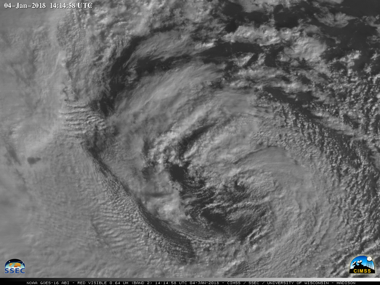
30-second GOES-16 “Red” Visible (0.64 µm) images [click to play MP4 animation]
Curious about the historical context of this system impacting the East Coast? Interestingly, there was a similar system WPC found that dated back to–oddly enough–January 4, 1989. pic.twitter.com/WcNbJUp2yp
— NWS WPC (@NWSWPC) January 4, 2018
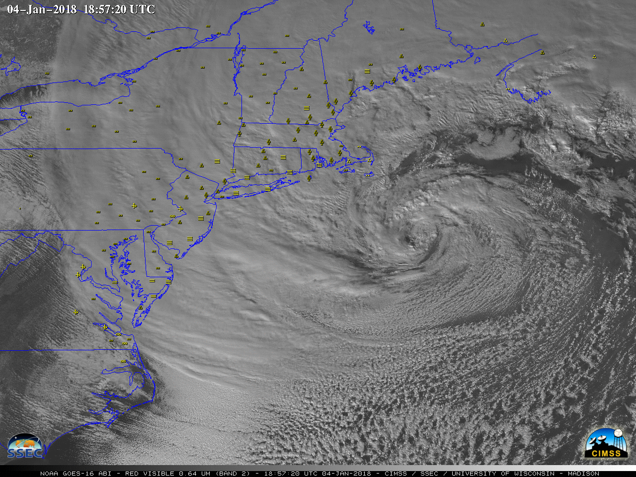
GOES-16 “Red” Visible (0.64 µm) images, with hourly surface weather type plotted in yellow [click to play MP4 animation]
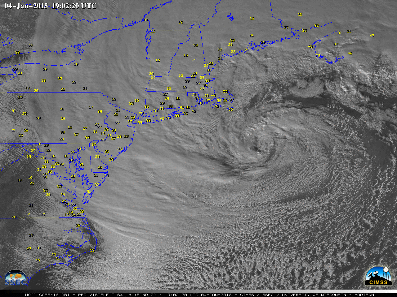
GOES-16 “Red” Visible (0.64 µm) images, with hourly surface wind gusts plotted in yellow [click to play MP4 animation]
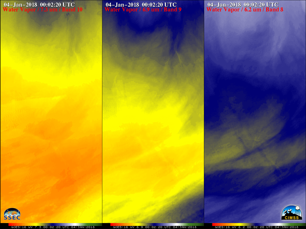
(7.3 µm, left), Mid-level (6.9 µm, center) and Upper-level (6.2 µm, right) images [click to play animation]” class=”size-medium” /> GOES-16 Lower-level (7.3 µm, left), Mid-level (6.9 µm, center) and Upper-level (6.2 µm, right) images [click to play animation]
![Suomi NPP VIIRS true-color RGB image [click to enlarge]](https://cimss.ssec.wisc.edu/satellite-blog/wp-content/uploads/sites/5/2018/01/180104_1738utc_suomi_npp_viirs_true_color.jpg)
Suomi NPP VIIRS true-color RGB image [click to enlarge]
![Suomi NPP VIIRS Visible (0.64 µm) and Snow/Ice RGB images, with surface station identifiers plotted in white [click to enlarge]](https://cimss.ssec.wisc.edu/satellite-blog/wp-content/uploads/sites/5/2018/01/180104_1739utc_suomi_npp_viirs_Visible_SnowIce_RGB_2_anim.gif)
Suomi NPP VIIRS Visible (0.64 µm) and Snow/Ice RGB images, with surface station identifiers plotted in white [click to enlarge]
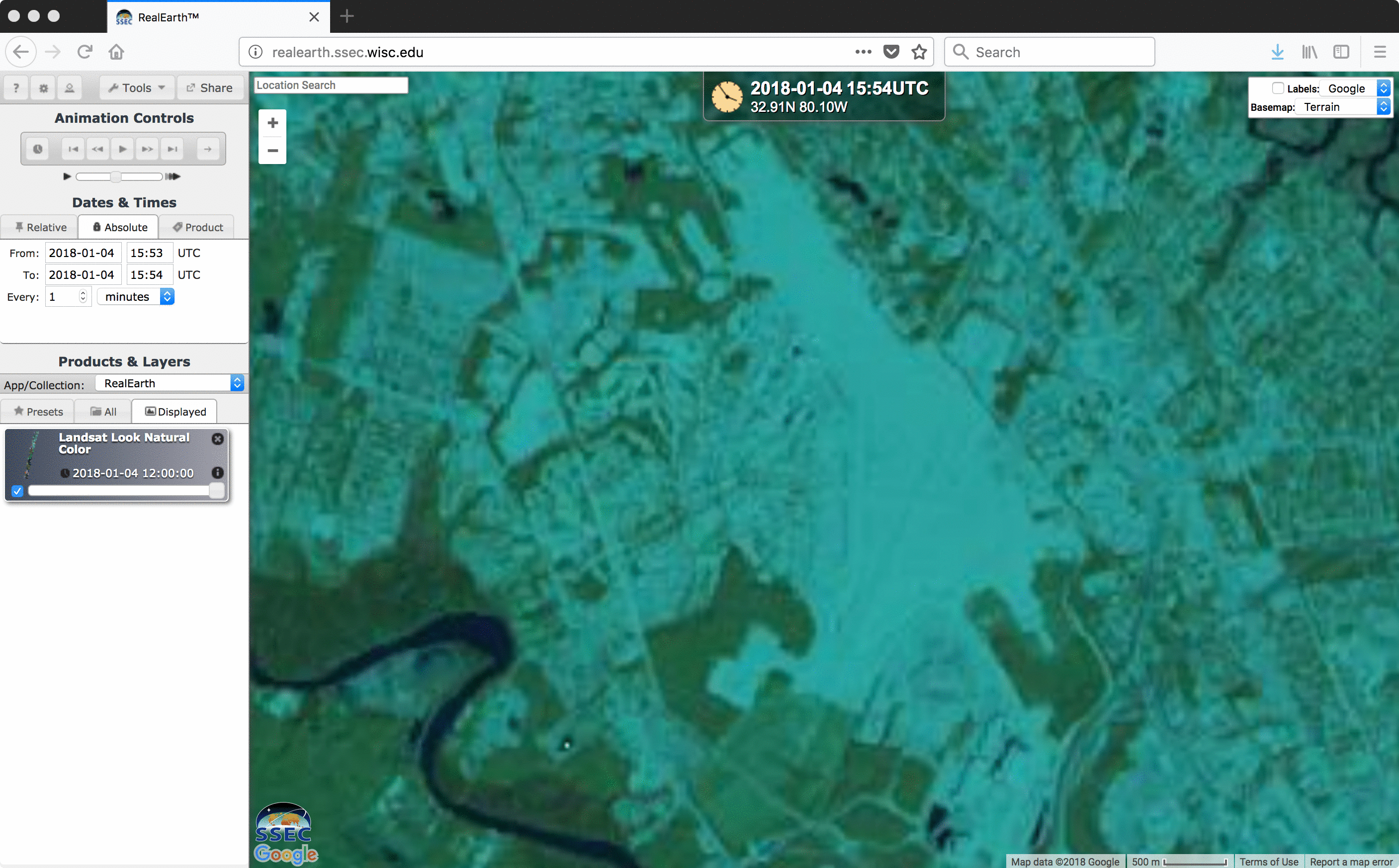
![Landsat-8 false-color RGB image [click to enlarge]](https://cimss.ssec.wisc.edu/satellite-blog/wp-content/uploads/sites/5/2018/01/180104_1554utc_landsat8_falsecolor_CHS_anim.gif)
Landsat-8 false-color RGB image [click to enlarge]