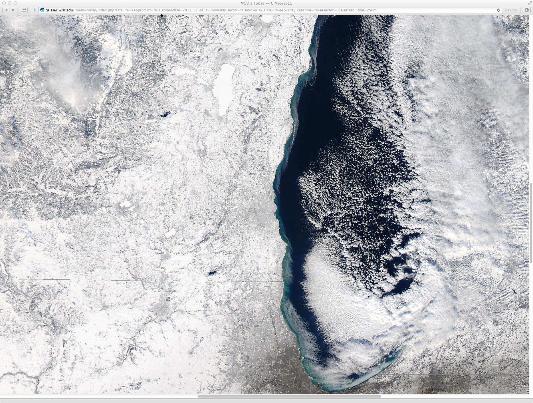
Archive: Dec 2013
Freezing rain in Oklahoma, with a broad swath of snow to the northwest
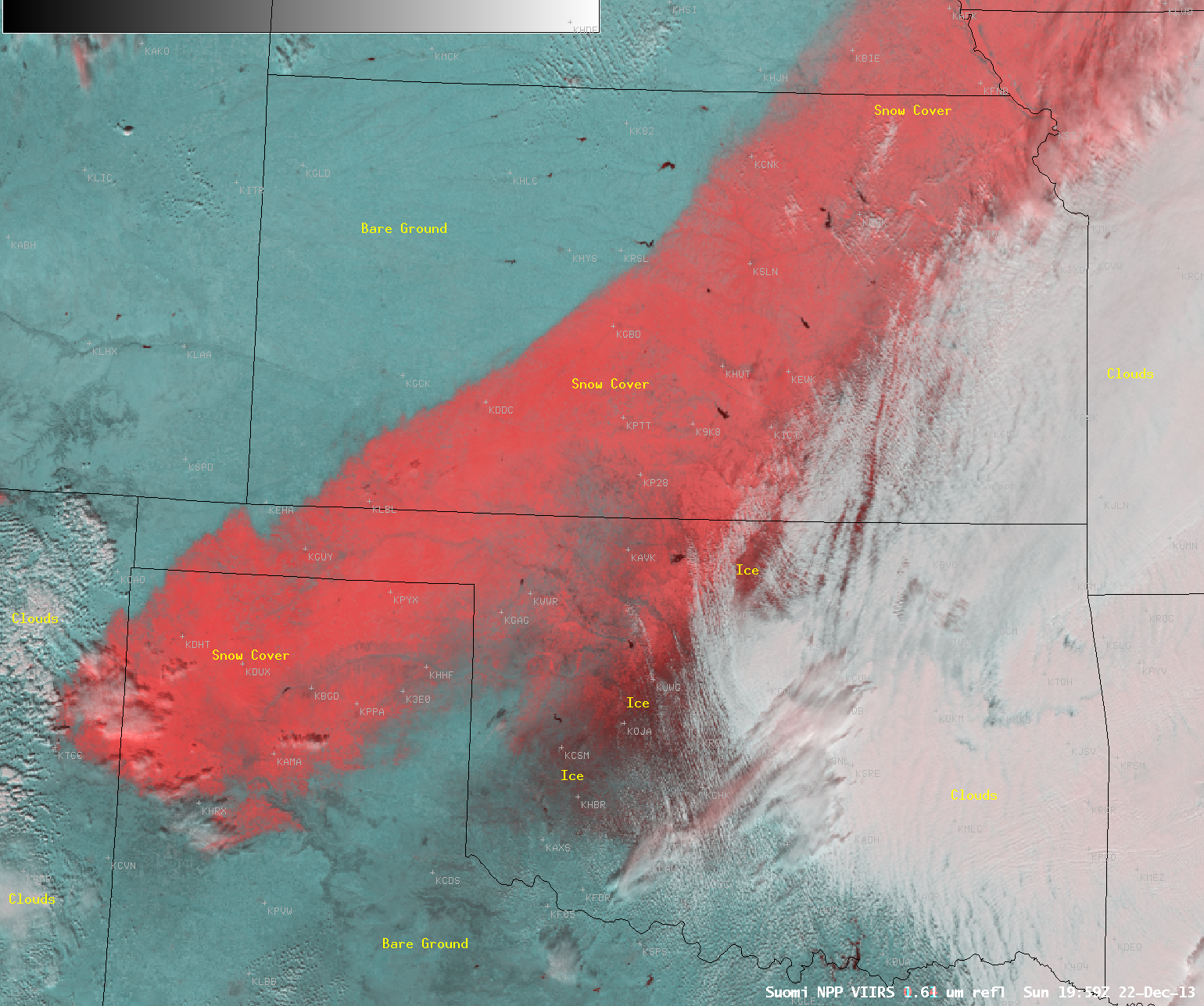
A large portion of central and southwestern Oklahoma experienced a signifcant freezing rain event during the 20 December – 21 December 2013 period, as abundant moisture moved over shallow cold air at the surface. On the... Read More
Blowing dust over southern Texas
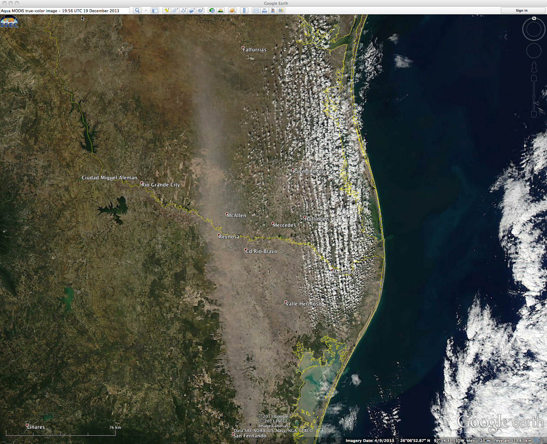
Strong southerly winds (gusting over 30 mph) generated a plume of blowing dust that originated in far northeastern Mexico and moved over Deep South Texas on the afternoon hours of 19 December 2013. McIDAS images of GOES-13 0.63 µm visible channel data (above;... Read More
Orographic cirrus over Colorado and Wyoming
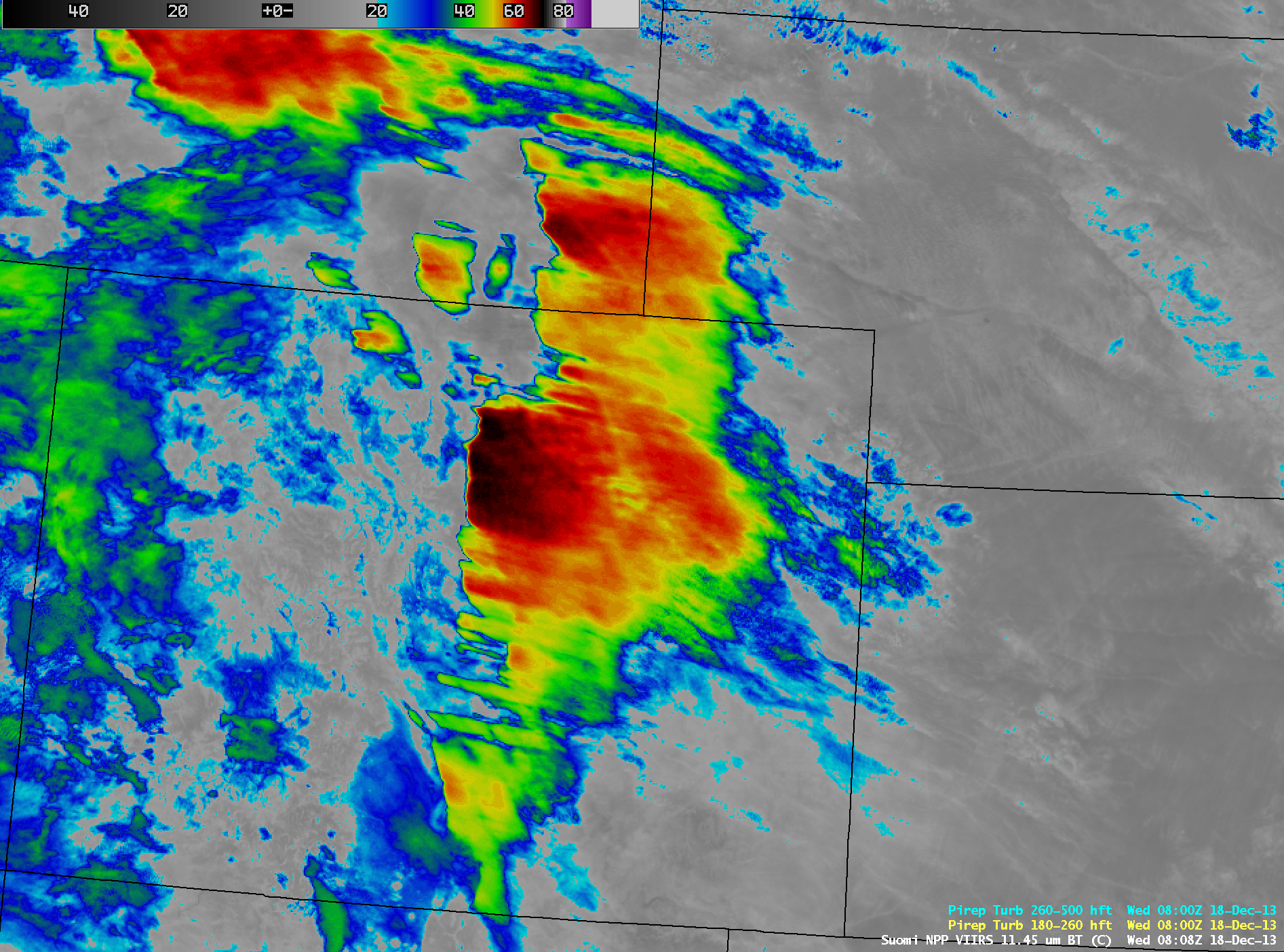
AWIPS images of 4-km resolution GOES-13 10.7 µm IR channel data (above; click image to play animation) showed the development of a large shield of orographic cirrus clouds immediately downwind (to the east of) the high terrain of the Rocky Mountains in eastern Colorado and southeastern Wyoming on Read More
