Blowing dust over southern Texas
Strong southerly winds (gusting over 30 mph) generated a plume of blowing dust that originated in far northeastern Mexico and moved over Deep South Texas on the afternoon hours of 19 December 2013. McIDAS images of GOES-13 0.63 µm visible channel data (above; click image to play animation) showed the plume as it moved northward; surface visibility dropped as low as 2.5 miles at Jim Hogg Country Airport (station identifier KHBV) at 23:35 UTC.
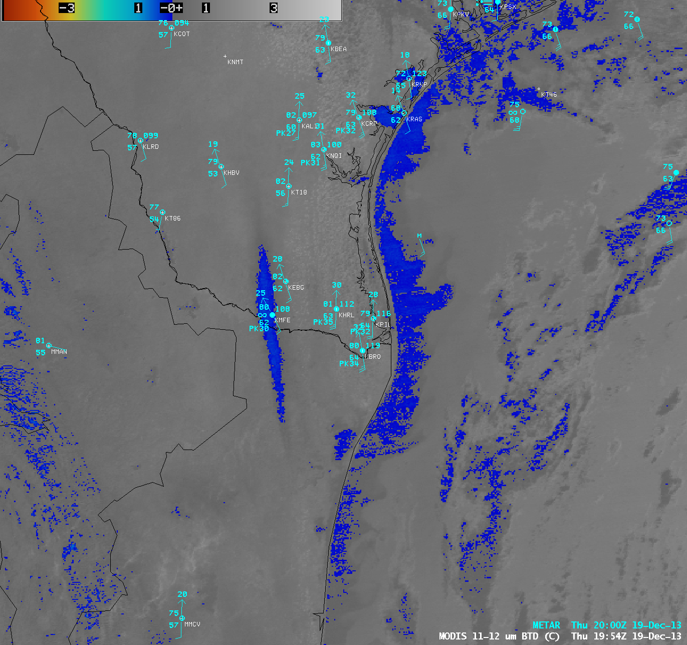
A signal of the airborne dust plume was evident on an AWIPS image of the MODIS 11-12 µm IR brightness temperature difference (below). At the time of the MODIS image the surface visibility had dropped to 5 miles at McAllen, Texas (station identifier KMFE).
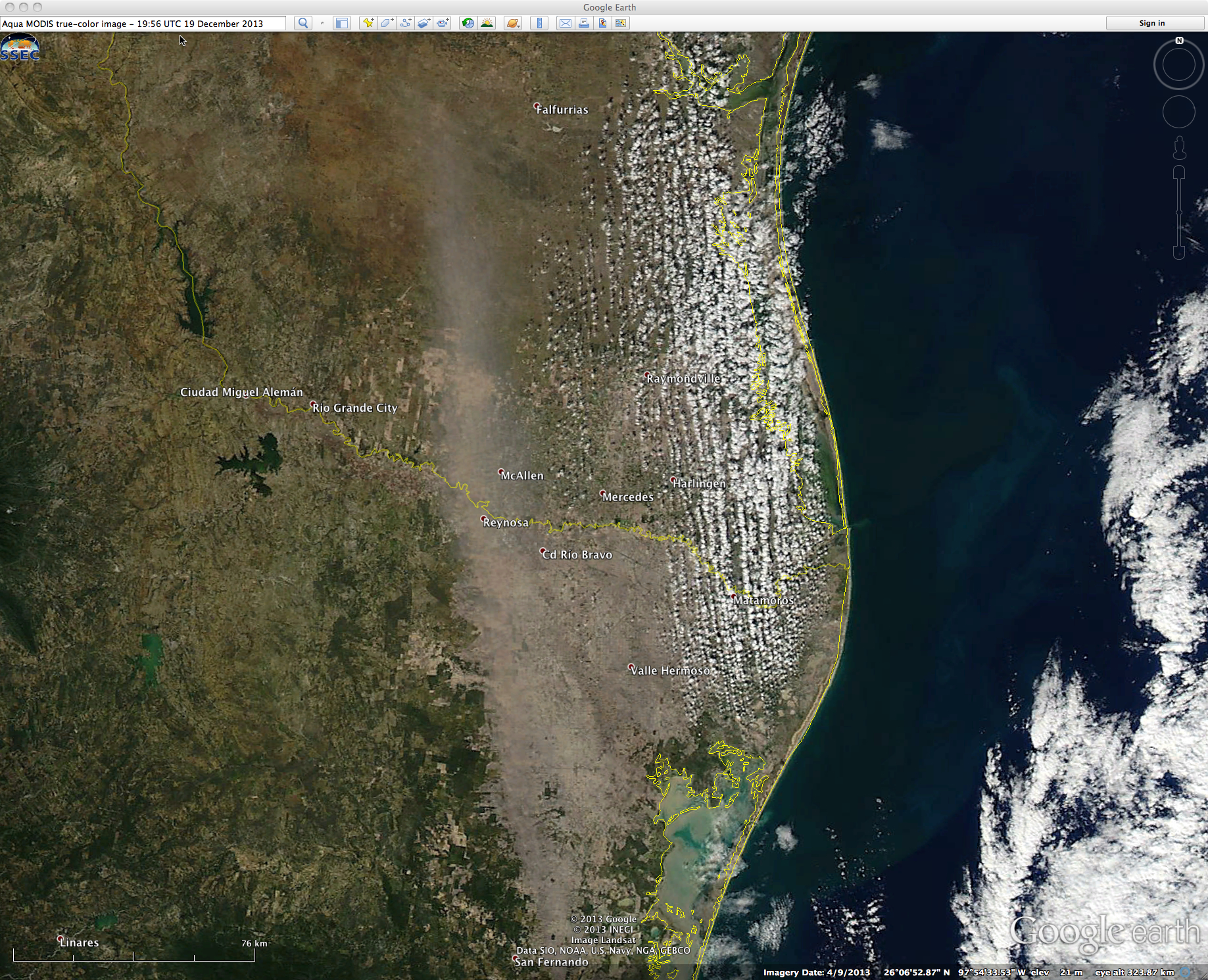
The hazy tan signature of the blowing dust plume was also quite evident on the corresponding 250-meter resolution MODIS true-color Red/Green/Blue (RGB) image (below).
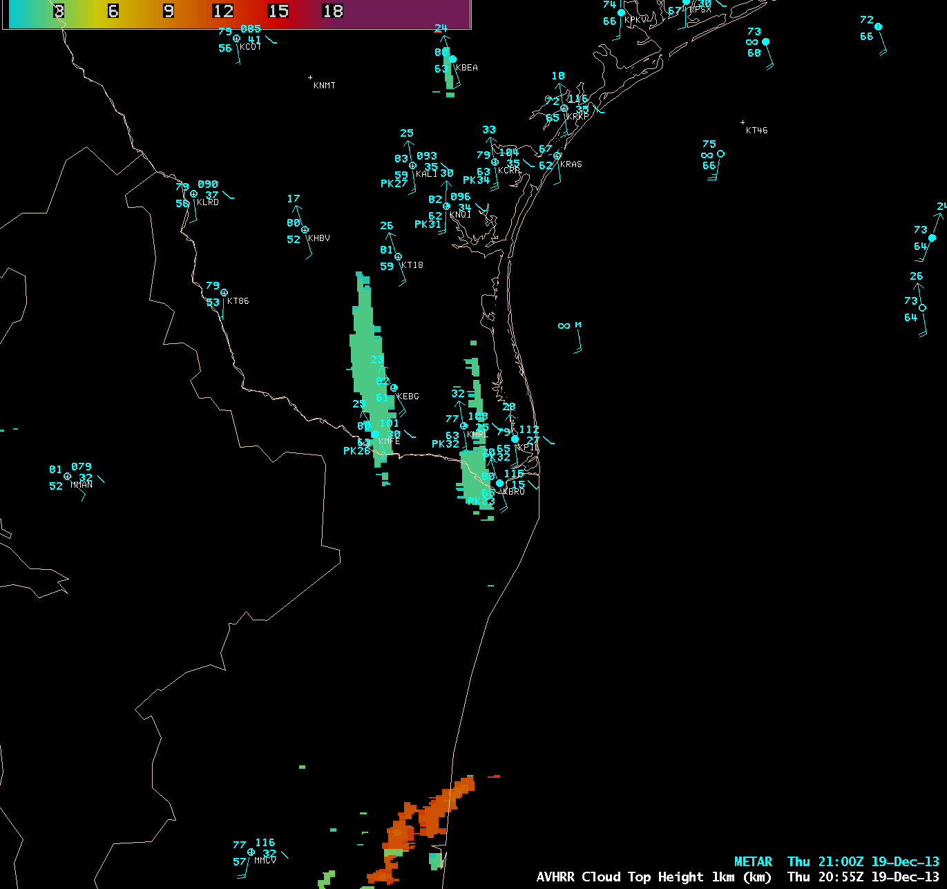
The POES AVHRR Cloud Top Height product at 20:55 UTC (below) indicated that the top of the blowing dust plume was at 2 km above ground level.


