Orographic cirrus over Colorado and Wyoming
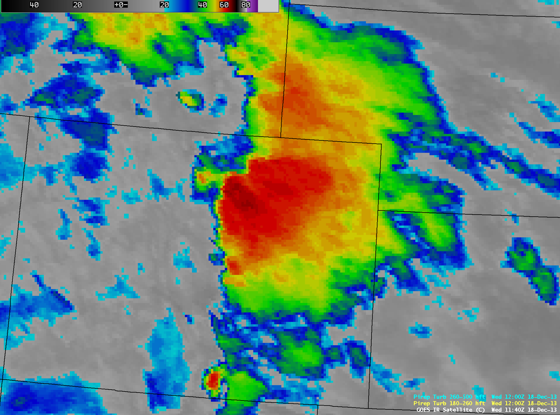
AWIPS images of 4-km resolution GOES-13 10.7 µm IR channel data (above; click image to play animation) showed the development of a large shield of orographic cirrus clouds immediately downwind (to the east of) the high terrain of the Rocky Mountains in eastern Colorado and southeastern Wyoming on 18 December 2013. The development and persistence of such cloud features is important to monitor, due to their potential impact on daytime temperatures: if incoming solar radiation is significantly reduced by a canopy of dense cirrus, surface temperatures may not be as warm as forecast. Early in the cirrus shield development during the overnight hours, GOES-13 IR brightness temperatures were as cold as -66º C (darker red color enhancement) along the western edge of the cirrus shield, suggestive of a high and potentially dense ice cloud feature — but during the early morning hours the cirrus was seen to begin to rapidly dissipate after about 15 UTC.
While not directly related to the orographic cirrus cloud shield per se, the strong westerly winds interacting with the complex terrain of the Rocky Mountains produced some areas of turbulence across Colorado. At 14:05 UTC a pilot reported Moderate turbulence throughout a very deep layer (5,500 feet to 20,000 feet), and at 15:22 UTC a pilot reported occasional Severe turbulence between the altitudes of 13,000 and 16,000 feet.
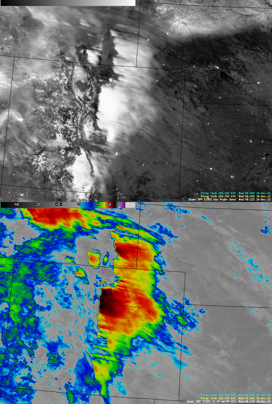
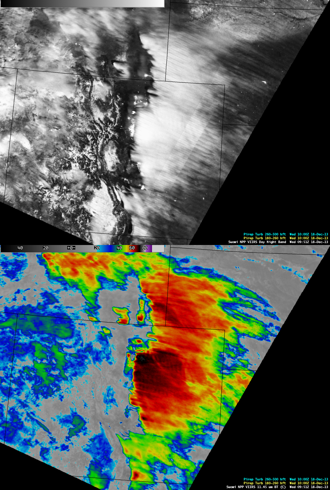
Night-time comparisons of 1-km resolution Suomi NPP VIIRS 0.7 µm Day/Night Band (DNB) and 11.45 µm IR channel images at 08:12 UTC or 1:12 AM local time (above) and 09:51 UTC or 2:51 AM local time (below) revealed that the cirrus along the western (upwind) edge was quite cold on the IR images (with IR brightness temperatures as cold as -71º C at 08:12 UTC, and -76º C at 09:51 UTC), and also appeared much more optically thick along the western portion on the DNB images. However, on the DNB images the cirrus shield — although still exhibiting fairly cold IR temperatures — appeared to be much more optically thin along the eastern portion. Due to ample illumination by a nearly-full moon, the DNB provided vivid “visible images at night” to compliment the IR images; in the upper right corner of the DNB images, snow on the ground could also be seen across northern Nebraska into far southern South Dakota.
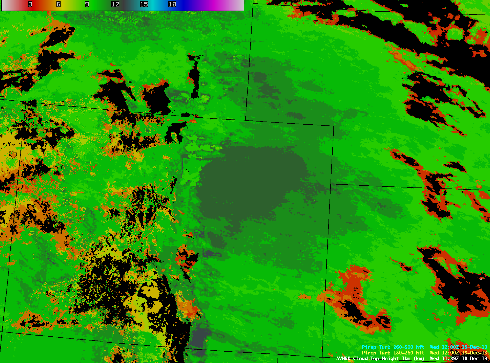
A 1-km resolution POES AVHRR Cloud Top Height product at 11:39 UTC or 4:39 AM local time (below) indicated that the tops of the cirrus shield were at 12 km (darker green color enhancement).
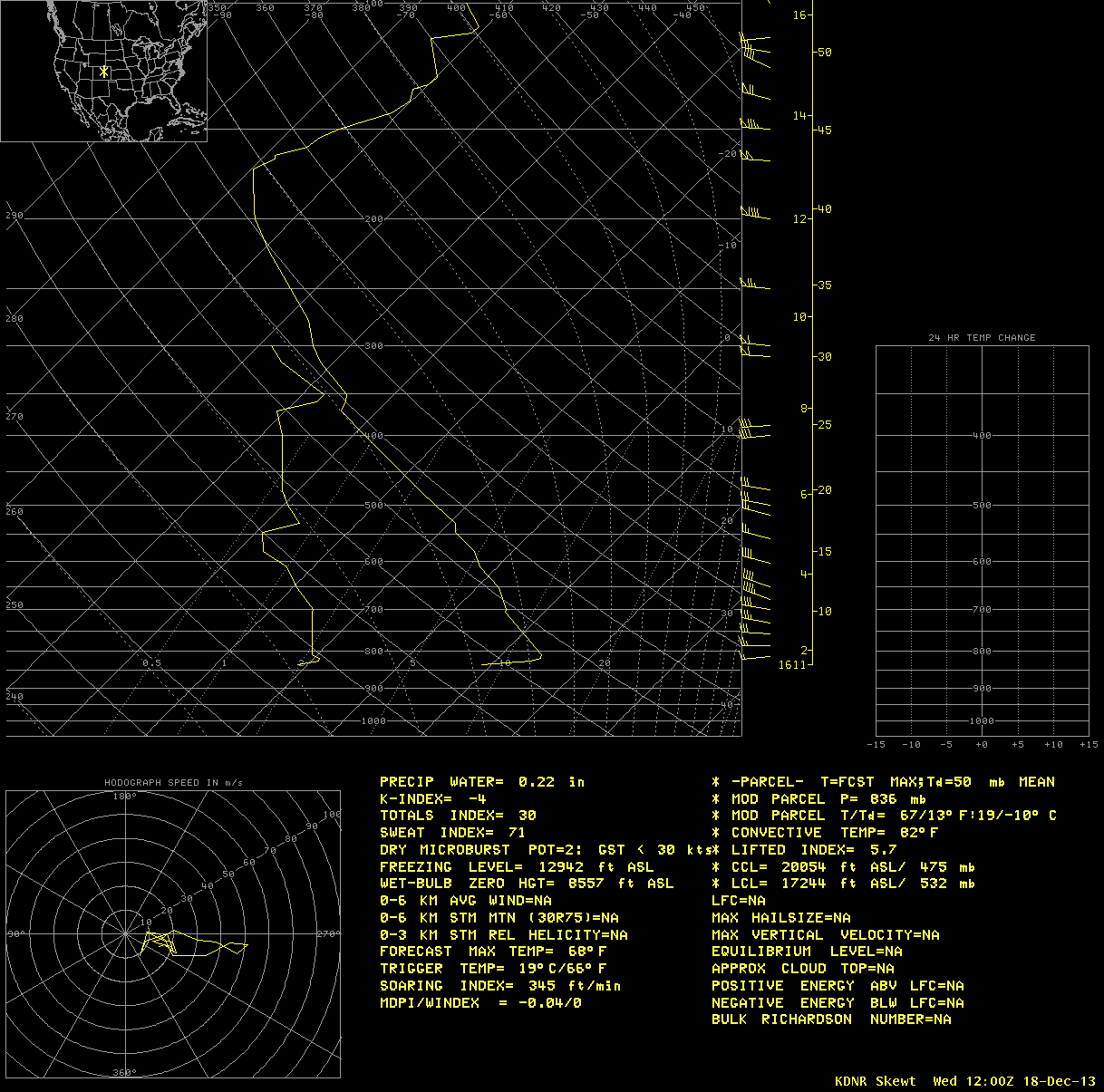
The 12 UTC Denver rawinsonde data (below) showed that the tropopause was around 13 km, with an air temperature of -70º C. Winds at that altitude were from the west at 100 knots (with strong westerly winds at all altitudes throughout the tropopause).
Additional details and imagery of this orographic cirrus event can be found on the CIRA RAMMB GOES-R Proving Ground Blog.


