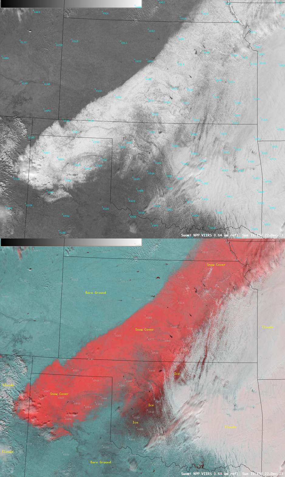
Freezing rain in Oklahoma, with a broad swath of snow to the northwest
A large portion of central and southwestern Oklahoma experienced a signifcant freezing rain event during the 20 December – 21 December 2013 period, as abundant moisture moved over shallow cold air at the surface. On the following day, as clouds began to clear across the region, AWIPS images of Suomi NPP VIIRS 0.64 µm visible imagery and a corresponding False Color Red/Green/Blue (RGB) product (above) revealed a broad swath of snow on the ground that stretched from the New Mexico/Texas border northeastward across Kansas (where as much as 15 inches fell) and into southeastern Nebraska and northwestern Missouri.
The False Color “snow/ice-vs-cloud discrimination” RGB image used the VIIRS instrument 0.64 µm visible channel and the 1.61 µm “snow/ice channel”, taking advantage of the fact that snow and ice are strong absorbers of radiation at the 1.61 µm wavelength (and therefore appear darker on that particular image). The result of this image combination shows snow cover as varying shades of red, with significant ice accretion on the ground showing up as the darkest shades of red (since ice is a stronger absorber of radiation than snow at the 1.61 µm wavelength). These darker shades of red in central and southwestern Oklahoma therefore corresponded to the area between Clinton (KCSM) and Oklahoma City (KOKC) which received as much as 0.75 to 1.00 inch of ice accretion. The weight of this thick layer of ice caused widespread downed trees and powerlines, with power outages at several locations. Note that the significant glaze of ice on the ground — for example, in areas surrounding Clinton (KCSM) and Hobart (KHBR) — did not show up particularly well on the visible image, since an ice layer is generally translucent in appearance as viewed from above (unless it is covered with a thin layer of snow, as was the case farther to the north).
Through holes in the clouds, there were some hints of darker red seen in southeastern Kansas, where significant accrual of ice also occurred.


