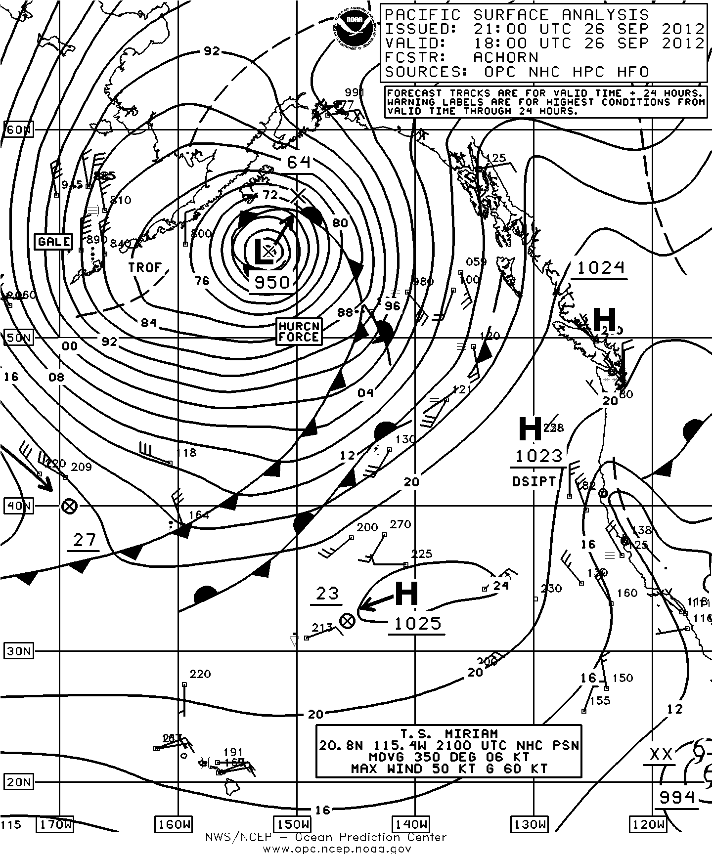
This website works best with a newer web browser such as Chrome, Firefox, Safari or Microsoft Edge. Internet Explorer is not supported by this website.

Category: VIIRS

Severe thunderstorms across northeastern Texas

AWIPS images of 4-km resolution GOES-13 10.7 µm IR channel images (above; click image to play animation) showed the development of a line of severe thunderstorms along an advancing cold frontal boundary as it approached the Dallas/Fort Worth, Texas region during the afternoon hours on Read More

Large mesoscale convective system over Argentina

McIDAS images of 4-km resolution GOES-12 10.7 µm IR channel data (above; click image to play animation) showed the development of a very large mesoscale convective system (MCS) over Argentina on 07 February 2012. A number of smaller, discrete thunderstorms initially began to develop around 14:45 UTC, which then eventually... Read More