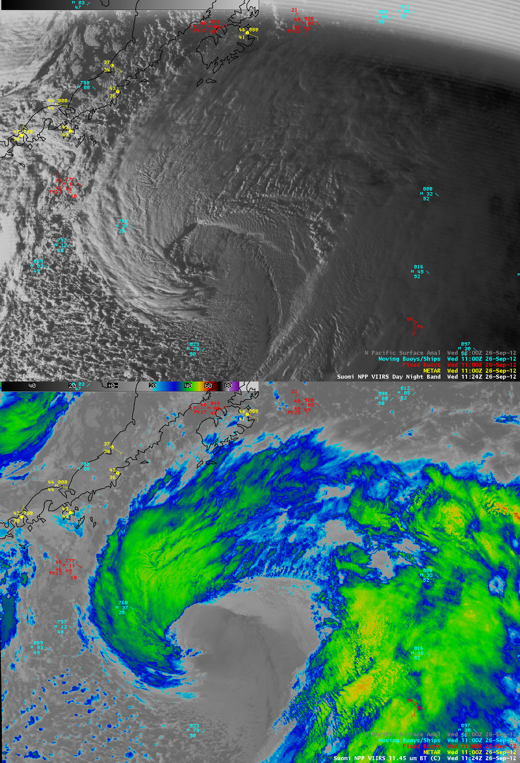
Intense cyclone in the Gulf of Alaska
A cyclone rapidly intensified (deepening 42 mb in 24 hours, and 26 mb in 12 hours) in the Gulf of Alaska on 26 September 2012, and was expected to produce winds up to hurricane force. An AWIPS image comparison of Suomi NPP VIIRS 0.7 µm Day/Night Band and 11.45 µm IR channel images at 11:24 UTC (above) showed great detail to the cloud features as the storm began to exhibit a classic “cusp” signature as rapid intensification was underway (IR image with surface analysis overlay).
McIDAS images of GOES-15 6.5 µm water vapor channel data (below; click image to play animation) portrayed the evolution of the storm from 04:00 UTC to 23:45 UTC.


