VIIRS Day/Night Band imagery: city lights and cloud-top lightning illumination
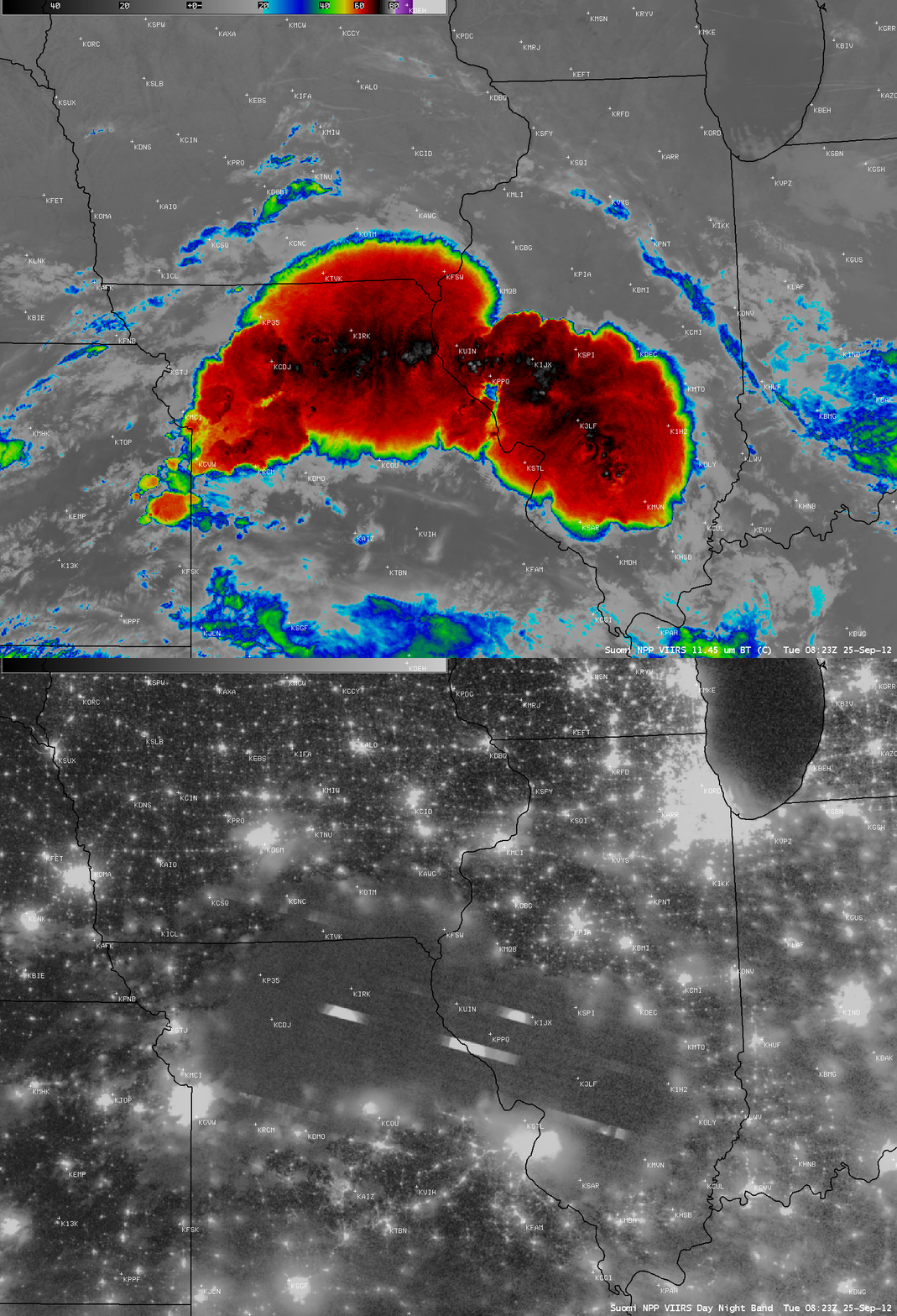
AWIPS images of Suomi NPP VIIRS 0.7 µm Day/Night Band and 11.45 µm IR channel data (above) showed a thunderstorm complex that stretched from northern Missouri to southern Illinois at 08:23 UTC (3:23 AM local time) on 25 September 2012. The IR image revealed a number of cold overshooting tops (exhibiting IR brightness temperatures as cold as -79 C), while the Day/Night Band image showed several bright “streaks” which were signatures of lightning illuminating the cloud tops as the VIIRS instrument was scanning the feature. Note how many city lights were able to be seen through the veil of thin cirrus around the edges of the thunderstorms.
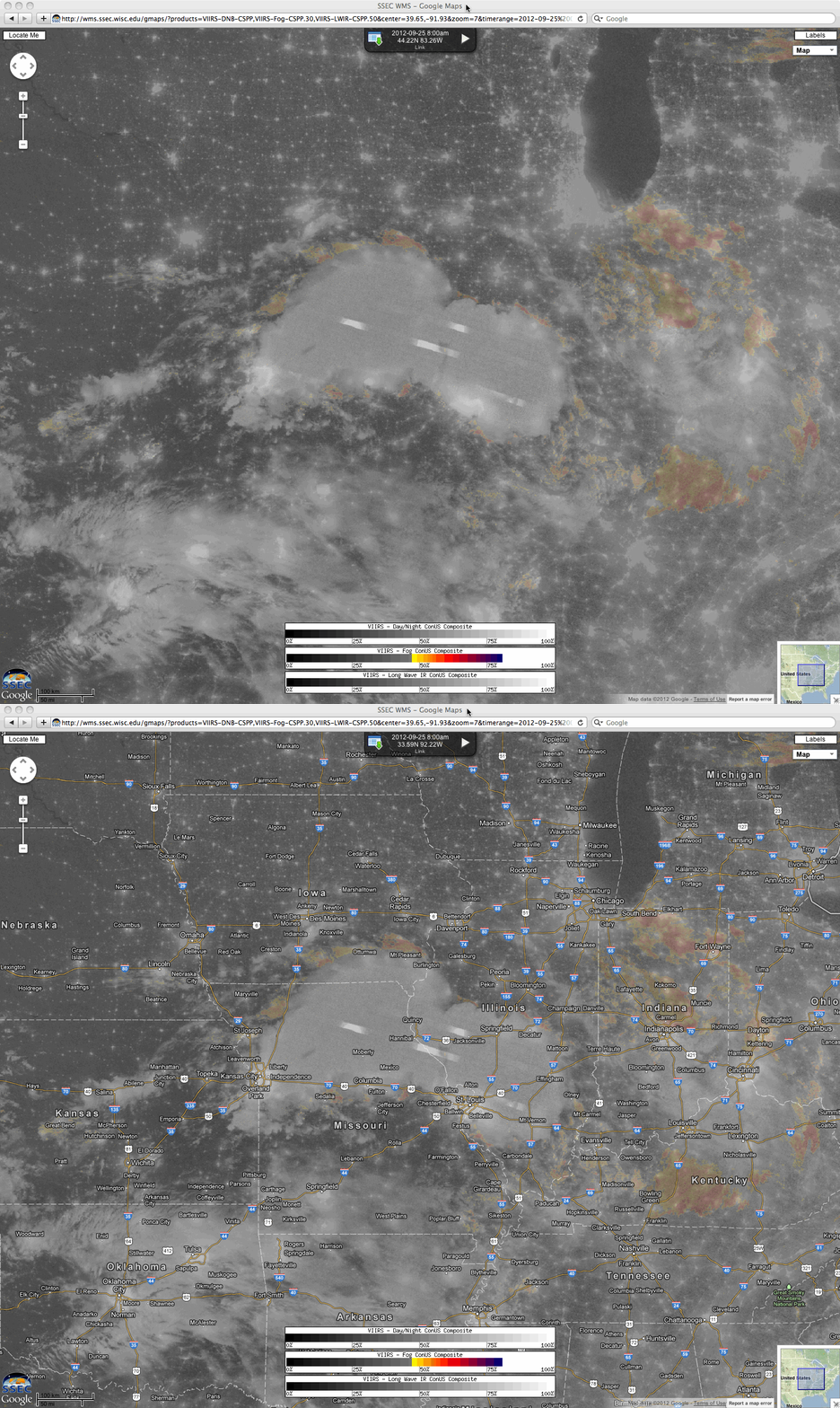
The SSEC Web Map Server offered a larger scale view (below), also combining the Suomi NPP VIIRS Day/Night Band and IR images with the legacy IR difference “fog/stratus product”.


