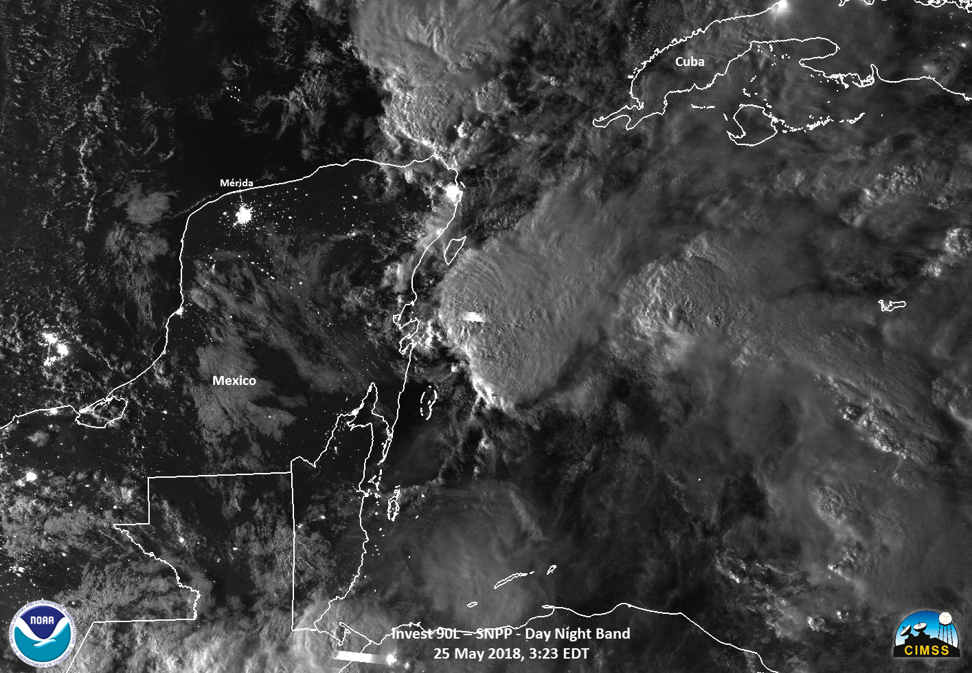
This website works best with a newer web browser such as Chrome, Firefox, Safari or Microsoft Edge. Internet Explorer is not supported by this website.

Category: Tropical cyclones

Irma over Florida as seen by Suomi NPP and GOES-16

Suomi NPP overflew Florida and Hurricane Irma shortly after 0700 UTC on Monday 11 September. The 10.8 µm Infrared Image from the VIIRS Instrument, above, shows cold cloud tops and strong convection over much of central Florida (Orlando International Airport received 3″ of rain between 0300 and 0600 UTC on... Read More

Hurricane Irma moves along the north coast of Cuba

GOES-16 data posted on this page are preliminary, non-operational and are undergoing testingHurricane Irma hit Cuba as a category 5 Storm late on 8 September 2017. The animation above shows the storm paralleling the north coast of Cuba; outer rainbands are moving into southern Florida. Irma is forecast to turn... Read More

Category 4 Hurricane Jose approaches the Leeward Islands

 GOES-16 data posted on this page are preliminary, non-operational and are undergoing testingHurricane Jose is approaching the Leeward Islands, following Irma’s path through the region earlier in the week. The Category 4 storm is shown above in 10.3 µm Infrared Imagery from GOES-16. Its satellite presentation is excellent. Geostationary Lightning... Read More