The Eye of Maria north of Hispaniola
GOES-16 data posted on this page are preliminary, non-operational and are undergoing testing
Hurricane Maria presented a very interesting eye structure during the course of the day on 21 September 2017, as shown in the mp4 animation above (also available as a YouTube video). The animation shows 10.3 µm imagery every 2 minutes from 0849 UTC through 2122 UTC on 21 September 2017.
Pete Pokrandt, at the University of Wisconsin Atmospheric and Oceanic Sciences Department, created a similar animation using the 0.64 µm Visible channel on GOES-16.
30-second interval (using overlapping 1-minute interval Mesoscale Sector) GOES-16 Visible (0.64 µm) and Infrared Window (10.3 µm) images covering the 6-hour period from 1031-1631 UTC are shown below. During this time, Maria re-intensified to a Category 3 hurricane, with the eye centered just off the northeastern coast of the Dominican Republic.
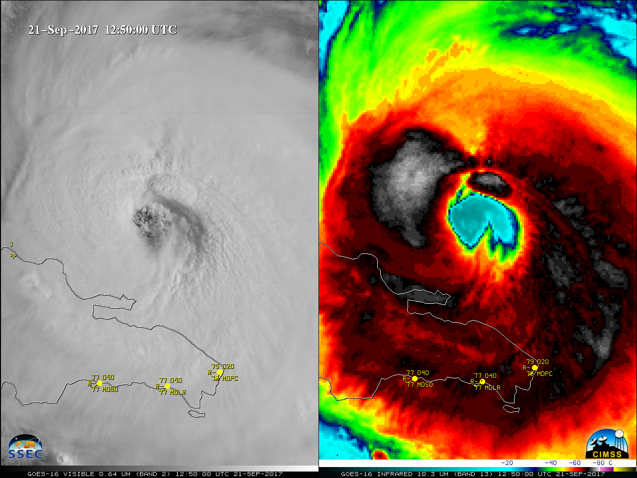
GOES-16 Visible (0.64 µm, left) and Infrared Window (10.3 µm, right) images at 30-second intervals (Click to animate)
For more information on Maria, visit the National Hurricane Center website. The CIMSS Tropical Weather Website has information as well.