Hurricane Maria moves across Dominica

GOES-16 “Clean Window” Infrared 10.3 µm imagery, 0055 to 0414 UTC on 19 September 2017 (Click to play 161 M animated gif)
GOES-16 data posted on this page are preliminary, non-operational and are undergoing testing
GOES-16 ABI 10.3 µm Infrared Imagery shows the path of Category 5 Hurricane Maria’s transit across the Caribbean Island of Dominica. The compact eye moved from east-central Dominica to the northwest coast of Dominica over the course of about 2 hours late on the 18th and early on the 19th of September 2017.
===================== Added, 2130 UTC on 19 September 2017 =====================
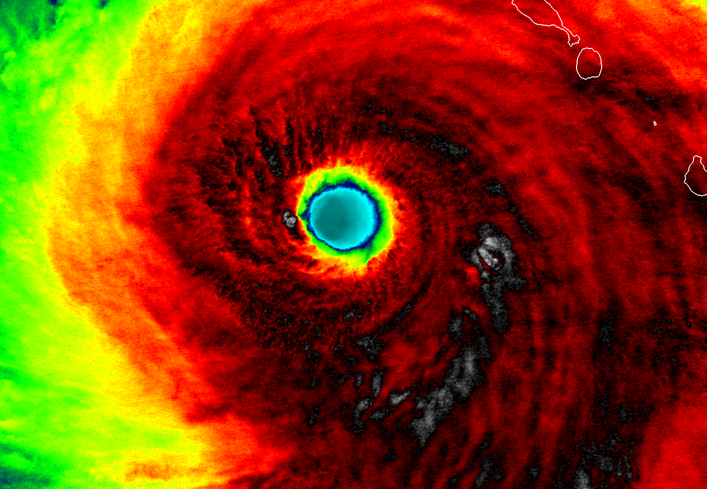
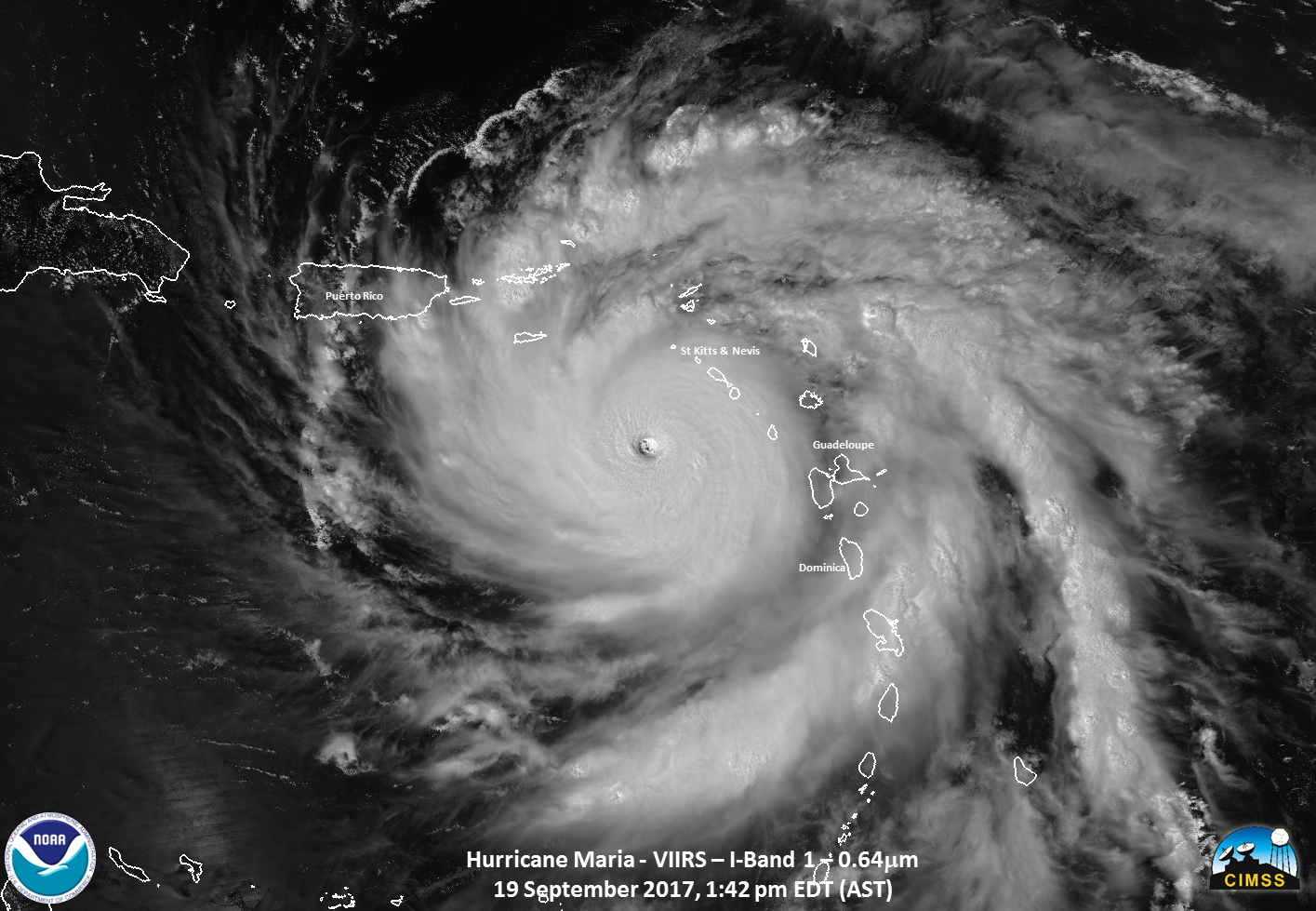
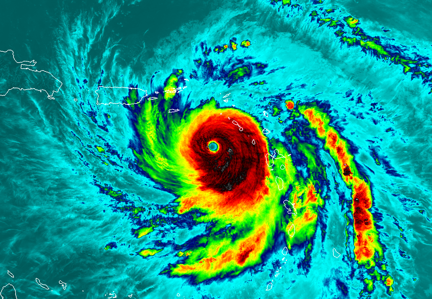
Later in the day on 19 September, Suomi NPP overflew Category 5 Hurricane Maria. The toggle below shows the Visible (0.64 µm) and Infrared Window (11.45 µm) imagery zoomed in over the eye. A Caribbean Basin-wide view (visible and infrared toggle) is below that. The storm displays excellent structure with strong banding and outflow and little indication of shear. (Suomi NPP Imagery courtesy William Straka, CIMSS)
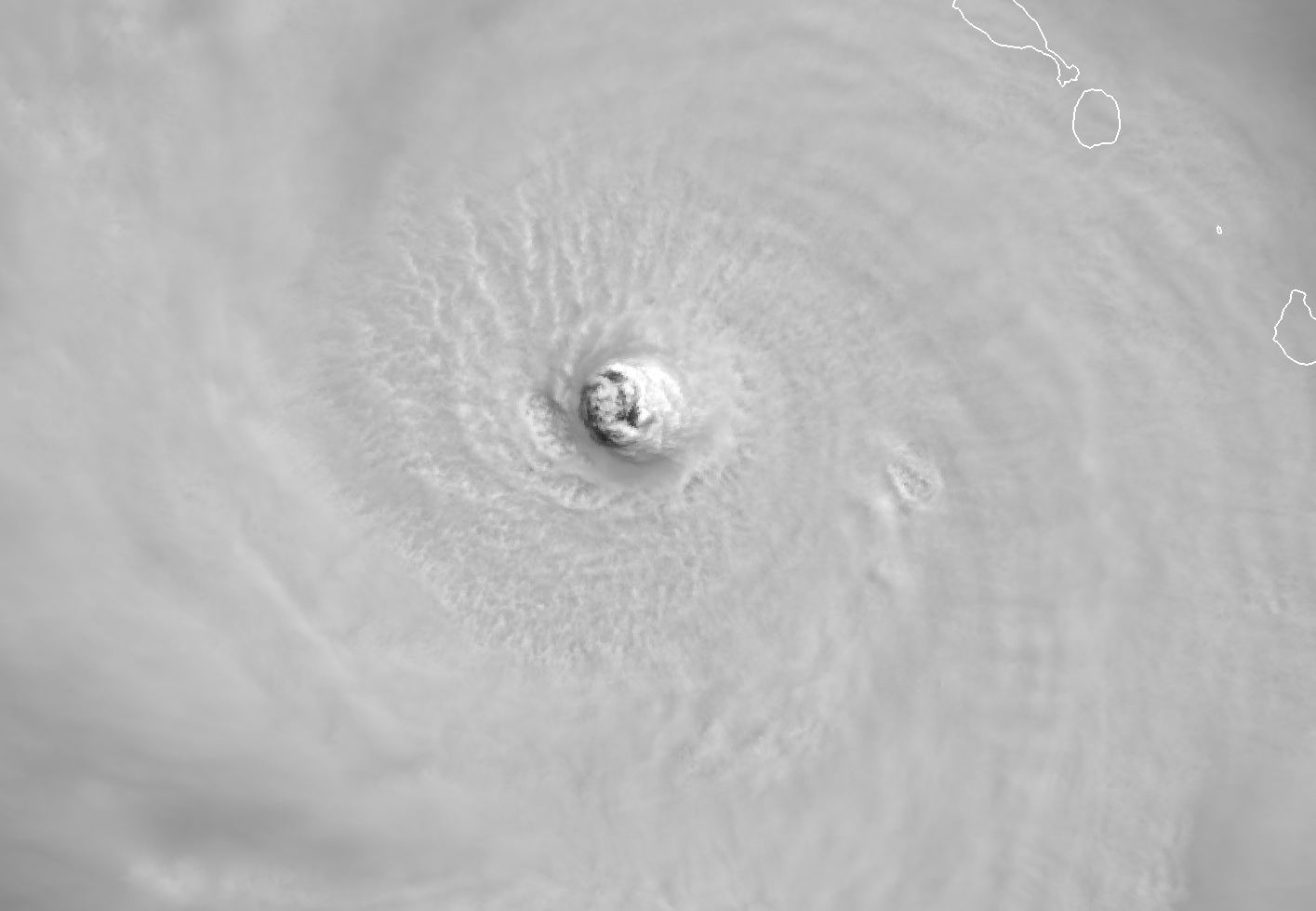
Suomi NPP Visible (0.64 µm) and Infrared (11.45 µm) imagery over the eye of Hurricane Maria, 1742 UTC on 19 September 2017 (Click to enlarge)

Suomi NPP Visible (0.64 µm) and Infrared (11.45 µm) imagery of Hurricane Maria over the eastern Caribbean, 1742 UTC on 19 September 2017 (Click to enlarge)
For more on the Hurricane Maria, consult the webpages of the National Hurricane Center or the CIMSS Tropical Weather Website.