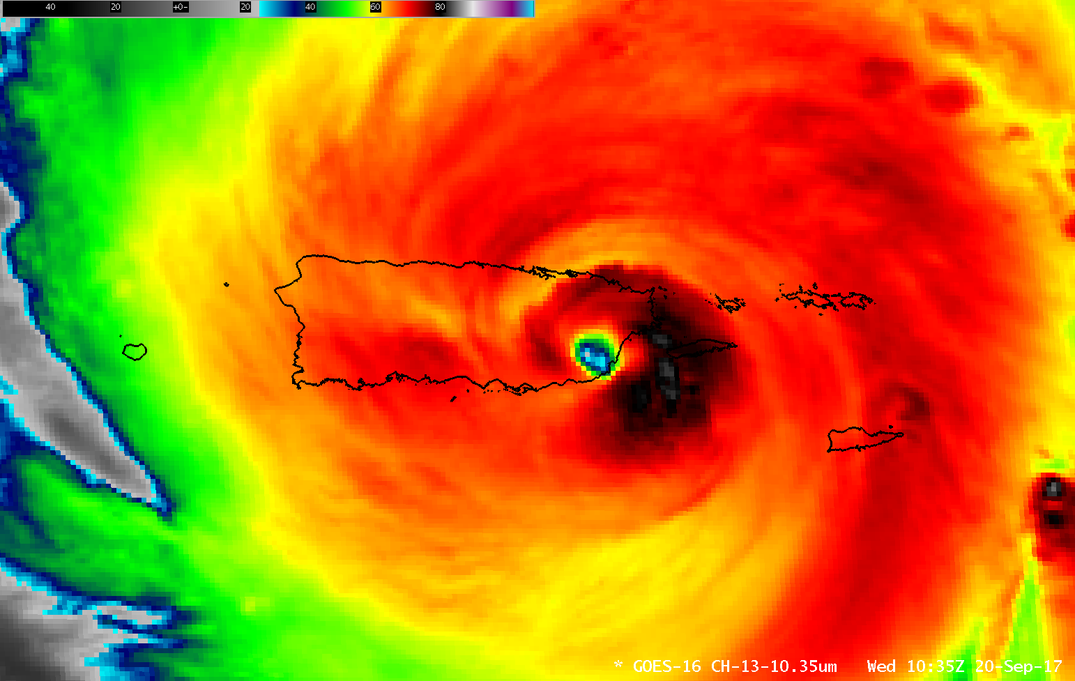
Hurricane Maria makes landfall in Puerto Rico
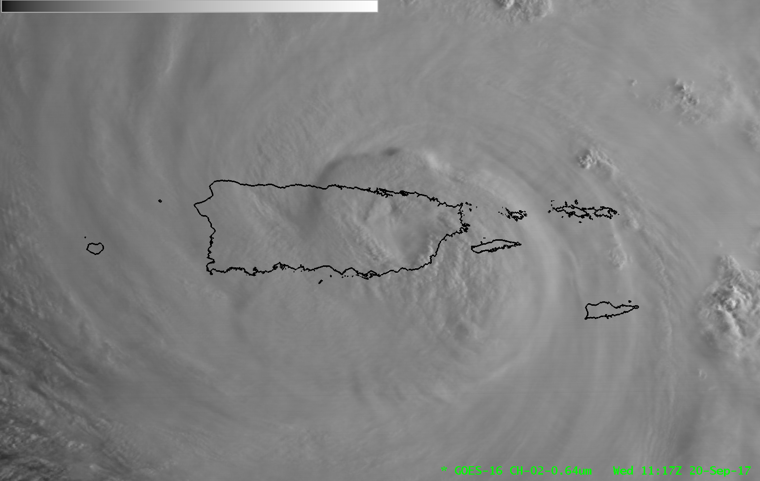
GOES-16 Visible Imagery (0.64 µm), 1017-1117 UTC, at 30-second time steps, on 20 September 2017 (Click to animate)
GOES-16 data posted on this page are preliminary, non-operational and are undergoing testing.
Strong Category 4 Hurricane Maria has made landfall in Puerto Rico. According to the National Hurricane Center, landfall occurred around 1035 UTC near Yabacuo on Puerto Rico’s southeast coast. The GOES-16 30-second (using overlapping mesoscale sectors) Visible Animation, above, shows the storm as it made landfall. Maria had recently completed an Eyewall Replacement Cycle as it made landfall. The animation below, using morphed microwave imagery (from this site), shows the development of an outer eyewall and subsequent erosion of the inner eyewall during the 24 hours prior to landfall.
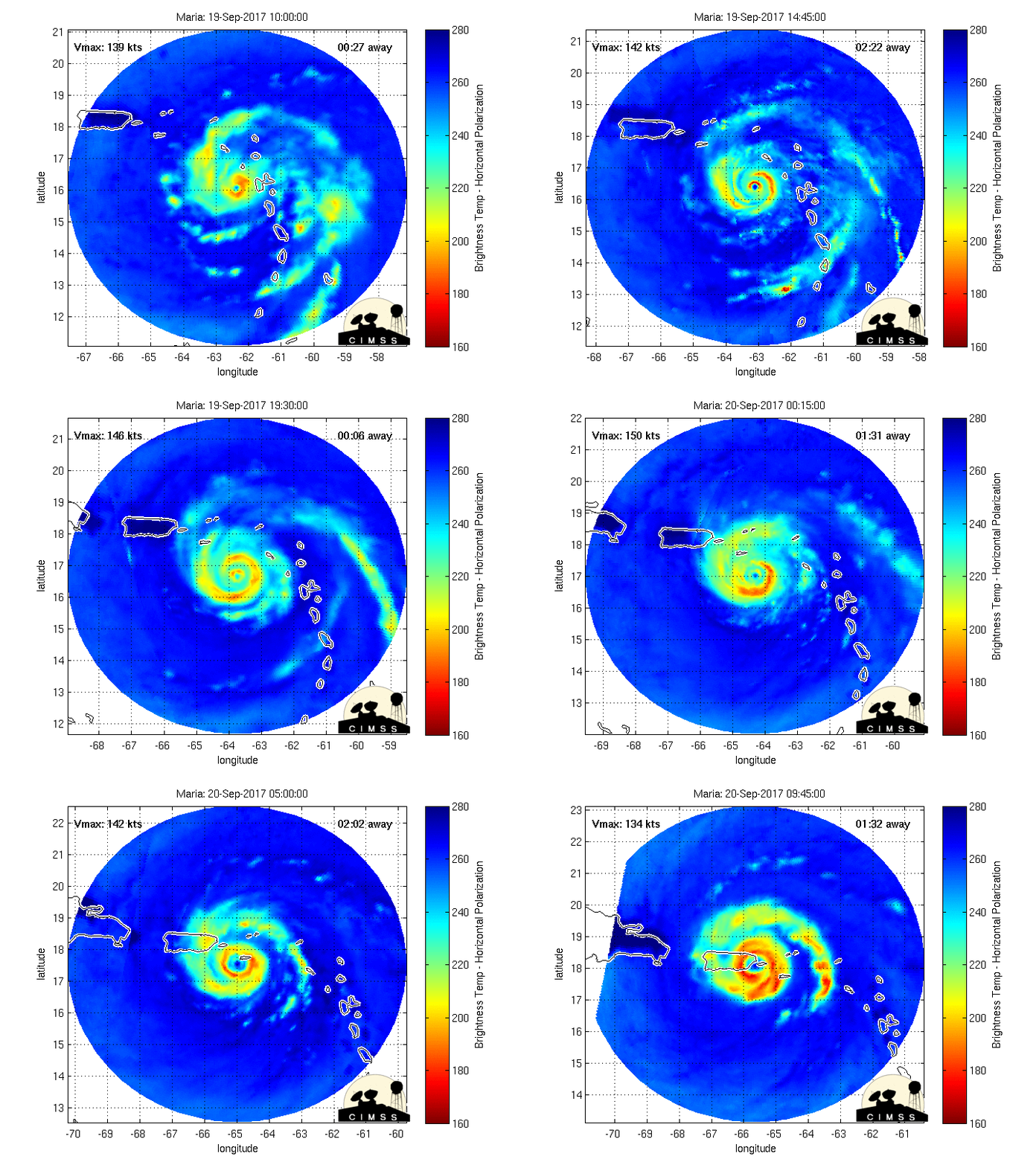
Morphed Microwave Imagery centered on Hurricane Maria for the 24 hours prior to landfall in Puerto Rico (Click to enlarge)
GOES-16 Clean Window Infrared (10.3 µm) Imagery shows a distinct eye as the storm makes landfall. Subsequently, however, the eye filled in as it moved over the mountainous interior of Puerto Rico.
GOES-16 Visible (0.64 µm, left) and Infrared Window (10.3 µm, right) images (Click to play MP4 animation)
A 2-panel comparison of GOES-16 Visible (0.64 µm) and Infrared Window (10.3 µm) imagery during the 1020-1620 UTC time period is shown above. It can be seen that deep eyewall convection moved over much of the island as Maria made its journey across Puerto Rico.
Suomi NPP flew over Maria early in the morning on 20 September, when the storm was near St. Croix. The toggle below shows the 11.45 µm Infrared image from VIIRS and the Day Night Band Visible (0.7 µm) Imagery. The Moon on 20 September was a New Moon, so no lunar illumination was present for the Day Night Band. The eye of the storm was nevertheless apparent in the image. A zoomed-in Infrared image over the eye is here.
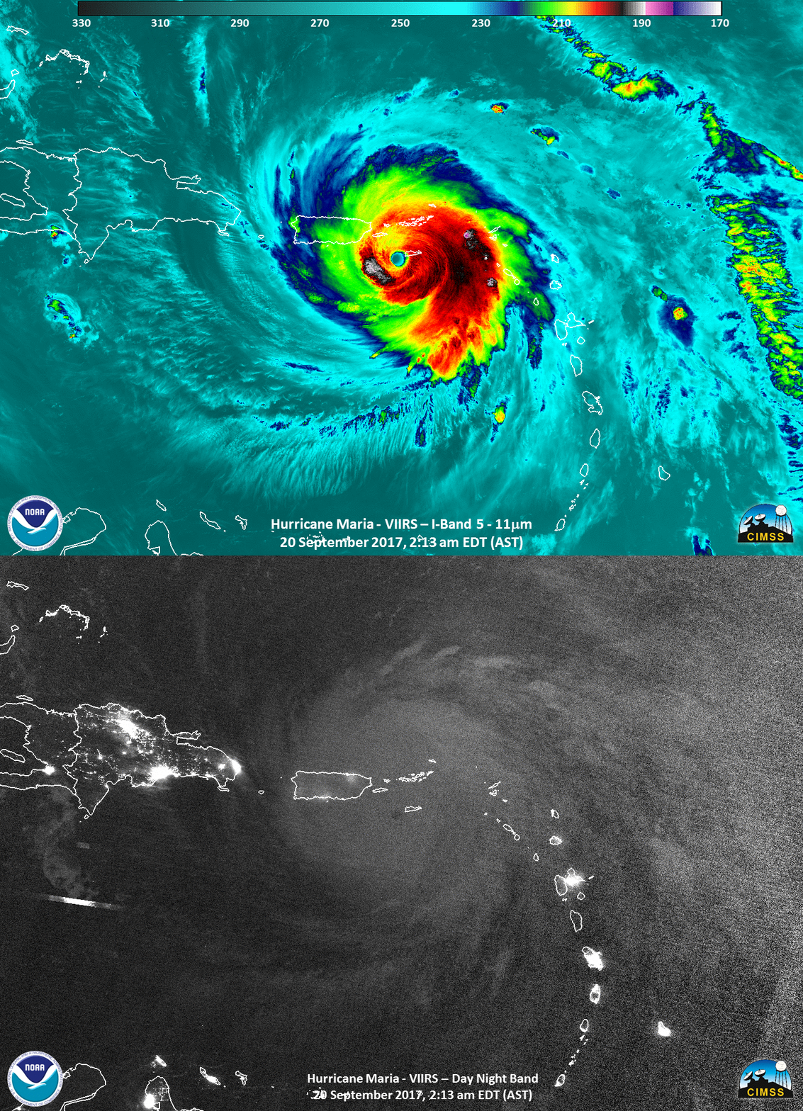
Suomi NPP VIIRS 11.45 µm Infrared image from VIIRS and the Day Night Band Visible (0.7 µm) Imager, 0613 UTC on 20 September 2017 (Click to enlarge)
Suomi NPP overflew Maria again when the storm was moving offshore from Puerto Rico, and a toggle (Visible and Infrared) below shows the storm at 1724 UTC on 20 September. Click here for a zoomed-in image (Visible) over the eye.
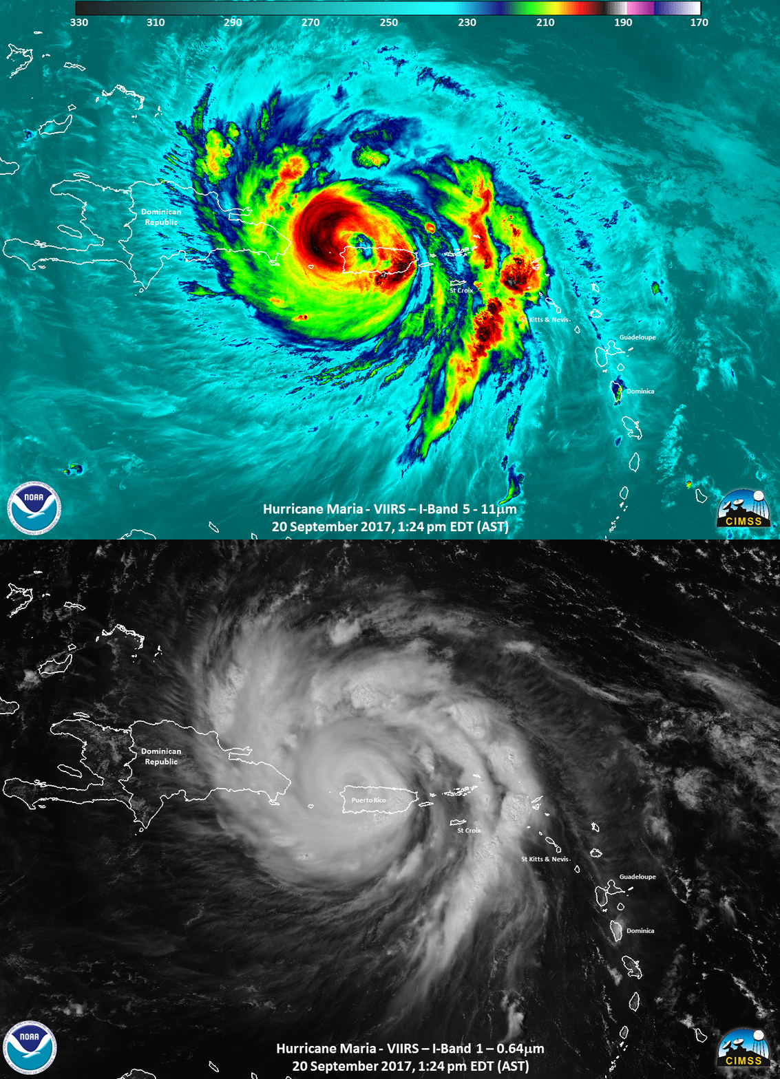
Suomi NPP VIIRS 11.45 µm Infrared image from VIIRS and Visible (0.64 µm) Image, 1724 UTC on 20 September 2017 (Click to enlarge)
More information on Maria is available at the National Hurricane Center and at the CIMSS Tropical Weather Website.


