Hurricane Earl makes landfall in Belize
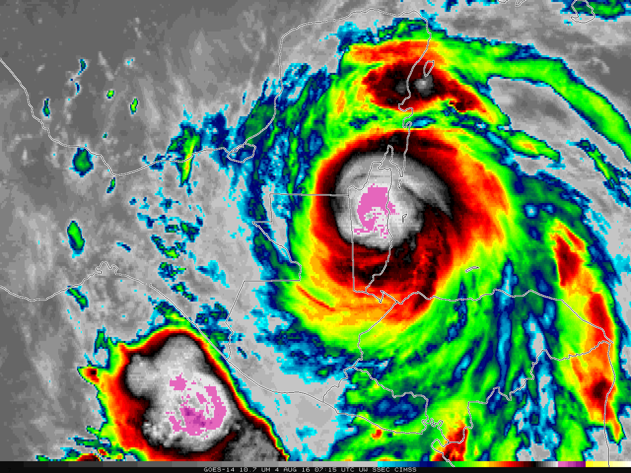
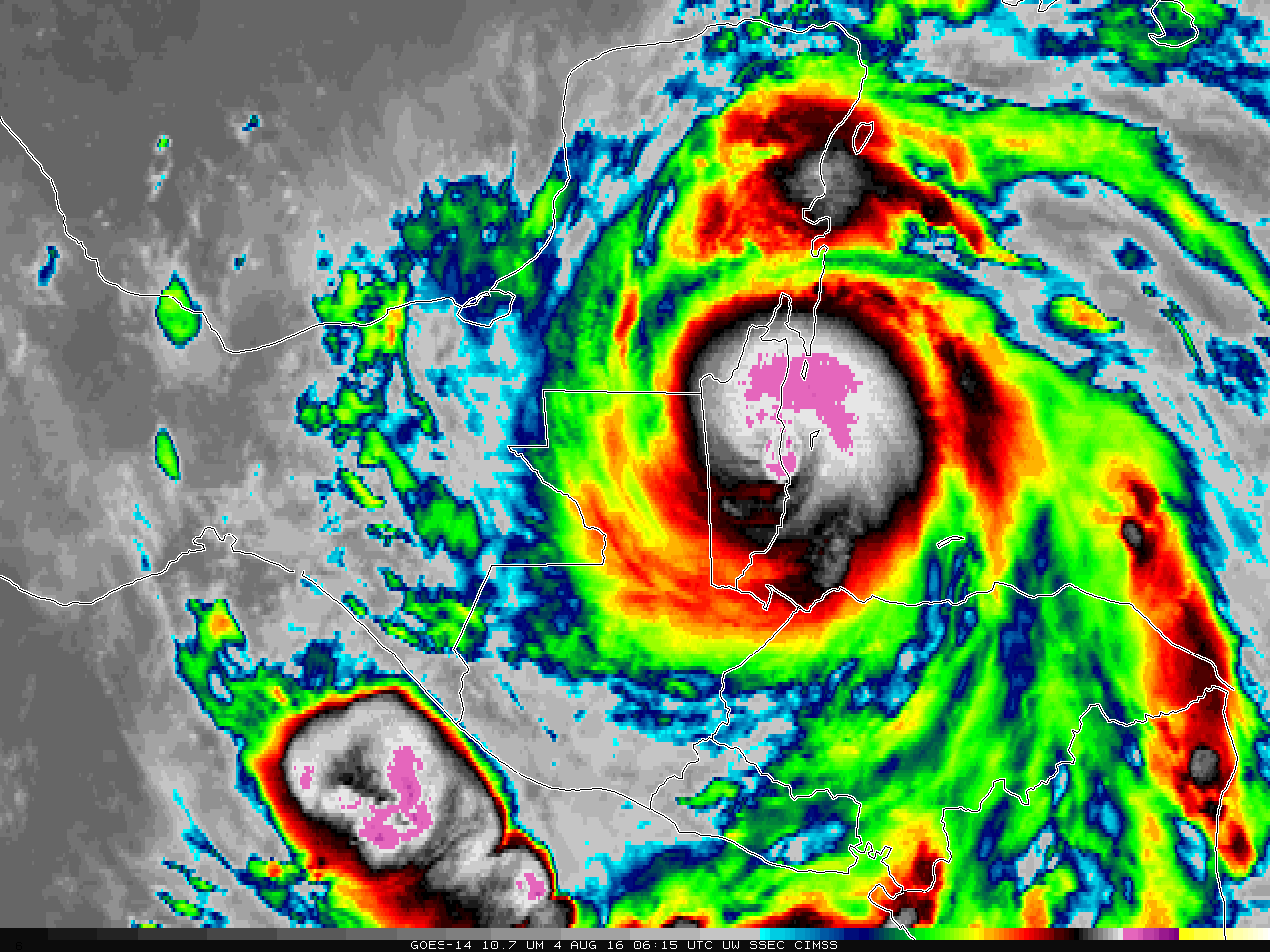
Hurricane Earl made landfall around 0600 UTC on 4 August in Belize. The hourly animation from GOES-14, above, shows a rapid warming of the coldest cloud tops over Earl after landfall, as commonly happens. GOES-14 is out of storage to support SRSO-R Operations beginning Tuesday August 9.The GOES-14 image at landfall shows coldest cloud tops on the north side of the storm. A timely Metop-A overpass (times... Read More
