Back-building thunderstorms in Oklahoma
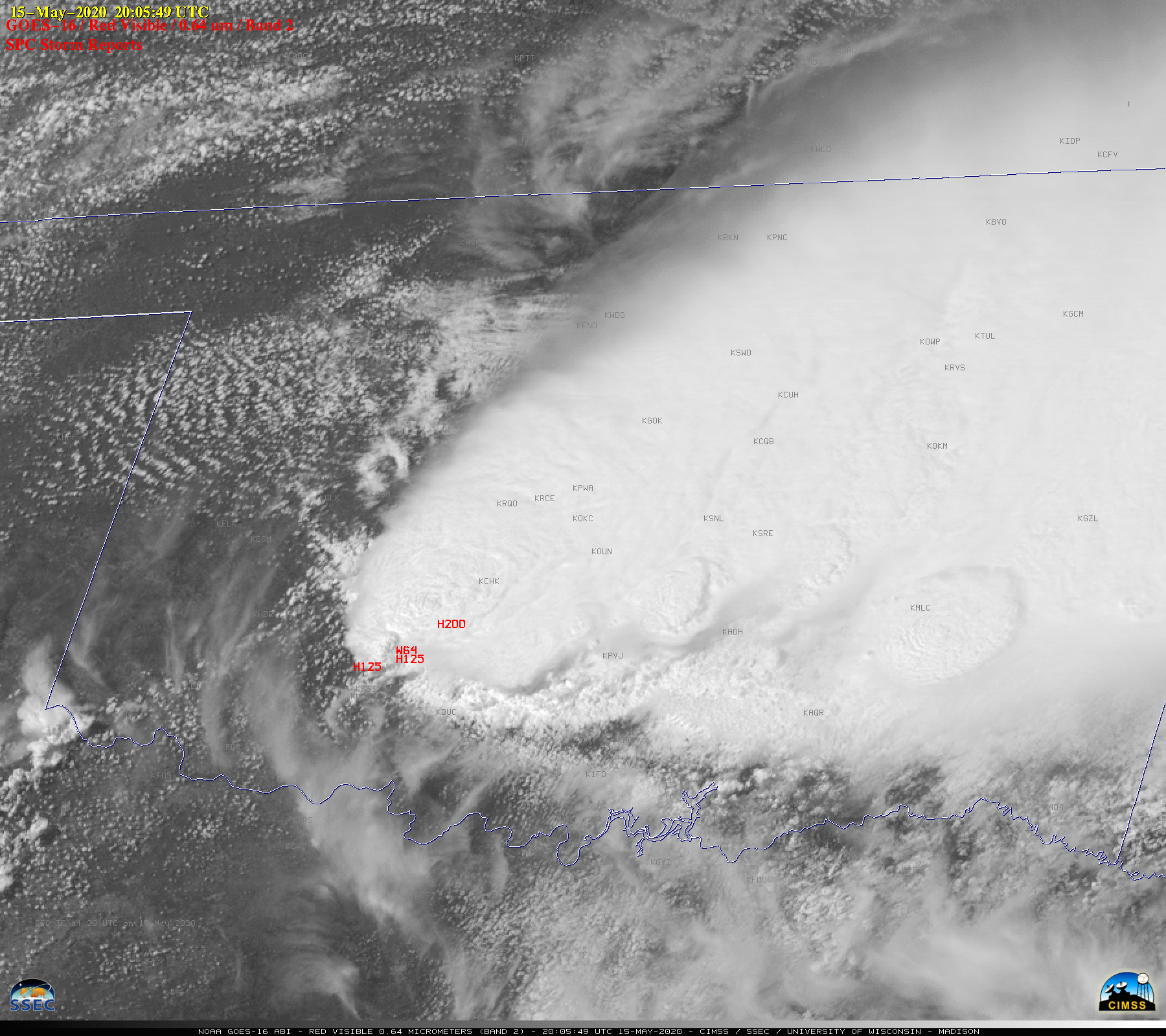
1-minute Mesoscale Domain Sector GOES-16 (GOES-East) “Red” Visible (0.64 µm) images with plots of time-matched SPC Storm Reports (above) showed back-building thunderstorms that propagated southwestward across Oklahoma on 15 May 2020.The corresponding GOES-16 “Clean” Infrared Window (10.35 µm) images (below) revealed pulsing overshooting tops that occasionally exhibited cloud-top infrared brightness temperatures as cold as -80ºC (violet pixels) toward... Read More