Derecho affecting Pennsylvania and New Jersey

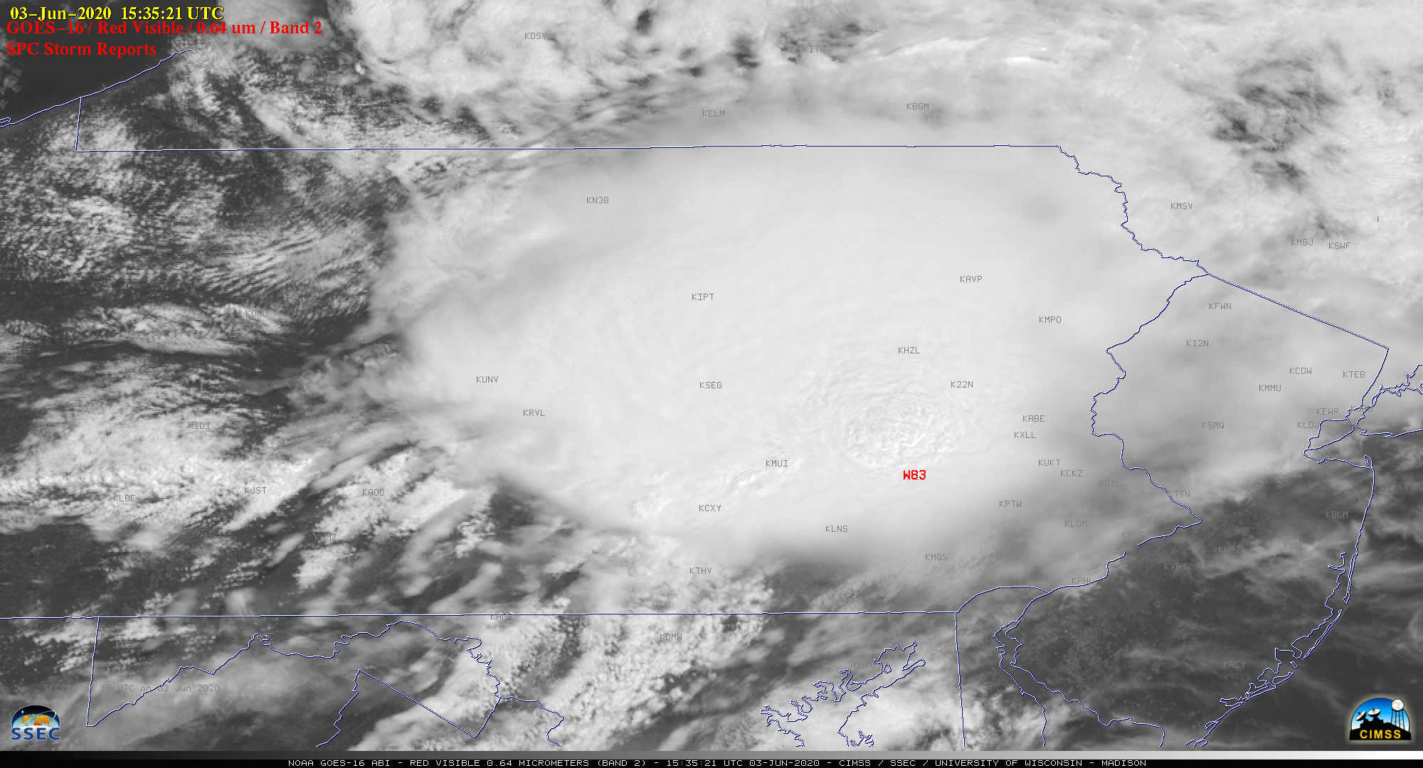
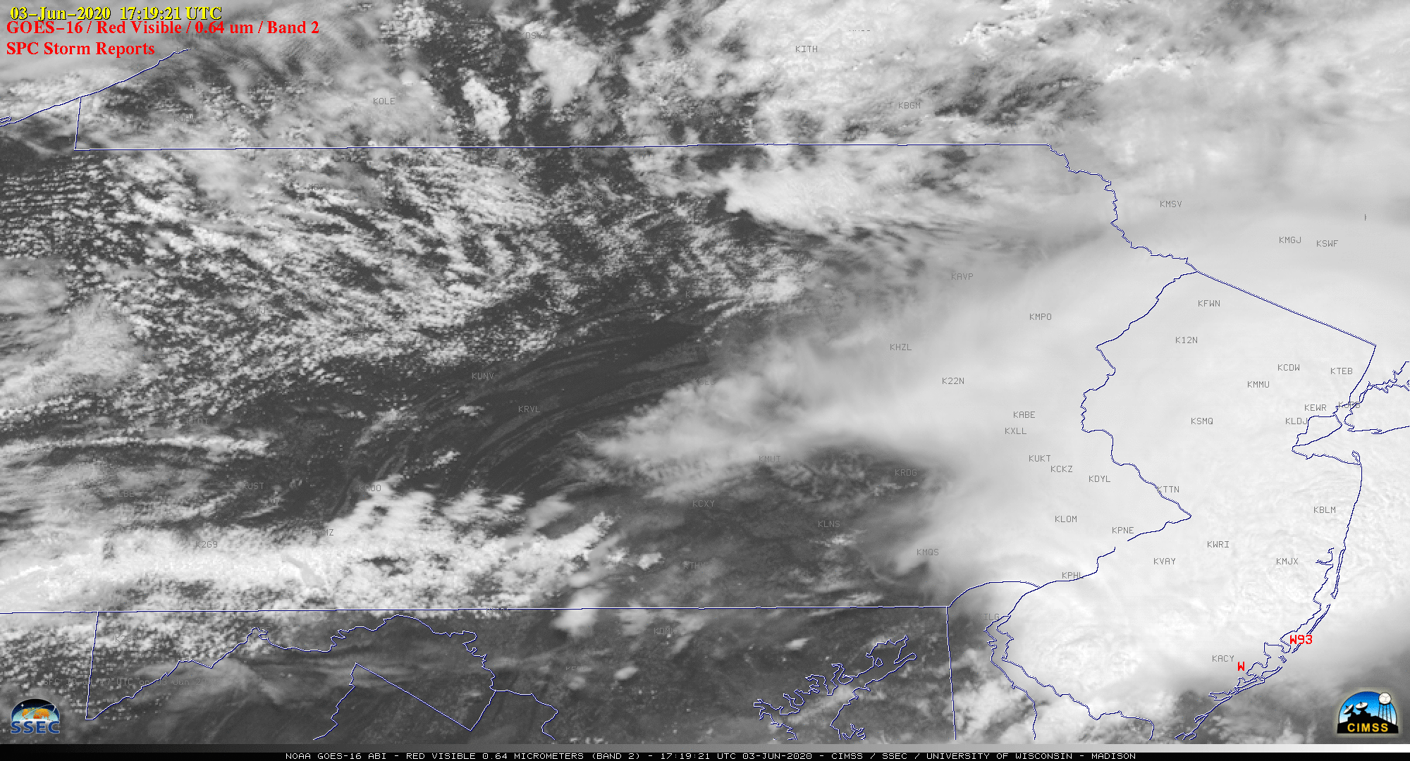
GOES-16 (GOES-East) “Red” Visible (0.64 µm) images with time-matched plots of SPC Storm Reports (above) displayed a fast-moving derecho which moved southeastward across Pennsylvania and New Jersey on 03 June 2020. Winds gusted as high as 83 mph in Pennsylvania (at 1535 UTC) and 93 mph in New Jersey (at 1719 UTC).A sequence of GOES-16 Visible images... Read More


