Hail-producing supercell thunderstorm in Texas
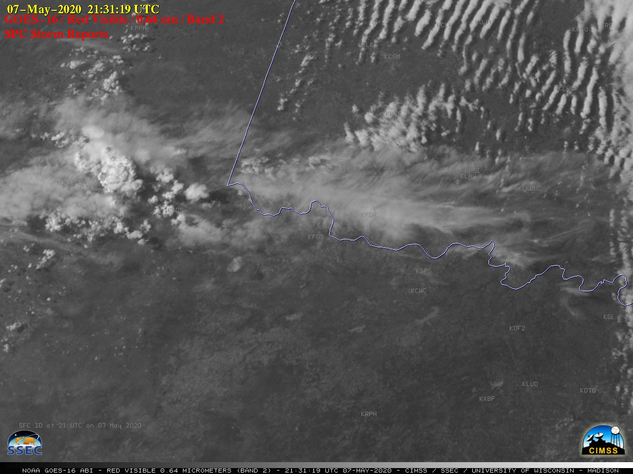
GOES-16 “Red” Visible (0.64 µm) images, with time-matched SPC Storm Reports plotted in red [click to play animation | MP4]
In the corresponding GOES-16 “Clean” Infrared Window (10.35 µm) images (below), the pulsing overshooting tops exhibited infrared brightness temperatures in the -70 to -80ºC range (black to white enhancement).
![GOES-16 "Clean" Infrared Window (10.35 µm) images, with time-matched SPC Storm Reports plotted in cyan [click to play animation | MP4]](https://cimss.ssec.wisc.edu/satellite-blog/images/2020/05/200507_goes16_infrared_spcStormReports_TX_anim.gif)
GOES-16 “Clean” Infrared Window (10.35 µm) images, with time-matched SPC Storm Reports plotted in cyan [click to play animation | MP4]
![Plot of 00 UTC rawinsonde data from Amarillo, Texas [click to enlarge]](https://cimss.ssec.wisc.edu/satellite-blog/images/2020/05/200508_00UTC_KAMA_RAOB.GIF)
Plot of 00 UTC rawinsonde data from Amarillo, Texas [click to enlarge]
![GOES-16 "Red" Visible (0.64 µm) and "Clean" Infrared Window (10.35 µm) images [click to play animation | MP4]](https://cimss.ssec.wisc.edu/satellite-blog/images/2020/05/200507_goes16_visible_infrared_TX_anim.gif)
GOES-16 “Red” Visible (0.64 µm) and “Clean” Infrared Window (10.35 µm) images [click to play animation | MP4]
![GOES-16 "Red" Visible (0.64 µm) and "Clean" Infrared Window (10.35 µm) images at 0105 UTC [click to enlarge]](https://cimss.ssec.wisc.edu/satellite-blog/images/2020/05/200508_0105utc_goes16_visible_infrared_TX_anim.gif)
GOES-16 “Red” Visible (0.64 µm) and “Clean” Infrared Window (10.35 µm) images at 0105 UTC [click to enlarge]
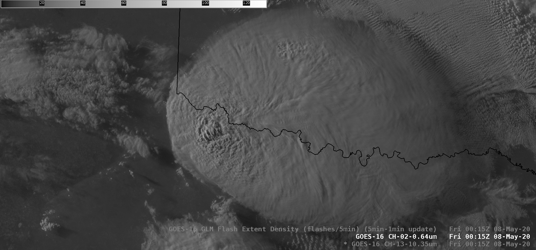
![GOES-16 "Red" Visible (0.64 µm) images, with and without an overlay of GLM Flash Extent Density [click to play animation | MP4]](https://cimss.ssec.wisc.edu/satellite-blog/images/2020/05/200507_goes16_visible_glmFlashExtentDensity_TX_anim.gif)
GOES-16 “Red” Visible (0.64 µm) images, with and without an overlay of GLM Flash Extent Density [click to play animation | MP4]
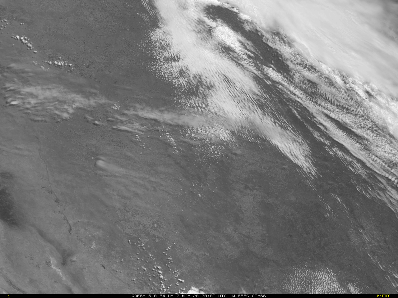
GOES-17 also viewed the storm development, albeit at a 10-minute time increment because west Texas sits outside of GOES-17’s ‘CONUS’ domain. GOES-17’s more oblique view from the allows the satellite to see more structure on the western flank of the system, particularly beneath the cirrus shield! (Click here for a faster animation)

GOES-17 Band 2 (0.64 µm) Visible Imagery, 2000 UTC on 7 May 2020 through 0200 UTC on 8 May 2020 (Click to animate)