Severe thunderstorms in Texas and Oklahoma
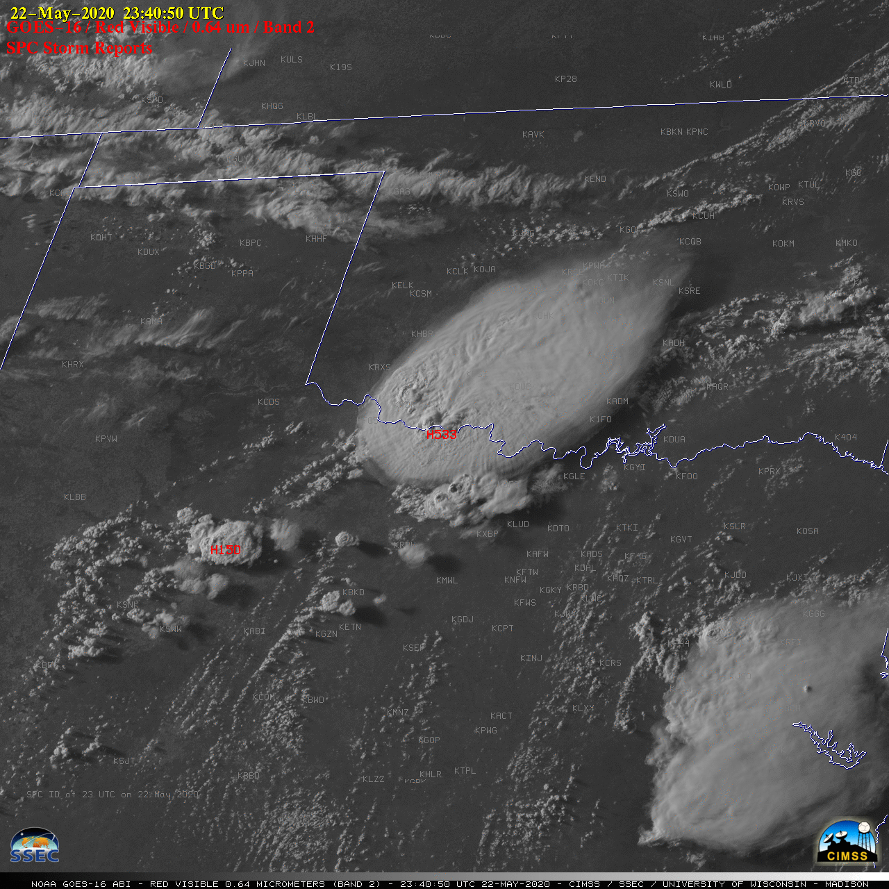
![GOES-16 “Red” Visible (0.64 µm) images, with SPC Storm Reports plotted in red [click to play animation | MP4]](https://cimss.ssec.wisc.edu/satellite-blog/images/2020/05/200522_goes16_visible_spcStormReports_OK_TX_anim.gif)
GOES-16 “Red” Visible (0.64 µm) images, with SPC Storm Reports plotted in red [click to play animation | MP4]
The corresponding GOES-16 “Clean” Infrared Window (10.35 µm) images (below) revealed pulsing overshooting tops which exhibited cloud-top infrared brightness temperatures as cold as -80ºC (violet pixels). According to 20 UTC rawinsonde data from Fort Worth, Texas this temperature represented an overshoot of the Equilibrium Level of approximately 2 km.
![GOES-16 “Clean” Infrared Window (10.3 µm) images, with SPC storm reports plotted in cyan [click to play animation | MP4]](https://cimss.ssec.wisc.edu/satellite-blog/images/2020/05/200522_goes16_infrared_spcStormReports_OK_TX_anim.gif)
GOES-16 “Clean” Infrared Window (10.35 µm) images, with SPC storm reports plotted in cyan [click to play animation | MP4]
1/n Regarding Friday’s Burkburnett, TX 5.33″ diameter #hail…(Photo: ToniRieScott/FB)
NOAA’s Storm Events Database documented 24 other 5″+ hail events in Texas since 1950.
The last one was almost exactly 1 year ago (5/20/2019) in Collingsworth County. pic.twitter.com/RFABUIlglQ
— Jonathan Erdman (@wxjerdman) May 24, 2020