Severe thunderstorms in Minnesota
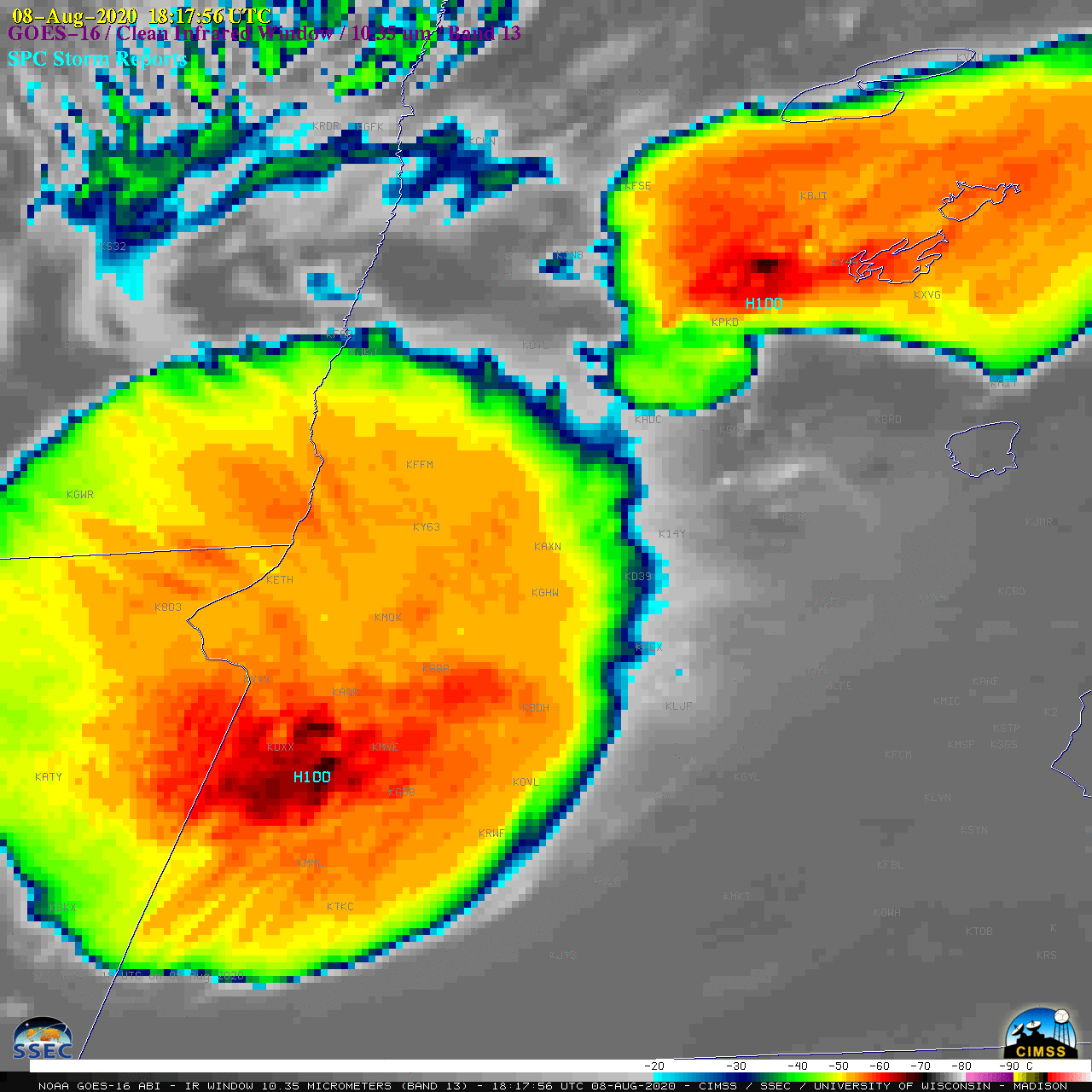
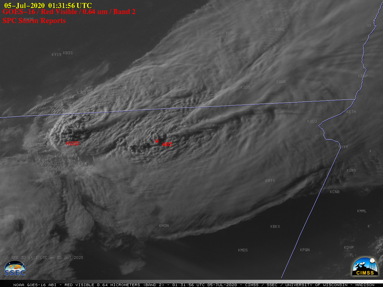
1-minute Mesoscale Domain Sector GOES-16 (GOES-East) “Red” Visible (0.64 µm) and “Clean” Infrared Window (10.35 µm) images (above) showed clusters of thunderstorms that developed along and just behind a cold front moving eastward across Minnesota on 08 August 2020. The northernmost hail-producing thunderstorm in Minnesota exhibited an Above-Anvil Cirrus Plume (reference | VISIT training); in addition, a decaying thunderstorm complex in southeastern... Read More


